
Today, if you want to leverage geospatial data for an application, there is no dearth of online marketplaces offering affordable, pay-as-you-go analysis of open-source spatial data and commercial satellite imagery alike.
However, there is one dataset that plays a crucial role in global defense programs, wildlife protection, maritime applications, and emergency management, and yet, there is no easy way to monitor, locate, visualize, or analyze it in a cost-effective manner.
This data is found in the radio frequency (RF) portion of the electromagnetic spectrum.
For the longest time, radio signals were available only in the form of highly classified datasets, which meant nobody outside the state intelligence communities could be privy to them. But with the RF spectrum finding utilization in everything from consumer goods like cellphones to deep-sea shipping vessels, the demand for unclassified RF data has increased across commercial and humanitarian sectors too.
And this is why Virginia-based geospatial analytics company HawkEye 360 has launched Mission Space, a first-of-its-kind commercial platform built to facilitate the analysis of RF data for geospatial intelligence (GEOINT) missions.
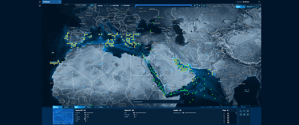
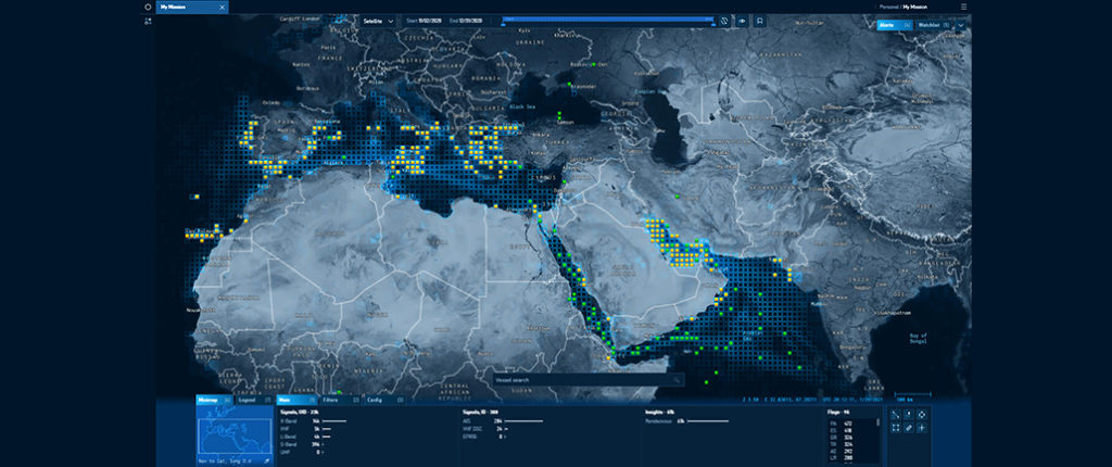
HawkEye 360 Mission Space RF Analysis Platform
By automating the ingestion and visualization of RF signal data and analytics, Mission Space allows analysts to intuitively manipulate and explore all available spatial information within one frame of view. Analysts can see trends and patterns and grab in-depth detail about RF signals, all while maintaining a summary of RF activity for context.
For example, while identifying RF activity in a designated maritime area of interest, not only will Mission Space pinpoint a shipping vessel’s specific RF geolocations, but the platform would also show you its identity, history, past sanction violations, and any identified behavior patterns.
Interestingly, HawkEye 360 uses its own constellation of small satellites to gather commercial RF data and improve the geospatial intelligence. And the company foresees its data supporting a variety of GEOINT applications, such as tipping and cueing of other data sources to include electro-optical and radar imaging satellites.
For Alex Fox, Executive Vice President, HawkEye 360, Mission Space is no less than a “breakthrough for commercial RF mapping” and is unrivaled in the commercial sector. “The platform will empower our customers to efficiently extract immense value from our RF signal subscription services. It will accelerate user adoption of commercial RF analytics across the global defense, intelligence, commercial and humanitarian sectors.”
As John Serafini, HawkEye 360 CEO, puts it, “Visible imaging was once only the domain of governments, until the first commercial imaging satellites were launched. Now look at all the value we’ve gained from commercial images. The emergence of small satellite technology and the lower cost of launch have made it feasible for HawkEye 360 to develop high-capability satellites that are able to generate valuable geospatial insights from RF signals.”
Did you like the article? Read more and subscribe to our monthly newsletter!

#


Next article


After a series of satellite launches related to Earth Observation (EO) in the previous couple of years (Sentinels, IceEye, PAZ, GOES, Landsat, RADARSAT Constellation, CSG-1, etc.) plus the pandemic during last year, the number of EO satellites entering the orbit in 2020 was scarce. This article gives a short update about major planned launch EO spaceflight events related to Earth Observation (EO) satellites in the first half of 2021 and also beyond it. As changes might occur, the article does not state exact dates. The subsequent list does not claim to be complete.
Capella 3 and 4: Two more satellites of the Capella constellation are planned to be launched together with a number of other nano satellites on a Falcon 9 rocket in the first quarter of 2021. Once complete the Capella constellation will consist of 36 X-band radar satellites delivering sub 0.5m imagery at a repeat time of one hour. The originally planned completion of the constellation in 2021 will probably be shifted backwards. The owner of the satellites is Capella Space.
Pléiades Neo: The planned launch of Pléiades Neo 1 in the second half of 2020 was postponed to this year. In early 2021 the first 2 satellites of the Pléiades Neo constellation consisting of four identical satellites will be launched by a Vega rocket departing in Guyana Space Center. A second batch will follow in the second quarter of 2022. The constellation owed by Airbus will deliver optical satellite imagery at an unprecedented resolution of 30cm. The acquired 2 million km² per day will be fully dedicated to the commercial market.
LARES 2: The Laser Relativity Satellite 2 is a passive satellite of the Italian Space Agency (Agenzia Spaziale Italiana – ASI). It is equipped with laser mirrors for the study of the Earth’s gravitational field, general relativity measurements and the measurement of the Lense-Thirring effect. It is due to launch on a Vega rocket around mid 2021.
COSMO-SkyMed 2nd generation (CSG): The second satellite of the CSG mission (CSG-2) will be launched in the second half of 2021. The second generation of COSMO-SkyMed satellites is the first synthetic aperture radar (SAR) satellite system in the world able to acquire two images simultaneously. It will ensure continuity of the X-band radar data archive with improved functionalities of the new satellites. COSMO-SkyMed is an Earth observation program of the Italian Space Agency. The contractor for the satellites is Thales Alenia Space.
SARah: SARah is the planned follow-on system for the SAR-Lupe radar satellite constellation operated by the German armed forces (Bundeswehr). SARah consists of one active phased array-antenna satellite built by Airbus Defence and Space and two passive reflector antenna satellites provided by OHB-System. The satellite will be launched with a co-passenger on a Falcon-9 rocket until September 2021.
Landsat: After the launch of Landsat-8 in 2013, a new satellite of the series, Landsat-9, is waiting to be launched in September 2021. It will continue Landsat’s irreplaceable 44-year data record of the Earth’s land surface providing users worldwide with high-quality, global, land-imaging measurements.
On its website ESA announces the next Galileo launch in the third quarter of 2021. The exact date still is under discussion.
Apart from these major launches, numerous nano satellites developed for research purposes by Universities or research institutions/companies will be launched in the 1st half of 2021.
A couple of launches will be (in)directly dedicated to human space flight:
- The Northrop Grumman’s 15th contracted resupply services mission will deliver tons of cargoes and supplies to the International Space Station (ISS) onboard an uncrewed Cyngnus spacecraft. Supported by NASA, the resupply mission is planned to be launched on 20th February 2021. See NASA launch schedule 2021.
- On March 29 2021 Boeing will perform its second unscrewed flight test of the Boeing’s CST-100 Starliner. The Starliner is a next-generation space capsule that will take people to and from low-Earth orbit. Crewed flight tests with NASA astronauts Mike Fincke, Nicole Mann, and Barry “Butch” Wilmore will follow no earlier than June 2021.
- A United Launch Alliance Atlas V rocketwill launch the USSF-8mission for the Space Force’s Geosynchronous Space Situational Awareness Program (GSSAP). It will lift off from Space Launch Complex 41 at Cape Canaveral Space Force Station in Florida.
- NASA astronauts Shane Kimbrough and Megan McArthur, JAXA astronaut Akihiko Hoshide and French ESA astronaut Thomas Pesquet will fly to the ISS on board of a Dragon spacecraft in the second quarter of 2021. The Dragon spacecraft of SpaceX is capable of carrying up to 7 people to and from Earth orbit. It is currently the only spacecraft capable of returning significant amount of cargo to Earth.
Following websites list launches of any kind of satellites or vehicles:
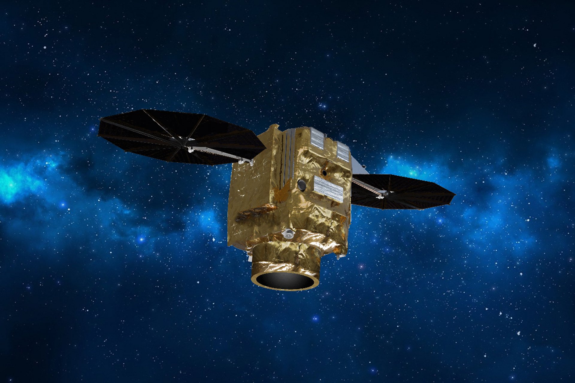
Pléiades Neo satellite. Source: Airbus