
Top satellite observations in 2022!
Here’s a summary of our top observations from spectator.earth from the last year. Observations are based on Copernicus Sentinel-2 satellites’ acquisitions. This whole year was varied by sudden atmospheric changes, as well as less noticeable, long-drawn events and presented us with many astonishing observations.
Wildfires around the world
Despite the changes in temperatures and humidity during the year, it didn’t change the fact that we could still see many ongoing wildfires, no matter the season. However, most memorable fires happened during summer months (check out summer observations 2022), such as:
- Pipeline Fire in Arizona.
- Oak Fire – one of the largest fires in California in 2022.
- Fire on Bickerton Island in Australia.
- Cedar Creek Fire on the east of Oakridge.
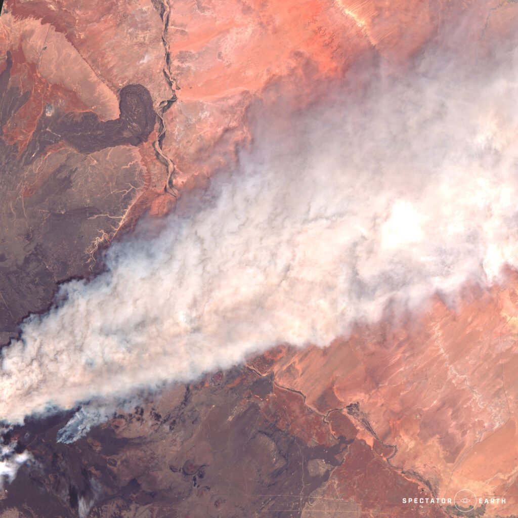
Huge Pipeline Fire in Flagstaff Arizona – view on the map.
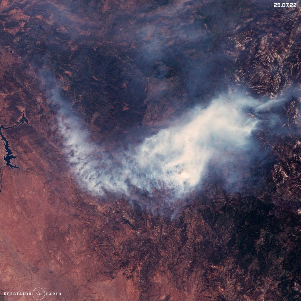
Oak Fire – one the largest fire in California this year – view on the map.
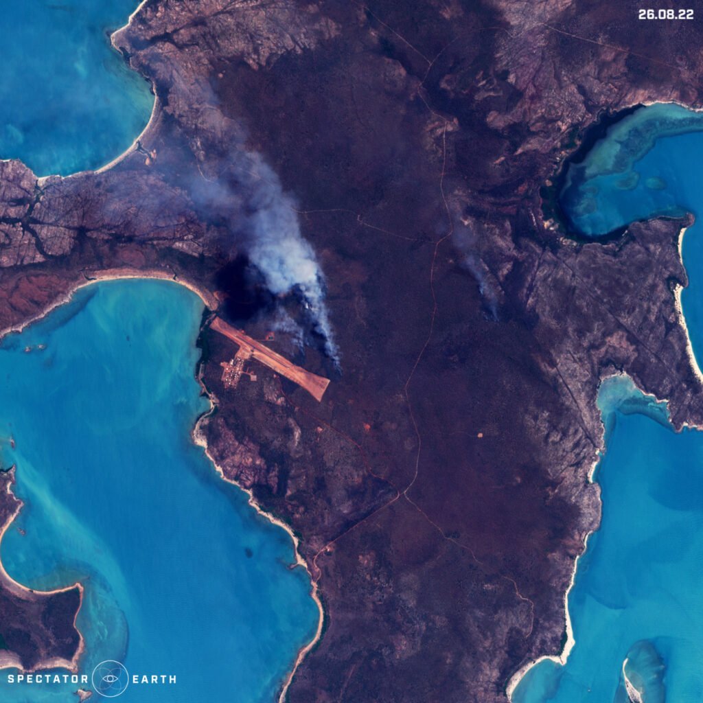
Fire spotted near Bickerton Airfield on Bickerton Island Australia – view on the map.
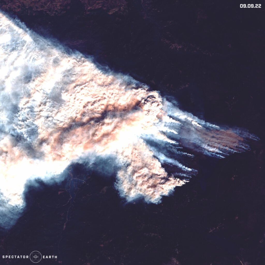
Cedar Creek Fire on the east of Oakridge – view on the map.
Active Volcanos
We can observe most volcanic eruptions no matter the time of the year:
- Very visible all throughout the year activity of Etna in Sicily.
- October activity of Alaid volcano located on the Kuril islands.
- Noticeable process of formation of an island caused by recent eruptions of the Home Reef volcano.
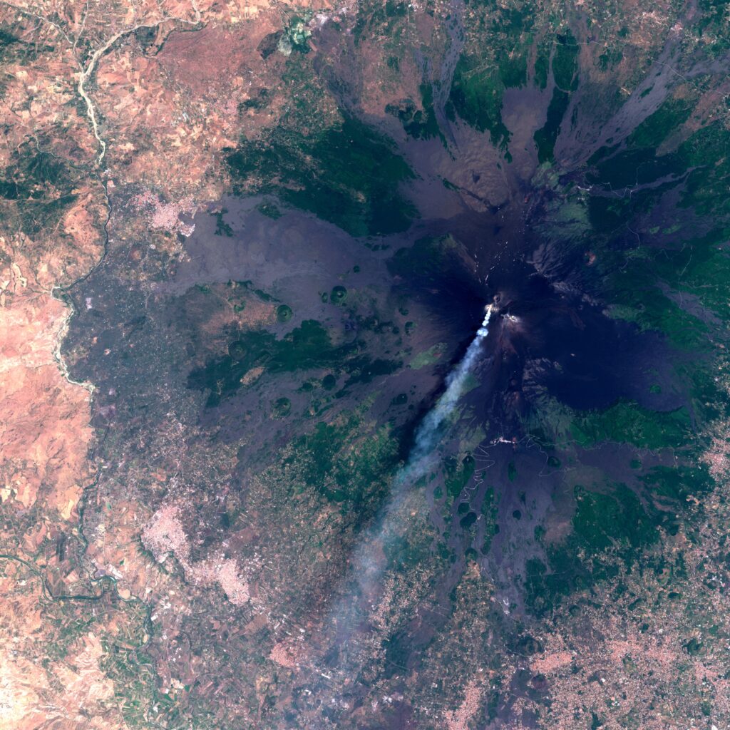
About 15km long line of smoke coming from Etna volcano – view on the map.

The latest activity of Alaid volcano – view on the map.
Latest changes of Home Reef volcano – view on the map.
Other Effects of Climate Change
During 2022 there have been many flash flooding events. Climate change is resulting in very polarized struggles in our environment. On one hand, we have a serious problem with droughts, on the other – we have heavy but short rainfalls, which are resulting in floods:
- Floods in Pakistan visible in the Hamal Lake area.
- Flood in Death Valley – an extremely dry place in California, where 3/4 of its annual rainfall in summer fell in just 3 hours.
- The beginning of Autumn was filled with hurricanes and typhoons. One of the most talked about hurricanes was Ian, which had devastating consequences for the state of Florida.
- We can also observe changes in a bigger time frame, like the melting of the Twitcher Glacier over the past 6 years.
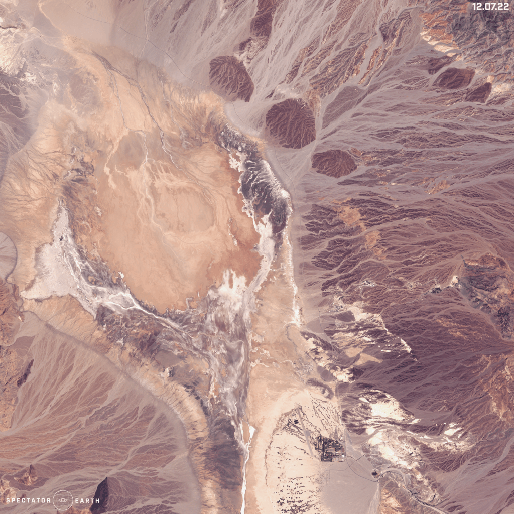
Flood in Death Valley during summer – view on the map.
Floods in Pakistan, visible in Hamal Lake area – view on the map.
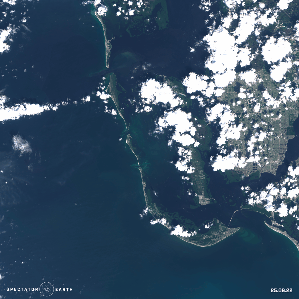
The aftermath of Hurricane Ian – view on the map.
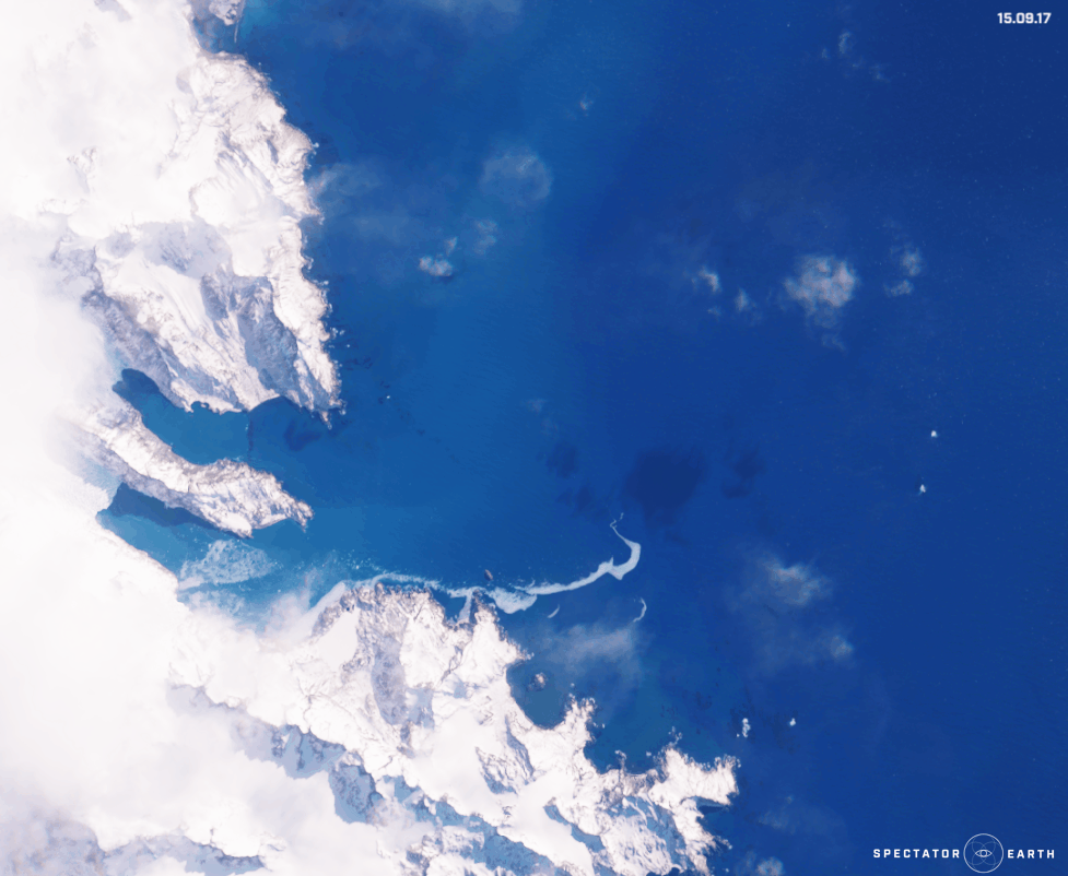
The melting of the Twitcher Glacier over the past 6 years – view on the map.
OSINT
Satellite imagery enables us to follow the course of action and events happening all over the world:
- We could see the continuation of intense fighting in military conflicts, for example in Ukraine. Multiple fires were visible from different parts of the country, like Sievierodonetsk, Sloviansk, and Mariupol in the images below.
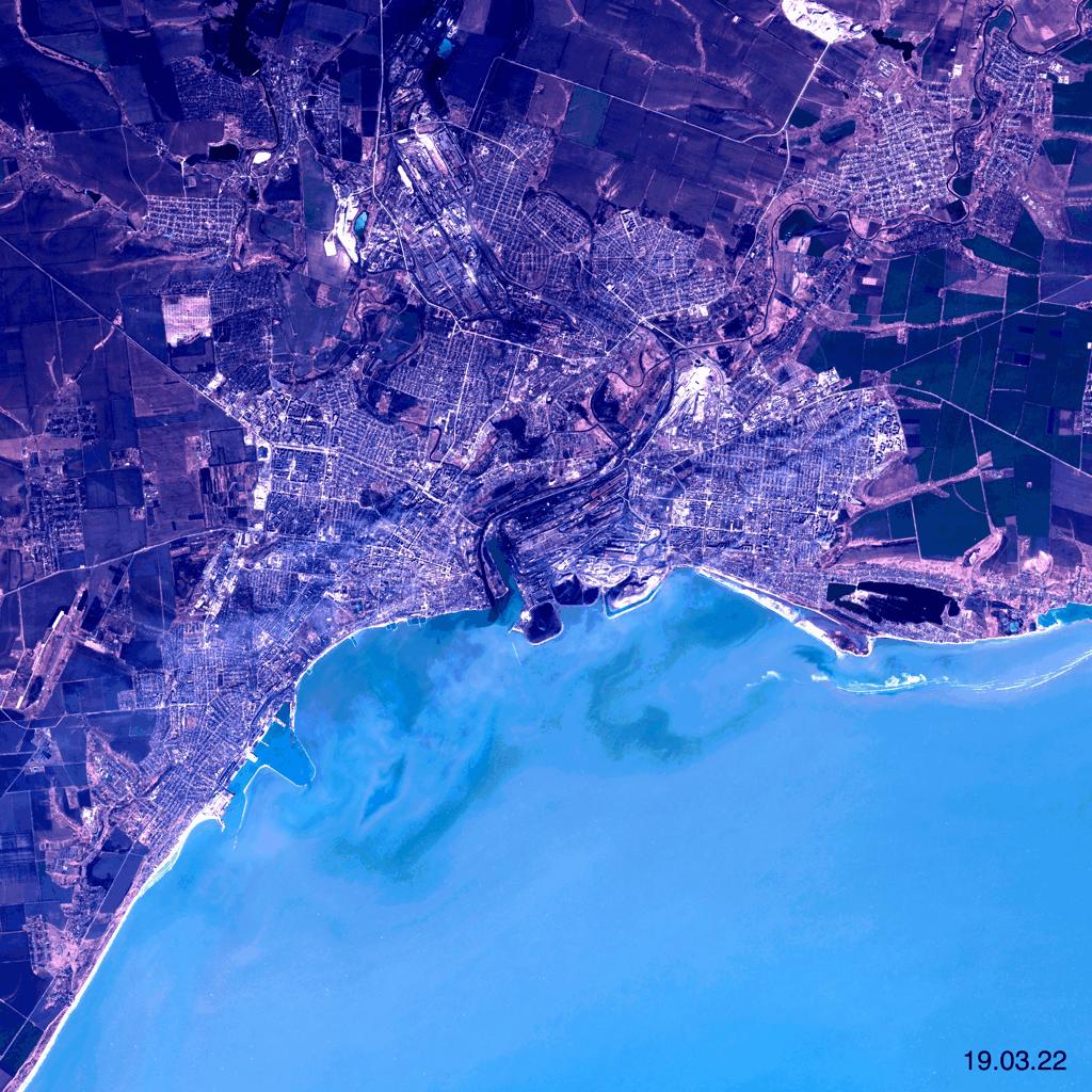
- On September 17 there was an opening ceremony for the Vistula Spit Canal in Poland, which allows bypassing of the Russian Strait of Baltyisk. Below we can see the construction of the Canal which started in February 2019.
- We could also monitor many different constructions, such as a construction of a new terminal at Kuwait International Airport.
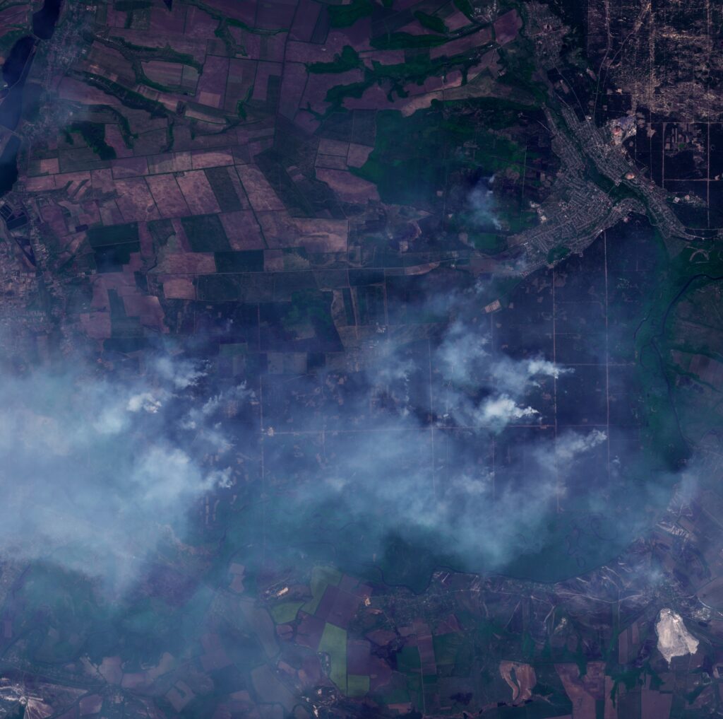
Fires spotted near Sievierodonetsk in Ukraine on May 8th – view on the map.
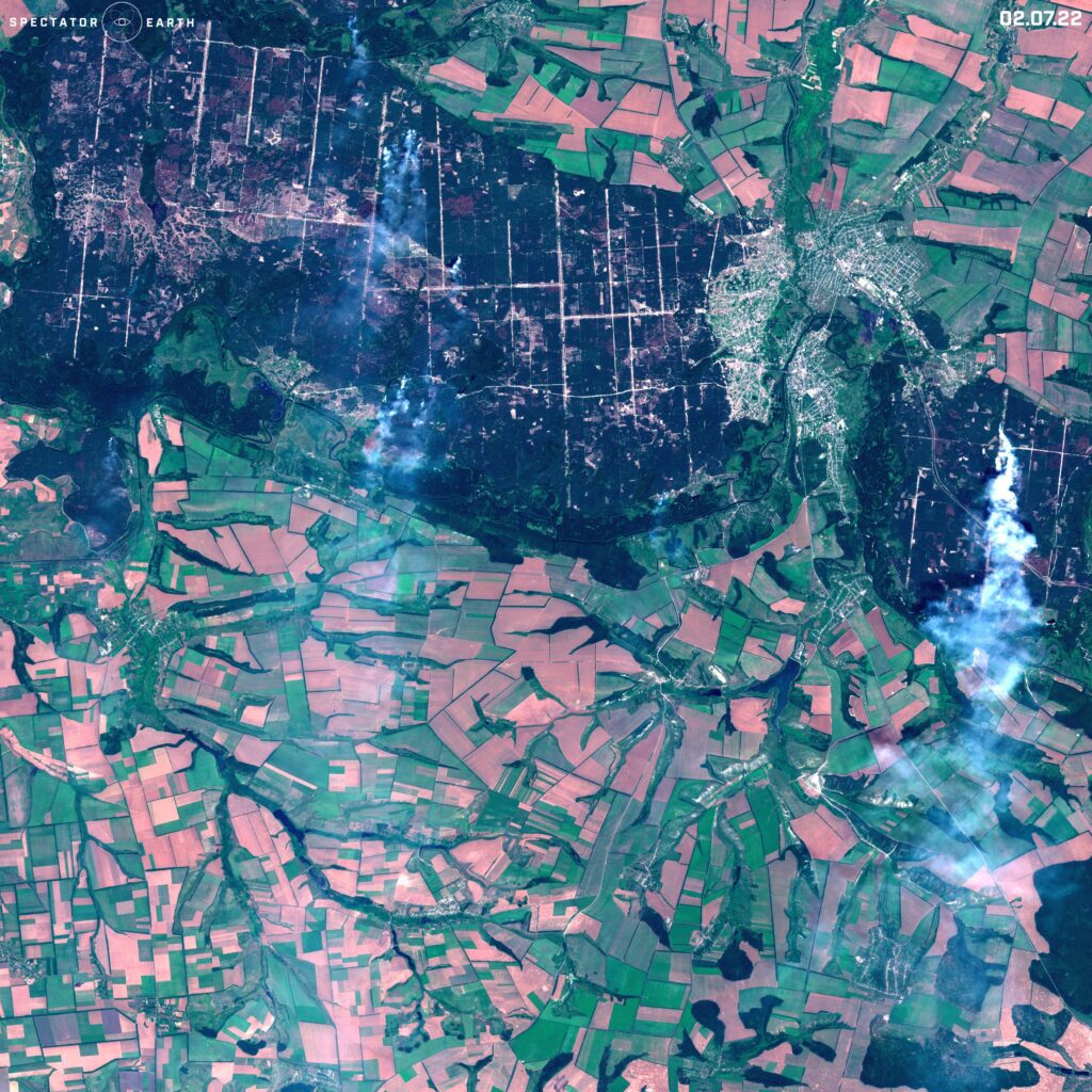
Fires are visible in the north of Sloviansk – view on the map.
Changes visible in Sentinel2 images of Mariupol in Ukraine – view on the map.
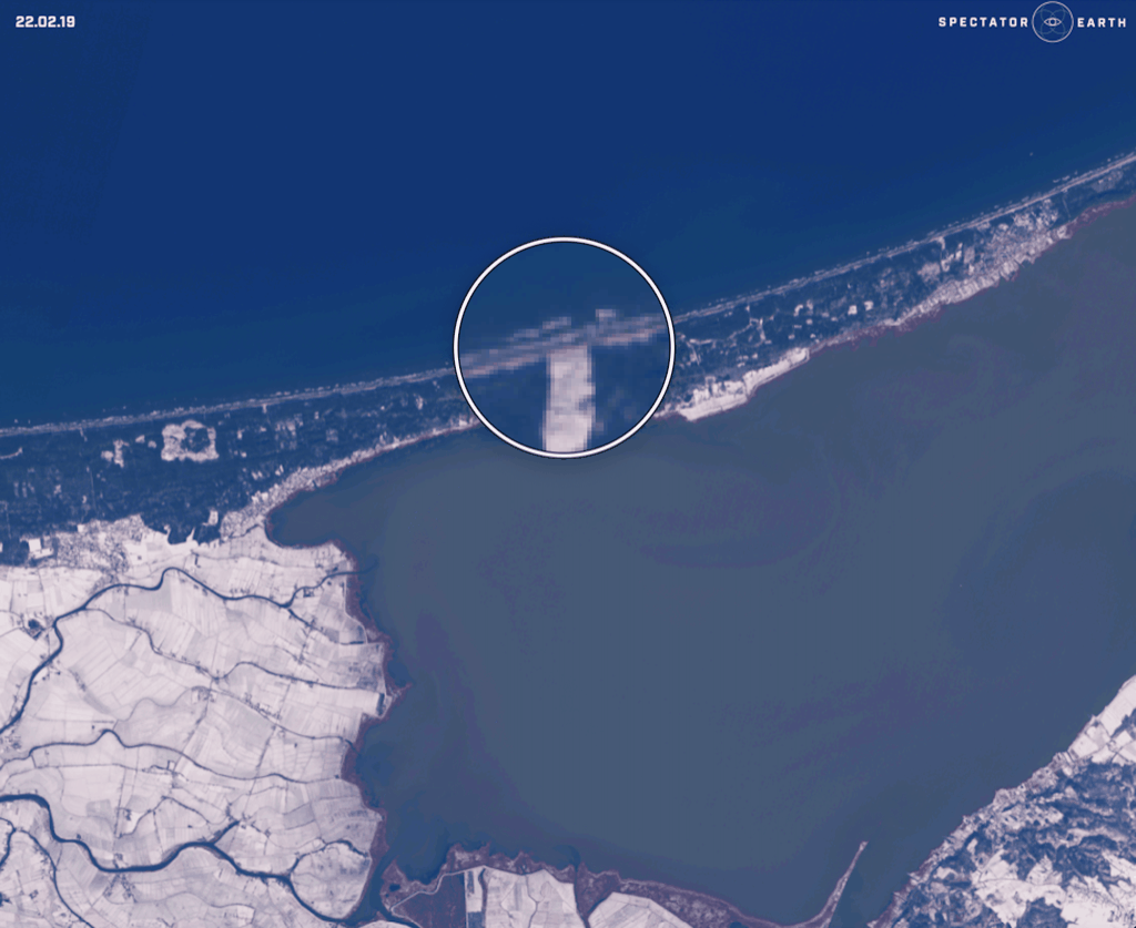
The construction of the Vistula Spit Canal in Poland – view on the map.
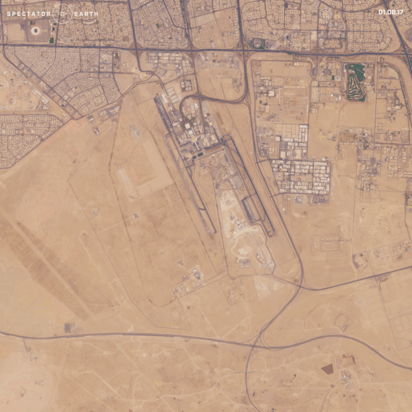
The construction of a new terminal at Kuwait International Airport – view on the map.
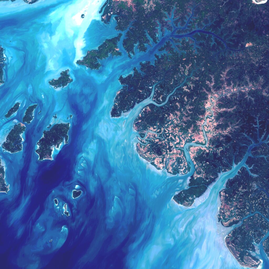
Beautiful Views
Besides monitoring many world events, we can also use satellite imaging to look for amazing views worldwide. Thanks to satellite images, in just a couple of seconds we can transport to another continent and appreciate the beauty of our planet.
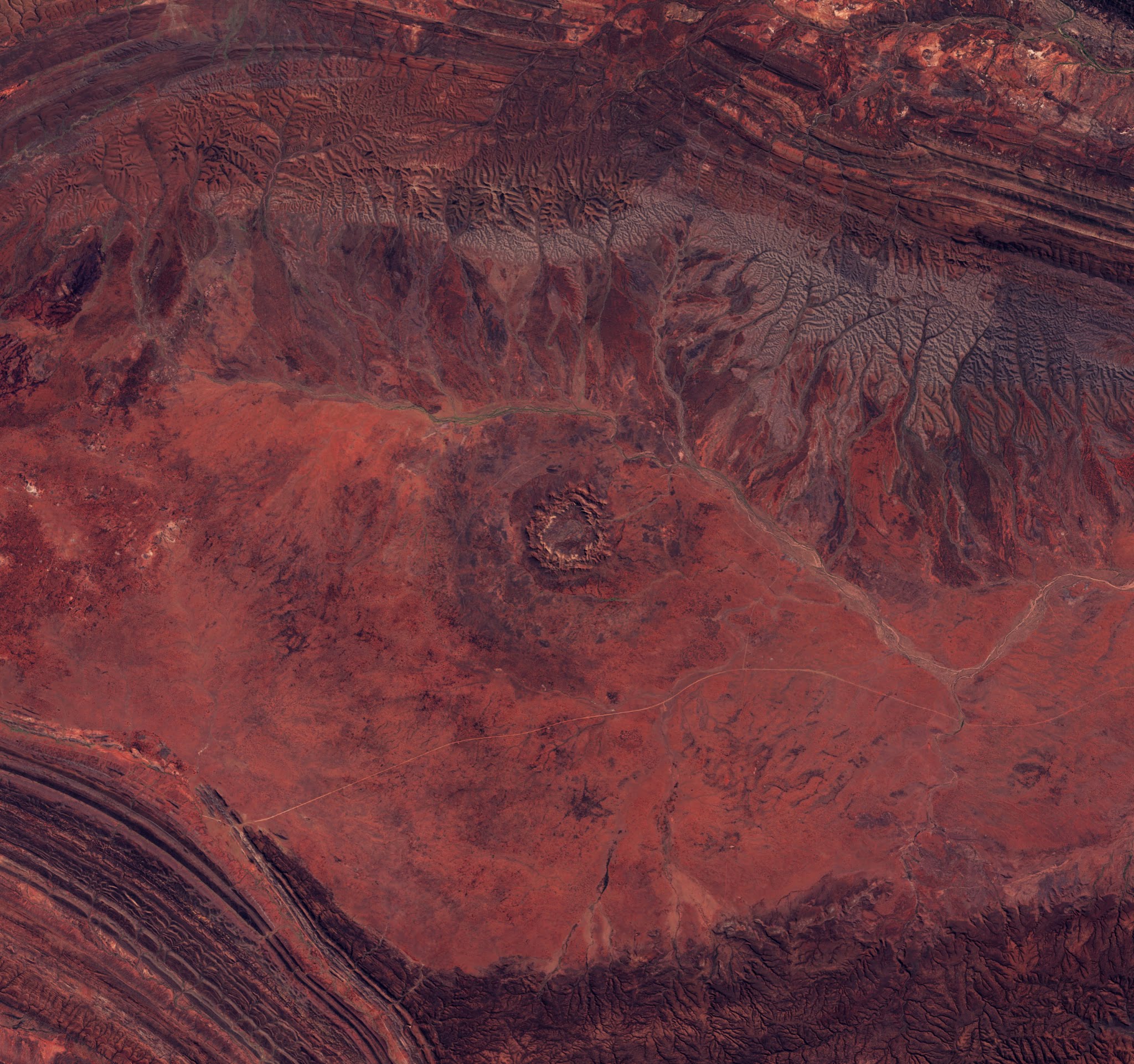
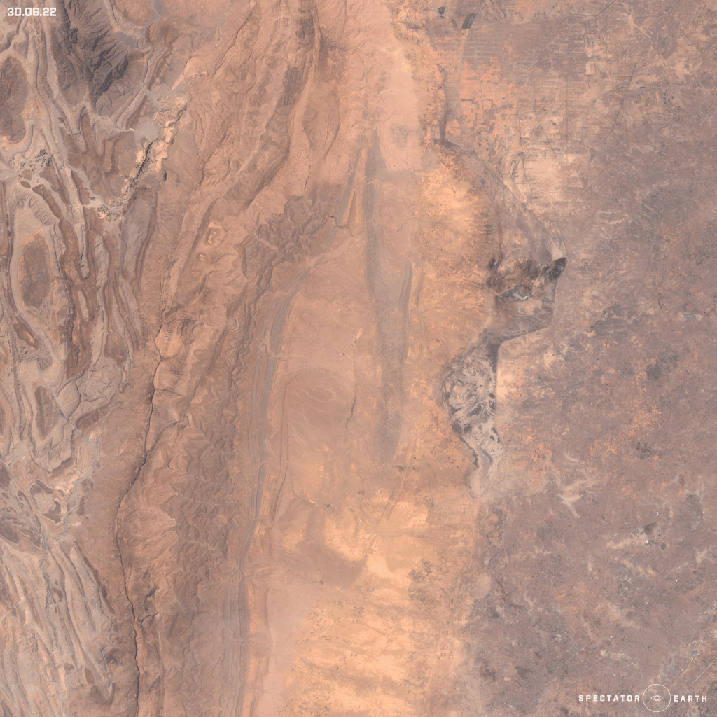
Gosses Bluff – one of the most known Australian impact craters with around 22 kilometers in diameter and 5 kilometers deep – view on the map.

Beautiful view of the British Virgin Islands on the North Atlantic Ocean – view on the map.
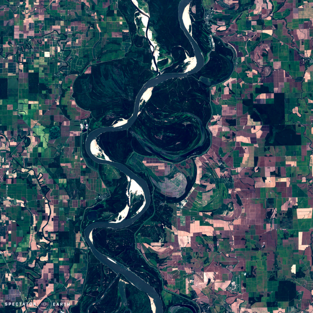
Here’s a Sentinel-2 image of the Mississippi River – view on the map.


#Environment


Next article

Editor’s note: This article written by the Satelligence team is part of the annual GeoTrends series. GeoTrends series aims to provide a platform for thought leaders, executives and strategic thinkers in the industry to articulate their vision and help our readers understand where the industry is headed in the future.
AI is proving to be the key to unlocking the supply chain quagmire; empowering farmers at the frontline of supply chains to lead the fight against deforestation by making sure they’re fairly compensated.
Deforestation related to agriculture is responsible for 15% of global greenhouse gas emissions.
A wave of sustainability commitments from some of the world’s largest businesses has created unprecedented demand for tools that can help companies identify and mitigate deforestation in their supply chains. New laws such as the EU’s Regulation on Deforestation Free Products will soon place mandatory obligations on companies to eliminate deforestation from their supply chains in order to keep trading on the EU market.
In order to stay within our planetary limits, companies and countries know they must act fast to make deforestation-free supply chains a reality. But company supply chains are huge operations spanning multiple countries, companies, and legal frameworks.
How AI Empowers Farmers To Fight Climate Change
On the one hand, smallholder farmers in the first mile of supply chains are squeezed from both sides by a need to clear more land for expansion and by demands for emissions reductions from manufacturers.
On the other, the race to net zero has corporations around the globe cutting emissions to meet climate commitments. For now, some of these emissions are unavoidable, so companies are compensating with carbon offsets.
For the first time, developments in AI machine learning have made it possible to measure precisely how much carbon has been captured and sequestered as a result of the agroforestry practices on individual smallholder farms. The carbon is converted into CRU’s (Carbon Removal Units) which are sold on the Voluntary Carbon Market. As much as 80% of the revenue from the sale can go directly to farmers, providing a significant incentive to nurture the trees on their land rather than cut them down.
CRUs are ex-post, meaning that each Unit sold represents one tonne of carbon that has already been removed from the atmosphere. This differs from the majority of carbon credits, which are sold before removal. More than just a novel application of AI, this nuance helps assuage concerns over the speculative nature of the carbon market.
Fulfilling the Potential of Applied AI: How does it work?
An AI-powered carbon estimation machine learning model based on satellite imagery is used to estimate the amount of stored carbon in plots at regular intervals. Those plots represent farm plot boundaries, which are catalogued in partnership with industry and local NGOs.
In order for machine learning to predict carbon stock, three components are needed:
- Farm plot field data as a training set
- Satellite imagery as a feature set
- A Random Forest machine learning model
With these ingredients, you can teach the model to estimate carbon levels based on the feature set to track changes over time. It can convert satellite images of plots into units of sequestered carbon that are organised farm by farm.
Improving Accuracy Over Time
Scalability is crucial, and repeatability and traceability are the cornerstones of scalability. One of the biggest challenges in using AI to achieve scalability is coping with variations in farm plot field data, as different companies across different countries submit data in different ways. Divergent interpretations and a lack of homogeneity across training data sets create issues with local bias. The predictive capability of the model can only ever be as good as the training data set it’s drawn from.
In practice, this means that modelling approaches are tied to the ecological region they’re drawn from. They aren’t transferable to locations where the environmental conditions are entirely different.
AI machine learning has been crucial in overcoming these obstacles. an ISAE-3000 Type 1 Certified quality control audit process has been developed for each type of environment, country or commodity, a form of meta-algorithm, that allows carbon modelling approaches to be adapted to any ecological region.
With the ISAE-3000 certified algorithm, companies can use the same quality control process to map Cocoa in the Ivory Coast as they could to Palm oil in Indonesia.
AI Facilitates Human Creativity
The project leverages the ability of AI to discover and repeat patterns that are too complicated for humans to recognise, or too boring for them to repeat, enabling engineers to apply their expertise to analyse, curate and fix errors in the data. Experts are then free to focus on fixing external abnormalities like clouds, atmospheric disturbances and noise, so the product can be continuously improved.
Thanks to innovations in AI, the otherwise costly and complex process of scaling carbon footprinting measurements across global commodities is getting simpler by the day.