

 It’s a great feeling when you’ve finally decided that you will learn how code your first web map! You’re excited and ready to get going. Then, when you do a little bit of research…
The reality strikes: there’s so much to learn! Right? “It’s really hard!” you might think and…Well, just do nothing. Here, I will debunk some of the most common myths about coding web maps that will help you move forward. Along the way, I will share with you my favourite tools to make your life easier as you embark on this exciting journey! Let’s get started:)
Myth #1: Coding web maps is exactly the same as coding any other web application and it’s hard.
Coding web maps can be easier than coding most web applications because a lot of the time you can get a fully functional web mapping application without help of any code that runs on a web server.
What’s wrong with running code on a web server? Absolutely nothing. It’s just a steep learning curve for most beginners. And you just don’t always need all of the features of a web application in your web map. Here’s what you don’t need. Especially at the beginning:
You don’t need to get your data from a database (more about that in myth #2) or have editing or login capabilities for example. You can get a pretty useful web map without all that.
It will save you a lot of time (and frustrations) to start with a simple version of your web map. And then, once you see your web map working…and get a pretty good motivational kick out if, you will be ready to learn how to use all those other features.
As a beginner, you have to focus your whole attention on learning what you can do with a simple web page and a little bit of Javascript code (and here’s a clue: you can do a lot with just that:). No web server code needed.
But, of course you will be tempted to go to the “dark side” because your spatial data is probably in some kind of database…
And that brings me to the next myth:
Myth #2: I need to get data for my web map from a database.
It’s ok to have it as an end goal, but it will take you more time that it’s worth at the beginning. And the reasons is simple: you need to go the web server to make that happen. Or use a map server. The truth is that you don’t need to do that at the beginning. Here’s why:
A lot of beginners are quite surprised to know that they can get their whole spatial dataset into a web map code. Yes, inside an actual web page. Really?
Yes, it’s because everything becomes faster. Our devices, internet connections, browsers and even web mapping libraries are becoming faster. So, you might be surprised to find out that your data is not a big as you might think.
You also have plenty of other options to store and serve your spatial data instead of using a database. For example, you can use a cloud service or a map server. But, unless you’ve already have access to them and know how to use them, don’t start there! It will slow your down. Keep it simple, put your spatial data into your web map code! Ok, back to the actual process of coding web maps, next myth is..
Myth #3: I need to become an HTML & CSS & Javascript expert.
Here again, coding maps can be a much easier than coding a web application. First, you can safely forget about CSS when you’re starting out. CSS is just a way to describe, how a web page element should look like. But, when you use a modern Javascript web mapping library (every web map does) a lot of styling is done for you.
Of you course, if you need more customisation you will eventually need to get into it. But, for now. Don’t worry about it. What about HTML? You need a very little HTML and a simple web page template for your web map.
This is again, where the most work is done by Javascript web mapping libraries. And that brings me to the last technology: Javascript.
Yes, you need to learn how to use it. But, the good news is that you will learn it just by using a specific web mapping library. It’s much easier to do that rather than just trying to learn Javascript without any context.
It’s just good old learning by doing. And, for most beginners, it works really well. Let’s move to myths about the tools of a web mapping trade, next myth is…
Myth #4: I need to use a “professional” code editor.
This is a big one. A lot of people get really stuck here. There are endless choices here. Some with very advanced features and sometimes a price tag too. But, to be honest with you, you don’t need any special piece of software to write your code (I know, I keep repeating myself;).
You can even do that in Notepad. That’s fine. The only key feature that I see is very beneficial for beginners is syntax highlighting. This is a feature that will colour a different parts of your code into different colours.
And one of code editors that has this feature and is very simple to use is a code editor called atom. And yes, it’s free. If you can’t decide which editor to choose, just use atom and be done with it. And once you code you web map it’s time to… Yes, share it with the world, which brings me to the next myth:
Myth #5: I need to buy a web hosting account to publish my web map.
When you buy a hosting account, you will get a place on some web server where you can put your web pages and web applications. The main reason why you need to pay for most hosting accounts is that you have access to plenty services you can use.
But, since, hopefully, I’ve convinced you that for your first web map you don’t need a database and all this code on a web server you can use a perfectly fine free options. One of them is 000webhost’s free web hosting account, it’s quite easy to use and totally free.
That’s it!
I hope, that I’ve helped you overcome some of the problems that you might have getting started with coding web maps.
What’s your biggest problem with getting started with coding web maps? Tell me in the comments below!
If you are ready to actually code your first web map, let me help you with that with those free video tutorials.


#Featured

Next article


Nobody said launching a satellite is easy. After all, it does require rocket science. But this year is far from over and we have already seen quite a few setbacks for some of the biggest names in the space industry. Take a look…
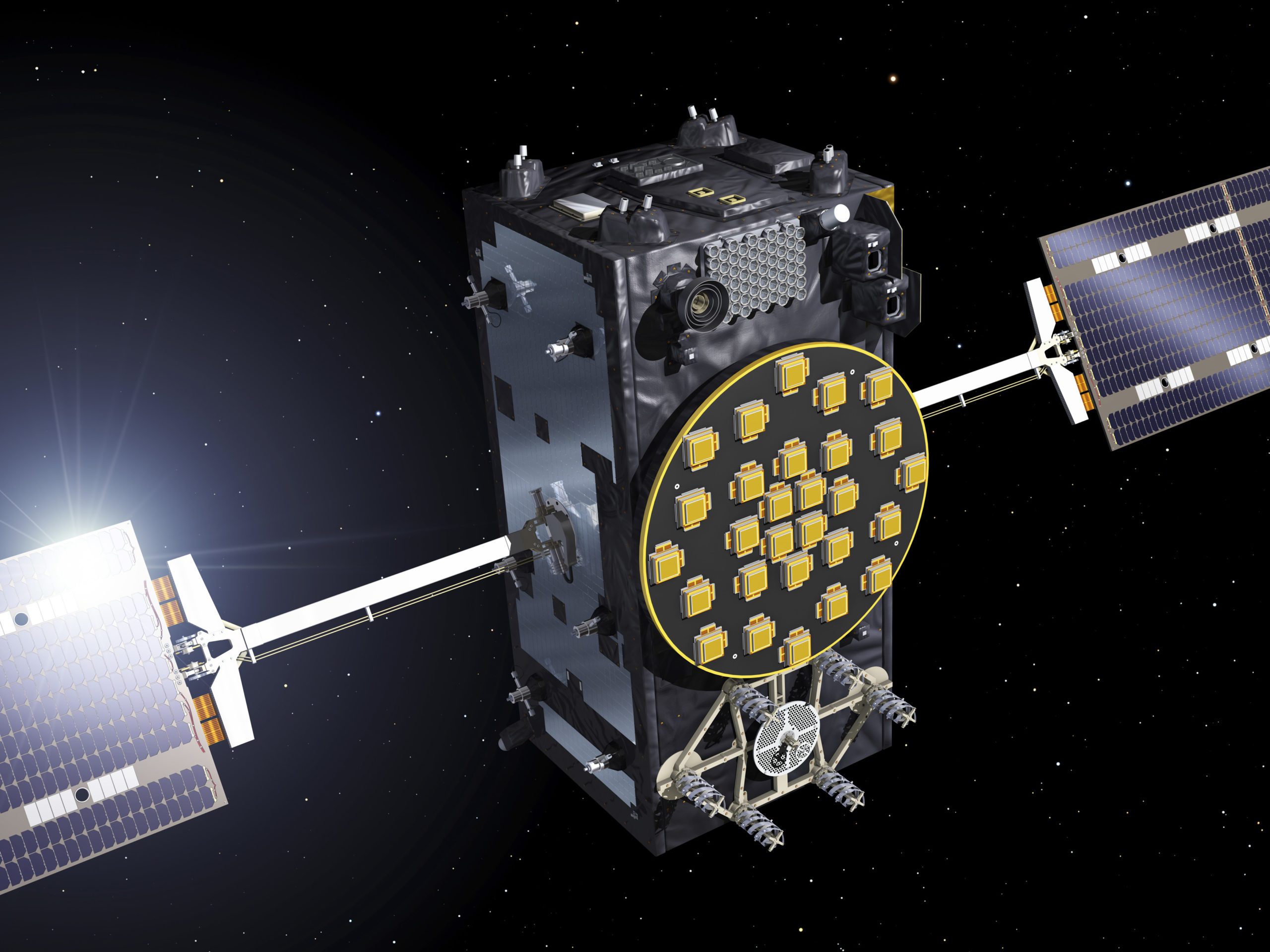
European Space Agency
What happened: Clocks on several Galileo satellites failed
The year began on a pretty ominous note when the European Space Agency (ESA) declared in January that the atomic clocks on a number of satellites in the Galileo satnav constellation had failed. Out of the 72 clocks launched till date, nine had become flawed. Though ESA didn’t declare any of the satellites as completely nonfunctional because of this glitch, Director General Jan Woerne acknowledged that more failing clocks meant reduced capability of Galileo and that was a serious issue. “If this failure has some systematic reason we have to be careful,” he told reporters in Paris.
The Galileo satnav system has already seen many setbacks, including the budget spiraling three times the original estimate in the last 17 years that it has taken to develop.
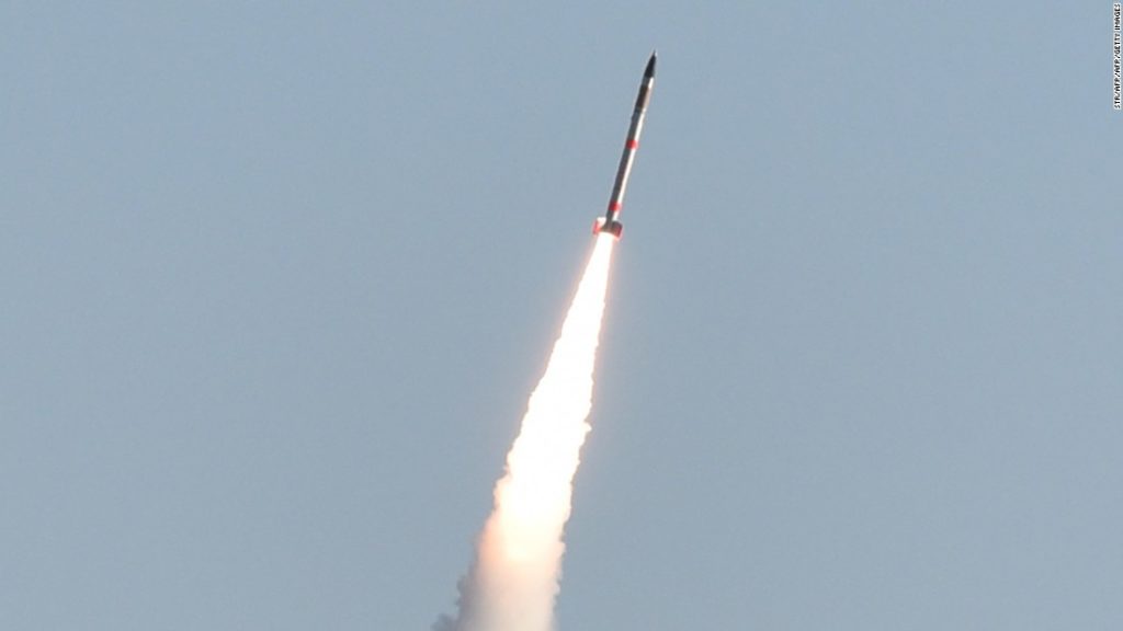
Japan Aerospace Exploration Agency
What happened: Japan’s smallest-ever rocket launch was a disaster
Also in January, Japan’s mini-rocket technology efforts ended up in deep water when the 32-feet rocket carrying a payload of 3 kg fell into the sea. According to the Japan Aerospace Exploration Agency, after the rocket launched, the communication systems malfunctioned and ignition of the second booster terminated. Several Japanese firms were backing this project as they sought cheaper and easier options to put a satellite into space.
“This is still a small step and we expect more impediments, but once the launch succeeds, we see a potential for making the rocket launch cheaper and shorter in project time,” the space agency’s public relations officer Takayuki Tomobe explained.

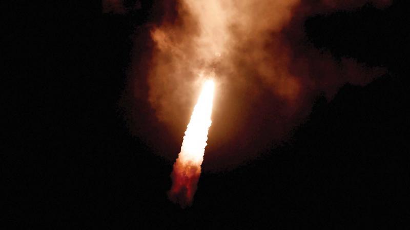
China Aerospace Science and Technology Corporation
What happened: China’s most powerful rocket failed
On July 2, China’s premier heavy-lift rocket, Long March 5, attempted to launch an experimental communications satellite into space, but couldn’t. The initial ascent seemed fine. But after the rocket had shed its boosters, there appeared to be an unplanned delay in the core stage separation. With the second stage’s burn not meeting predictions, the rocket began to lose altitude.
Even as official news agency Xinhua confirmed that “an anomaly occurred during the flight of the rocket,” the failure spelled a big setback for the country’s spaceflight program… Because only a month before, Long March 3B had sent a satellite into the wrong orbit after an unsuccessful launch. Having two back-to-back failures certainly didn’t look good for China Aerospace Science and Technology Corporation.
Indian Space Research Organization
What happened: Satellite couldn’t leave its launcher after liftoff
For the first time in two decades, Indian Space Research Organization’s trusted Polar Satellite Launch Vehicle (PSLV) failed to complete a mission successfully when the satellite it was carrying remained glued to its launcher on August 31. While an investigation is underway to deduce the exact reasons for the failure, the glitch apparently came from the heat shield. ISRO announced that even though the holding apparatus inside the rocket had unclasped, the satellite couldn’t get out because the heat shield simply didn’t open.
It’s interesting to note that the satellite PSLV was carrying, IRNSS-1H, was itself supposed to replace another satellite in India’s regional navigation constellation (IRNSS-1A) after an atomic clock on the latter failed completely last year, rendering its ability to transmit positioning data to the ground useless.
And now we come to the swarm of private organizations and academic institutions whose satellites simply refused to work… all in one launch

Astro Digital
What happened: 2 satellites launched in July became unresponsive
Not too long ago, we wrote about the new kid on the satellite industry block, Astro Digital and its plan to put the entire system of earth observation on steroids. The startup aims to do everything from offering its own imagery to providing ultra-fast, on-demand data processing. And to this end, it launched Landmapper-BC1 and Landmapper-BC2 satellites on July 14.
By September 9, the company was forced to declare both the satellites as ‘officially unresponsive’. This announcement came after 6 weeks of failed attempts to resuscitate the birds whose ability to transmit data back to earth had been compromised ever since their deployment. Astro Digital suspects launch anomalies that could have led to conditions extreme enough to fry the key electronics on the spacecraft. The launch was carried out by a Russian Soyuz rocket, which brings us to the next entry on this list…
Dauria Aerospace, Moscow Aviation Institute, Moscow State University, GeoOptics, and UTE-UESOR
What happened: 8 out of 9 cubesats deployed failed to function
In total, the July 14 Soyuz mission carried 73 satellites into orbit. Soon, we learned that at least eight of the nine satellites sent by the above-mentioned organizations had stopped responding to the operator’s commands. The company that provided the launch services, Glavkosmos, was quick to blame the developers for this failure, stating that there was no evidence to support the rocket was responsible for the misadventure.
“It’s their first experience in cubesat development,” Launch Program Director Vsevolod Kryukovskiy said. “It could be something on the development side, or with components or ground stations.” But, once he was pointed to the issues with the established players in the small satellite industry, Kryukovskiy had to admit his failings. Read about them below…
Planet and Spire
What happened: One cubesat each faced an issue with the Soyuz launch
Soyuz carried 48 Doves for Planet and 8 Lemur satellites for Spire on its July 14 mission. While Planet was unable to establish contact with one of the Doves, the Soyuz accidentally released one of Spire’s satellites into the wrong orbit. Both companies decided not to make any noise about this matter.
Meanwhile, launch director Kryukovskiy has assured that the technical team is examining the final mission telemetry, and the report should be ready soon.