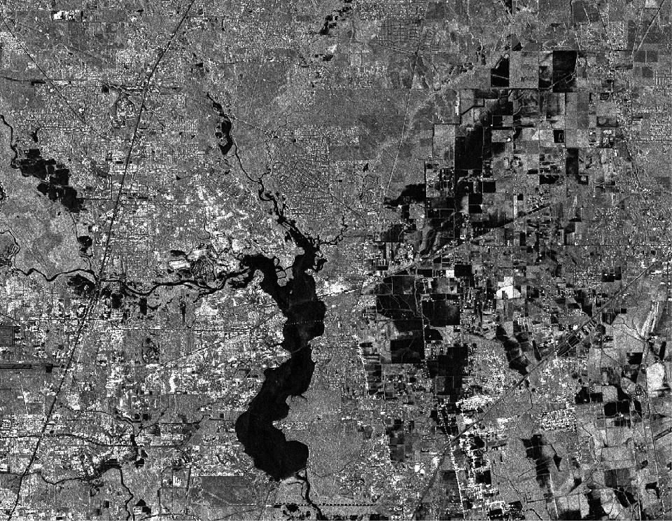


SAR image of Lake Houston during Tropical Storm Harvey
Yet even with all of these new developments, the ceiling for our industry remains high. We’ve only just begun to scratch the surface of the relevant use cases. For instance, outside of the typical finance and government sectors, we’re beginning to see increased interest in geospatial intelligence from other industries, such as insurance.
One of the factors powering this increase in use cases is the advent of data sources that utilize more of the electromagnetic spectrum than traditional visual imagery. For instance, we’re seeing satellites launch now that image using synthetic aperture radar (SAR), and satellites that can detect radio waves. These types of data present new challenges in analysis, as they require different kinds of algorithms to detect change and patterns. However, it’s also been interesting to see how many of the techniques we’ve developed for analyzing traditional EO imagery, such as deep learning, are also applicable to these new data sources. This is an area where we’ll continue to see development in the coming year.
Another trend that will gain momentum in 2019 is the use of GPUs to analyze non-imagery datasets. Historically, CPUs have been used for most computing needs, while GPUs have been reserved for tasks that require greater processing power, such as imagery analysis. But today, even non-imagery geospatial datasets are becoming quite massive, which means that you’ll start to see GPUs being used more and more outside of traditional computer vision tasks.
Overall, 2019 is poised to be an exciting year for geospatial analytics, with new applications being developed and advances being made in existing areas. In fact, this is a field with so much innovation on the horizon that it’s impossible to predict for certain what new technologies will evolve in the next twelve months—but it will undoubtedly be exciting to watch!


#Business


Next article

The wait is finally over! Here is the list of the Top 100 Geospatial Companies and Startups in 2019.
2019 Top 100 Geospatial Companies and Startups List
Below is the table with the list of the companies and startup that we think are the Top 100 in 2019. Please scroll down to bottom of the page to see details regarding their tech stack, funding stage, number of employees, company summary, etc in addition to being able to filter them.
If you are a twitter fan, then here is the twitter list with all of them – “Top Geospatial Companies Twitter List“.
Interested in learning more about how we determined the list, who was involved and which companies were considered? Here is the link with more details “The process behind how the Top 100 Geospatial Companies and Startups list was compiled”.
P.S: If you are interested in receiving the latest developments in the geospatial industry delivered directly to your inbox, then subscribe to the Geoawesomeness newsletter. No spam! That’s a promise 🙂
| Orbital Insight | Remote Sensing, Photogrammetry, Drones, Computer Vision, Augmented Reality | Palo Alto, California, USA | January 2013 |
| PlanetWatchers | Remote Sensing, Photogrammetry, Computer Vision, Augmented Reality | San Francisco, California, USA | January 2016 |
| Development Seed | Location Data Analytics, Location Intelligence, Remote Sensing, Photogrammetry, Mapping, GIS | Washington D.C, USA | April 2003 |
| Cesium (part of Analytical Graphics, Inc.) | Navigation, Mapping, GIS | Exton, Pennsylvania, USA | January 1989 |
| Esri | Location Data Analytics, Location Intelligence, Mapping, GIS | Redlands, California, USA | 1969 |
| Spatial AI | Location Data Analytics, Location Intelligence | Cincinnati, Ohio, USA | January 2016 |
| Urthecast | Remote Sensing, Photogrammetry, | Vancouver, British Columbia, Canada | December 2010 |
| Ordnance Survey | Location Data Analytics, Location Intelligence, Navigation, Remote Sensing, Photogrammetry, Drones, Mapping, GIS, Computer Vision, Augmented Reality, Urban Planning | Southampton, UK | August 1791 |
| Pix4D and SenseFly (Parrot group) | Remote Sensing, Photogrammetry, Drones, Mapping, GIS | Paris, France | 1994 |
| Coord | Location Data Analytics, Location Intelligence, Navigation, Mapping, GIS, Computer Vision, Augmented Reality, Developer tools for the mobility market | New York City, USA | January 2017 |
| PCI Geomatics | Location Data Analytics, Location Intelligence, Remote Sensing, Photogrammetry, Drones, Mapping, GIS, Urban Planning | Markham, Ontario, Canada | January 1982 |
| Geographica | Location Data Analytics, Location Intelligence, Location-based Marketing, Mapping, GIS, Urban Planning, Human Geography | Sevilla, Spain | January 2007 |
| FATMAP (Terrascope Ltd.) | Location Data Analytics, Location Intelligence, Navigation, Mapping, GIS, Computer Vision, Augmented Reality | Berlin, Germany | April 2013 |
| PrecisionHawk | Drone, Mapping, GIS, Location Intelligence | Rayleigh, North Carolina, USA | 2011 |
| SmartMonkey | Location Data Analytics, Location Intelligence | Barcelona, Spain | July 2015 |
| Boundlessgeo (part of Planet) | Location Data Analytics, Location Intelligence, Mapping, GIS, Urban Planning, Human Geography | St. Louis, Missouri, USA | November 2012 |
| CityMapper | Navigation, Apps | London, UK | 2011 |
| DroneDeploy | Drone, Mapping, GIS, Location Intelligence | San Francisco, California, USA | 2013 |
| Street Light Data | Mobility, Location Data Analytics, Location Intelligence | San Francisco, California, USA | May 2011 |
| Uber | Navigation, Mapping, GIS, Apps | San Francisco, California, USA | March 2009 |
| BuildingFootprintUSA | Location Data Analytics, Location Intelligence, Location-based Marketing, Mapping, GIS, Urban Planning, Insurance underwriting/catastrophe modeling/flood certification; Telco infrastructure planning | Albany, New York, USA | March 2016 |
| Here | Location Data Analytics, Location Intelligence, Navigation, Location-based Marketing, Remote Sensing, Photogrammetry, Drones, Mapping, GIS, Computer Vision, Augmented Reality, Blockchain, Decentralization, Internet Of Things, Urban Planning, Human Geography, Autonomous Driving | Berlin, Germany | January 1985 |
| Mapbox | Location Data Analytics, Location Intelligence, Navigation, Drones, Mapping, GIS, Computer Vision, Augmented Reality, Internet Of Things, Urban Planning, Autonomous Driving | Washington, D.C, USA | August 2010 |
| Pitney Bowes | Location Intelligence | Stamford, Connecticut, USA | April 1920 |
| Telenav | Location Data Analytics, Location Intelligence, Navigation, Location-based Marketing, Mapping, GIS | Santa Clara, California, USA | September 1999 |
| TomTom | Location Data Analytics, Location Intelligence, Navigation, Mapping, GIS | Amsterdam, Netherlands | January 1991 |
| Trimble | Surveying, Mapping, GIS, Transportation, Asset Tracking, Agriculture, Navigation, Location Intelligence | Sunnyvale, California, USA | November 1978 |
| DigitalGlobe (part of Maxar Technologies) | Remote Sensing, Photogrammetry | Westminster, Colorado, USA | 1992 |
| Planet Labs | Remote Sensing, Photogrammetry | San Francisco, California, USA | December 2010 |
| Boni | Indoor Mapping, Navigation | Istanbul, Turkey | September 2011 |
| Hexagon | Location Data Analytics, Location Intelligence, Navigation, Location-based Marketing, Remote Sensing, Photogrammetry, Drones, Mapping, GIS, Computer Vision, Augmented Reality, Blockchain, Decentralization, Internet Of Things, Urban Planning, Human Geography, Autonomous Driving | Stockholm, Sweden | 1992 |
| Mapillary | Location Data Analytics, Location Intelligence, Navigation, Mapping, GIS, Computer Vision, Augmented Reality, Autonomous Driving | Malmö, Sweden | September 2013 |
| Microsoft -Bing Maps | Location Data Analytics, Location Intelligence, Mapping, GIS, Computer Vision, Augmented Reality, Blockchain, Decentralization, Internet Of Things | Redmond, Washington, USA | April 1976 |
| Factual | Location Data Analytics, Location Intelligence, Navigation, Location-based Marketing, Mapping, GIS, Internet Of Things | Los Angeles, California, USA | January 2008 |
| Location Data Analytics, Location Intelligence, Maps, Apps | San Francisco, California, USA | September 1998 | |
| what3words | Navigation, Mapping, Urban Planning | London, UK | April 2013 |
| GIS Cloud | Location Data Analytics, Location Intelligence, Mapping, GIS | Zagreb, Croatia | October 2009 |
| Avuxi | Location Data Analytics, Location Intelligence, Mapping, GIS | Barcelona, Spain | June 2014 |
| Sparkgeo | Location Data Analytics, Location Intelligence, Navigation, Remote Sensing, Photogrammetry, Mapping, GIS | Prince George, British Columbia, Canada | May 2010 |
| Inrix | Location Data Analytics, Location Intelligence, Internet Of Things, Telecommunication | Kirkland, Washington, USA | 2005 |
| Satelligence | Remote Sensing, Photogrammetry, Mapping, GIS, prioritized deforestation alerts / commodity risk monitoring | Utrecht, Netherlands | January 2016 |
| OpenCage Data Ltd. | Location Data Analytics, Location Intelligence | London, UK | March 2015 |
| Applied Geographics, Inc. (AppGeo) | Location Data Analytics, Location Intelligence, Location-based Marketing, Mapping, GIS, Internet Of Things, Urban Planning, Human Geography | Boston, Massachusetts, USA | May 1991 |
| SensorUp | Internet Of Things | Calgary, Canada | December 2011 |
| MapTiler (part of Klokan Technologies) | Mapping, GIS, Map provider, GIS software development | Zug, Switzerland | January 2017 |
| Argis Solutions | Mapping, GIS, Computer Vision, Augmented Reality | Denver, Colorado, USA | April 2016 |
| Hivemapper | Location Data Analytics, Location Intelligence, Remote Sensing, Photogrammetry, Drones, Mapping, GIS, Computer Vision, Augmented Reality, Urban Planning | Burlingame, California, USA | January 2016 |
| Foursquare | Location Data Analytics, Location Intelligence, Mapping, GIS | New York City, USA | March 2009 |
| Ubisense | Location Data Analytics, Location Intelligence | Cambridge, UK | 2002 |
| Harvesting | Remote Sensing, Photogrammetry, Mapping, GIS | Fremont, California, USA | May 2016 |
| PlaceIQ | Location Intelligence | New York City, USA | 2010 |
| Meemim Inc. (vGIS) | Mapping, GIS | Toronto, Ontario, Canada | October 2016 |
| StreetCred | Mapping, GIS, Blockchain, Decentralization | New York City, USA | March 2018 |
| Living Map | Location Data Analytics, Location Intelligence, Mapping, GIS, Internet Of Things | Bath, UK | January 2012 |
| Ubimo | Location Data Analytics, Location Intelligence, Location-based Marketing, Mapping, GIS, Activation | Tel Aviv, Israel | April 2013 |
| Gruntify | Location Data Analytics, Location Intelligence, Mapping, GIS | Brisbane, Australia | October 2014 |
| Positium LBS | Location Data Analytics, Location Intelligence, Urban Planning, Human Geography | Tartu, Estonia | February 2003 |
| GeoCat BV | Mapping, GIS, Spatial Data Infrastructure | Bennekom, Netherlands | November 2007 |
| Vizonomy | Mapping, GIS, Internet Of Things, Urban Planning, Climate Risk Management (for cities and supply chains) | Washington D.C, USA | June 2014 |
| Spatineo | Location Data Analytics, Location Intelligence | Helsinki, Finland | January 2011 |
| SocialCops | Location Data Analytics, Location Intelligence, Location-based Marketing, Mapping, GIS, Urban Planning, Human Geography, Monitoring and Evaluation | New Delhi, India | August 2013 |
| Airsage | Location Data Analytics, Location Intelligence, Telecommunications | Atlanta, Georgia, USA | May 2000 |
| Indoors | Indoor Mapping, Navigation | Vienna, Austria | 2010 |
| Indoor Atlas | Indoor Mapping, Navigation | Oulu, Finland | 2012 |
| Nextome | Indoor Mapping, Navigation | Puglia, Italy | December 2013 |
| Point Inside | Indoor Mapping, Navigation | Bellevue, Washington, USA | February 2009 |
| Geoblink | Location Intelligence | Madrid, Spain | March 2015 |
| Urban Data Analytics | Location Data Analytics, Location Intelligence | Madrid, Spain | September 2014 |
| Radar io | Location Data Analytics, Location Intelligence | New York City, USA | May 2016 |
| Gather | Location Data Analytics, Location Intelligence, Mapping, GIS | London, UK | January 2016 |
| Azimap | Mapping, GIS | Cookstown, Northern Ireland, UK | August 2014 |
| Spectator | Remote Sensing, Photogrammetry, Computer Vision, Augmented Reality | Krakow, Poland | May 2017 |
| SKYMAP GLOBAL PTE LTD | Remote Sensing, Photogrammetry, Drones, Computer Vision, Augmented Reality | Singapore | January 2013 |
| Autodesk | 3D Technology, Architecture, Construction | San Rafael, California, USA | January 1982 |
| DataCapable | Location Data Analytics, Location Intelligence | San Diego, USA | 2013 |
| Jibestream | Location Data Analytics, Location Intelligence, Navigation, Location-based Marketing, Mapping, GIS, Internet Of Things | Toronto, Ontario, Canada | August 2009 |
| Digital Map Products | Location Data Analytics, Location Intelligence, Mapping, GIS | Irvine, California, USA | October 2000 |
| Awesome Maps | Mapping | Berlin, Germany | January 2010 |
| Beaconinside | Location Data Analytics, Location Intelligence, Location-based Marketing | Berlin, Germany | March 2014 |
| 28East | Location Data Analytics, Location Intelligence, Mapping, GIS, Telecommunications | Pretoria, South Africa | January 2011 |
| Carto | Location Data Analytics, Location Intelligence, Mapping, GIS | Madrid, Spain | January 2012 |
| Geocode | Location Data Analytics, Location Intelligence | Ottawa, Ontario, Canada | December 2016 |
| Swift Navigation | Location Data Analytics, Location Intelligence, Navigation, Drones, Centimeter-Accurate GNSS Sensors for Autonomous Vehicles | San Francisco, California, USA | January 2012 |
| NavVis | Mapping, GIS, Computer Vision, Augmented Reality, 3D visualization | Munich, Germany | May 2013 |
| Navmii | Location Data Analytics, Location Intelligence, Navigation, Mapping, GIS, Computer Vision, Augmented Reality, Urban Planning | London, UK | October 2017 |
| Maptionnaire | Mapping, GIS, Location Intelligence | Helsinki, Finland | April 2011 |
| TopCon | Surveying, Mapping, GIS | Livermore, California, USA | September 1932 |
| Descifra | Location Data Analytics, Location Intelligence |
Read on
Search
|