
Supergeo Technologies belongs to one of the global companies in providing GIS software and solutions. The new mobile GIS software version SuperSurv 3.1a now supports high definition mobile Android devices. It will be also available for iOS users in the Apple Store.
SuperSurv was developed to accomplish field tasks including data display and manipulation functions, enabling field workforce to capture data, position, overlay maps, as well as edit map service published by SuperGIS Server online. The collected data features (polygons, points, lines) can be saved in commonly used vector formats like *.shp and *.geo.
The newest version of Supersurv 3.1a primarily enhances the connection of SuperGIS Server 3.1a, which permits users to edit, query and measure features online and to synchronize the update feature and attribute data with the server. Also, Online Map Tool in built in SuperSurv 3.1a to support OpenStreetMap as reference basemap for field surveys. To efficiently display the attribute data in different languages in other GIS applications, code page can be added while users are creating a new layer.
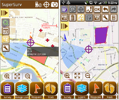
The built in Online Map Tool provides webmaps such as OpenStreetMaps or Google Maps and is able to adopt them for spatial data collection without pre-generating cache-maps.
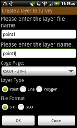
Code page settings are also added in “Creating a new layer”. This function facilitates spatial data collection globally, when the attribute data in different languages can be read and applied easily.
Supergeo Technologies: Supersurv

#Business


Next article

 Maps have been our favourite form of representing information that is geographic in nature. With the boom of mobile technology and internet, the average person uses maps almost everyday.
But can maps be used to mislead and create false perceptions? Maps are a very powerful media that can create perceptions and the unfortunate part happens to be that they can indeed create false perceptions when they are used in an improper manner.
Hmm, sounds possible right? Well ever wondered to what extent maps can create our impression about the world? Here’s a video that has been doing the rounds for sometime now.
http://www.youtube.com/watch?v=n8zBC2dvERM
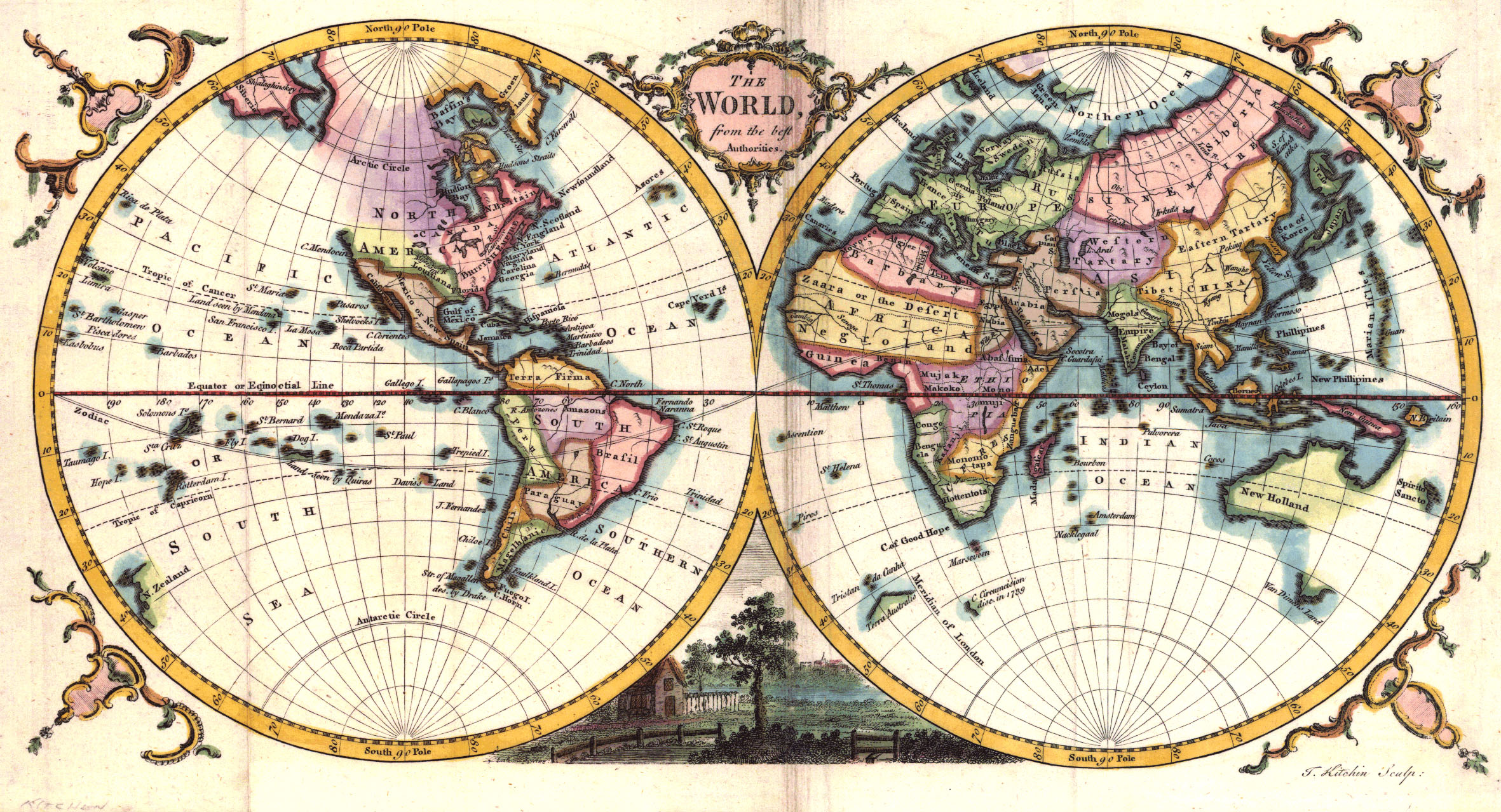
Surprise! Surprise! Yup that’s true. For the last 500 years, our impression about the world has been based on one person’s interests and we have not really made much of an attempt to correct the “false” perception.
Can we create perfect map?
Well unfortunately we cannot! Maps happen to be 2 dimensional representations of an almost spherical planet that we call home. It is mathematically impossible to transform from 3-D to 2-D without inducing some sort of errors or the other. I can go on rambling about it for another couple of hours 😉 But its more interesting to read about it from a cartographer than a GPS engineer 🙂 If you are more interested in understanding the different map projections and transformations, have a read. What sort of errors are we talking about in these projections? Well, errors in representing relative areas for one, distances and others. Dean Howell wrote an interesting article elaborating on it. Here’s the link
But Still…
Maps may not be perfect due to their inherent mathematical limitations but it is always possible to ensure that as a cartographer we are using the right projection for the right (information) visualization/representation. It is very important that we educate our audience about how maps can be used to mislead as well.
Maps are like any other form of information. They are misleading if the intention is to do so. Cartographers for Social Equality is a wonderful attempt to ensure that we understand the responsibility of being a cartographer. Remember we have the power to create perceptions! With power comes responsibility!
Source: Upworthy.com