

The power of maps! When we can use Maps to monitor elections on a real time basis to ensure fairness; you know that this is the “Location Revolution” era.
How do people ensure free and fair elections with limited resources? Crowd sourcing of information + Geographic visualization! That is precisely what Uchaguzi is all about.
Uchaguzi, an online initiative aims to help Kenya have a free, fair, peaceful and credible general election. A joint initiative between SODNET, Ushahidi, CRECO and Hivos Foundation with support from Canadian International Development Agency (CIDA) lead to this amazing and efficient idea.
Wondering how it works? Simply send a message like this (town name, intersection and Name of polling station), Ineligible Voters allowed to vote, More details) to the specified number or use social media to get the message across. The work flow looks like this –
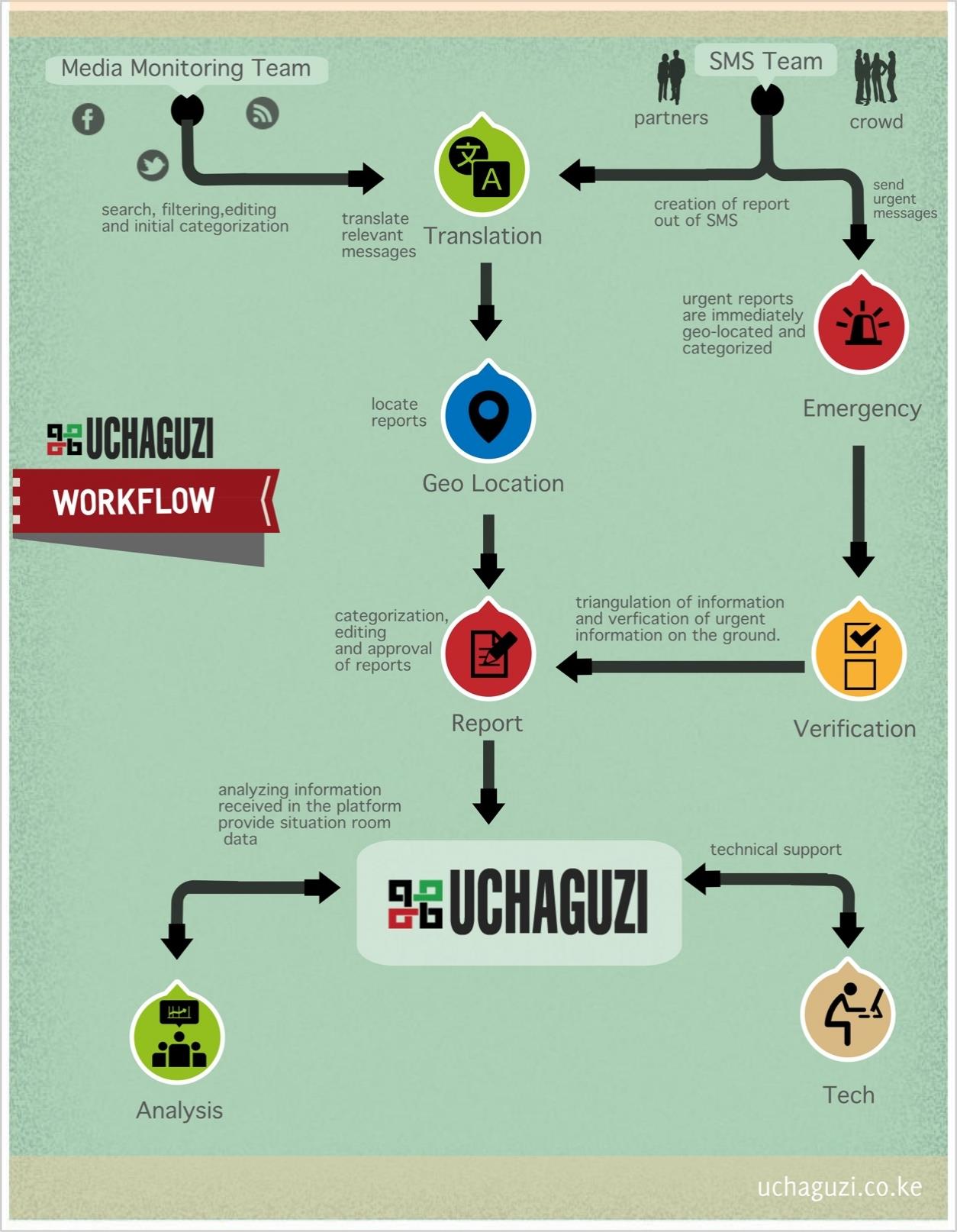
WORK FLOW
Uchaguzi is coordinated through an ICT platform, which enables the locals to ensure free and fair elections and provides many avenues using any technology through which they can report incidences significant to the elections. The electoral process according to Uchaguzi doesnt stop with just the Election day or counting day, its perceived as a permanent and recurrent cycle.
A wonderful application of location based information and visualization.
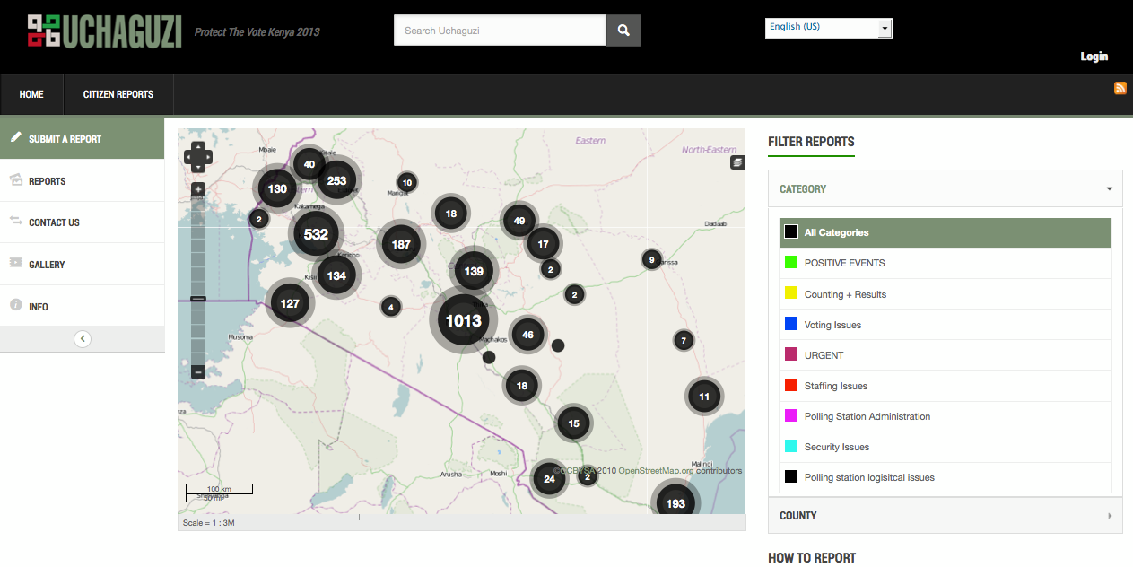
Visualization – Lets keep elections free and fair
Lets keep elections free and fair. Hope this trend becomes mainstream. Here’s the link to the site
Location Revolution – Citizen Power!
Source: Ushahidi


#Business


Next article
People’s Republic of China is all set to launch its first national census of geographic conditions later this year. The Census is scheduled between 2013 and 2015.
The Census is reportedly said to target natural and cultural elements on the surface of the earth within the vast territory that China encompasses. Basically general and locational information about land features, vegetation, water bodies, transportation among other utilities will be collected during the Census.
Looks like the Census will be the biggest Geographic Information collection exercise, considering the length and breadth of China and its population. As a matter of fact, China is the world’s most populous country and the third largest country in terms of geographic area.
The Census aims to gather objective and accurate geographic information which will help provide the basis for creating and carrying out national development plans besides facilitating ecological conservation efforts in the country.
Phase 1 is scheduled to be completed by June 2015, featuring data collection and processing. Phase 2 includes analysis of information and is scheduled for December 2015.
This census is in all possibility the biggest “single” geographic data collection event in recent history. And yeah, they need to cover only an area of 9,707,000 km²
Source: China.org
P.S: It looks like the Chinese Cabinet cleared this Census sometime earlier this week.