
Spatial awareness is a key to human existence (especially if you’re a GeoGeek). Therefore whenever I read a novel, play a game or watch a movie that takes place in a fictional world I need to look at the map to mentally comprehend it. Below you’ll find Top 10 maps of the most important fictional worlds you’ve ever crossed.
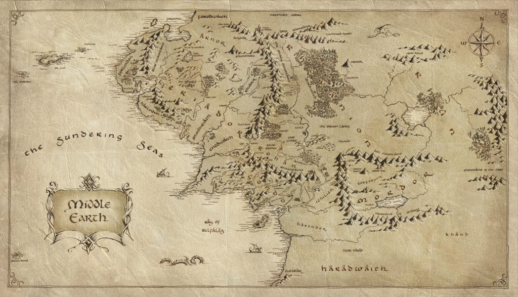
Middle Earth Map

Star Wars Galaxy Map

Game of Thrones Map

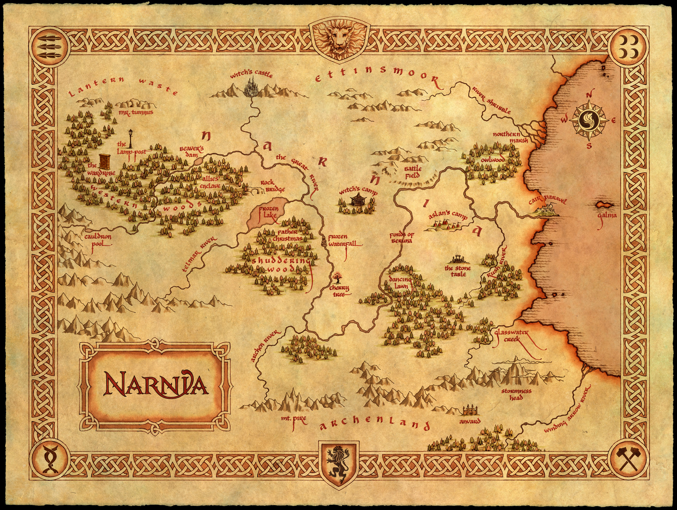
Narnia Map
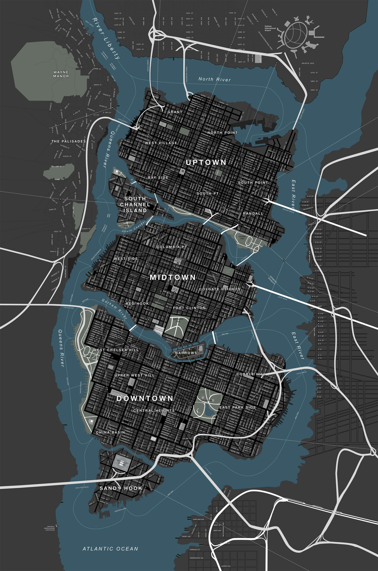
Gotham City Map
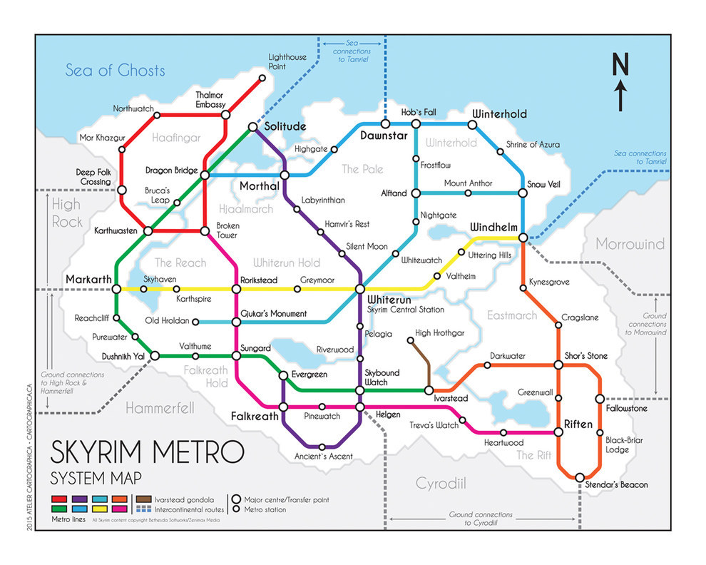
Skyrim Map
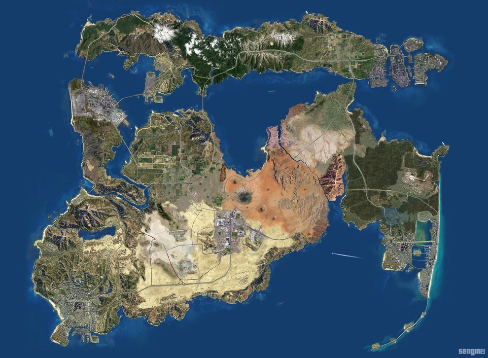
Grand Theft Auto Map
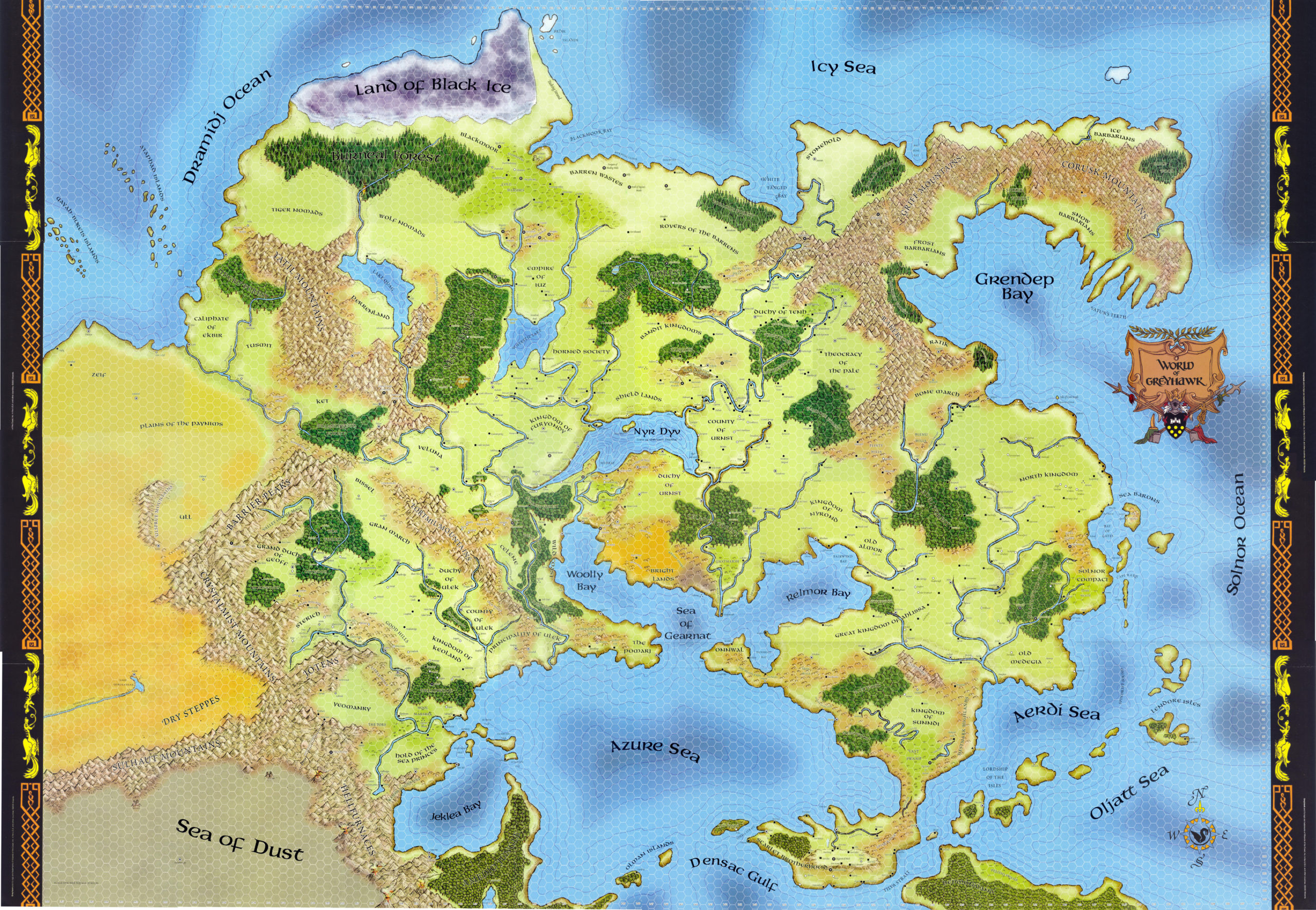
World of Greyhawk Dungeons & Dragons
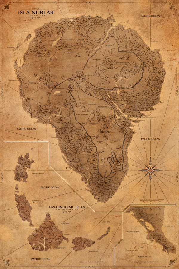
Jurrasic Park Map
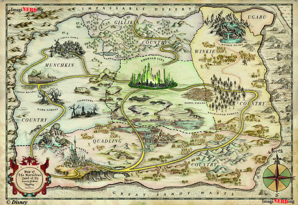
Oz map
[td_smart_list_end]
Did you like the article about Top 10 maps? Read more and subscribe to our monthly newsletter!

#Featured


Next article
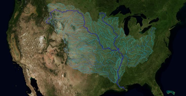
The Mississippi River is one of the world’s largest and most diverse river systems. It is also the third longest river in North America. Going further The Mississippi River watershed is the fourth largest in the world. It extends from the Allegheny Mountains in the east to the Rocky Mountains in the west. Measuring approximately 1.2 million square miles (3.2 million sq kms), the watershed covers all 31 states and 2 Canadian provinces.
Horace Mitchell at NASA’s Scientific Visualization Studio created a beautiful map that will allow you to finally understand the scale and geographic scope of that phenomena. The visualization is based on the USGS database of this area that indicates the direction of waterflow at each point. By assembling these directions into streamflows, Horace traced the path of water from every point of the area to the mouth of the Mississippi in the Gulf of Mexico.
Really cool project.