

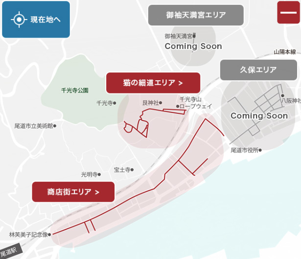
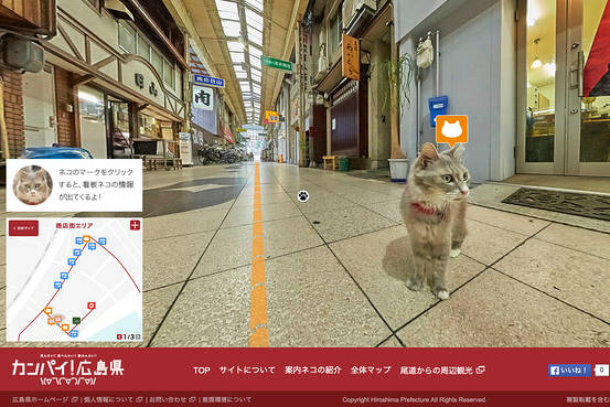
The Japanese city of Onomichi created a project that could happen only there… Google-like Street View for cats. The mapping application works in a similar way to Google’s but it’s positioned at the height of a cat…
The idea for the project came from the top – tourism biuro of the Hiroshima province. They decided that this is the ultimate way to promote the city. And they were right, the whole world wrote about the project. A Hiroshima tourism official commented:
We were seeking to introduce a different way to look at our cities and offer a view of the streets that wasn’t available before
For now the map now covers a shopping arcade and surrounding areas in Onomichi, which is about 70 kilometers east of Hiroshima city.
What else there is to say.. just play around.

#Business

Next article
Last year the number of active mobile phones crossed the level 7.22 billion, while the number of people is estimated at the level of 7.2 billion. It basically means that there are more mobile devices than human beings and that statistically everyone in the world owns a mobile phone.
What we are not fully aware of, is that each phone call, text message, and each movement of our device creates a huge amount of data. With the development of Big Data tools researches and companies have understood the potential of this data and started to look closer into what can be done with it.
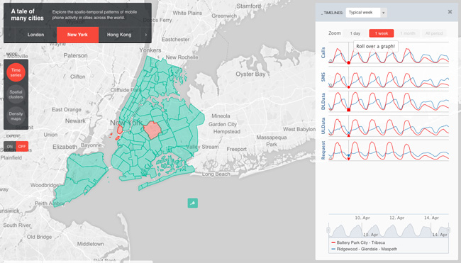
One of the key research centres pushing developments in that area is MIT’s Senseable City Labs. The Lab partnered with Ericsson in order to explore an unprecedented dataset which includes spatio-temporal traces of calls, SMS, data requests (initiated either by the users or background applications), and data traffic from mobile phones in several cities around the world.
The project called ManyCities visualizes this dataset on a cool interactive map for London, New York, Los Angeles and Hong Kong. The map allows to you to switch between three views. The first one shows how phone usage varies over time, revealing clear daily and weekly patterns as well as longer term trends. The second view shows activity clusters in different parts of cities and by analyzing these clusters, it classifies them per land use (core business, commercial, mixed, residential). The last one allows to view density maps per different mobile phone activities.
This sort of location-based big data, although already commercially used, is under heavy investigation of researchers and companies. We are still lacking of powerful computational tools that can gather, crunch, and present the data in meaningful ways. But with the ManaCities project we’re definitely one step closer.
source: MIT Technology Review