PwC opens drone mapping division in Poland and it’s a milestone for the whole industry.


If you’ve ever had a chance to work with one of the Big Four consulting firms you must have noticed that these guys are good with numbers. They don’t engage in any business activities that don’t bring significant return of investment.
When recently PwC – one of the biggest consulting companies in the world, announced that it launched a dedicated drone mapping unit in Warsaw, Poland, it became clear that drones are no more a start-up niche, but they’ve just entered to a big business and they are here to stay.
The potential for using drones as commercial tools and a mapping platform has grown exponentially over the last few years. Many businesses are already finding clever ways to incorporate these solutions into their processes and activities. Also within the last 12 months we’ve seen a significant increase in drone investments on a huge scale. Only last month PrecisionHawk received $18 million funding and valuation of companies like DJI and 3D Robotics is skyrocketing.
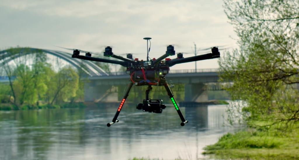
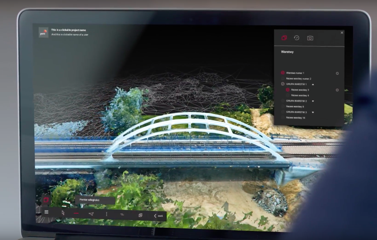
Since #drone is the keyword of 2016 I thought that PwC is using it as a catchword to position itself as an innovative company while outsourcing all of the services outside of the organisation. To my surprise PwC created the entire photogrammetry team, implemented a cloud-based solution to store the data and a web service to visualise and analyse it online.
PwC Drone Data Analysis App (source: YouTube)
Although it doesn’t sound like anything extraordinary, compared to other players on the drone mapping market, PwC has something that others do not… the scale. PwC offers business consulting services to the largest companies in the world from all the key industry sectors. In order to play with sharks you need to be one of them, so when PwC adds a new business area to its portfolio it can’t afford to experiment.
The company puts every new service in its portfolio into a proper business framework, context and builds a set of well-defined processes around it. Combined with a knowhow of global consulting teams, high and measurable quality standards, and a proper risk management methodology it ends up with a service that can be accepted even by the most demanding corporate clients.
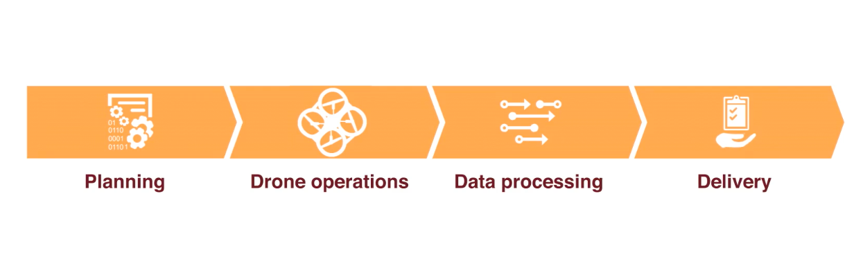
PwC Drone Powered Solution mapping process (source: Youtube)
Why it is so important for the big companies to have this corporate layer around services they buy? The answer is simple: the risk. Large organisations hate risk. When you are a decision maker in a corporation, you can hire a start-up to do a job but when it goes wrong you are the one to blame. When you hire a well established consulting company like PwC, they are the one to blame. Simple as it is.
But the launch of the PwC Drone Powered Solutions is not only about providing drone services and consultancy to corporate clients. From the industry perspective it is all about making the drone mapping technologies credible. In the life cycle of every new technology, building trust and awareness to transition from a start-up concept to a mainstream solution takes years.
PwC gave a clear signal to the market. Drone-based low altitude photogrammetry is a profitable business and a reliable solution. From the investor perspective it proves that there is an opportunity for high ROI. From the client side it shows that there is real and practical value in using that sort of technologies. From the legislation perspective, adoption of drone solutions by large corporations will be a push towards regulating the commercial use of drones.
It’s a big move for a global consulting company to put faith in the power of drones. I believe it is also an important milestone in the lifecycle of the entire industry.

#Business


Next article
Drones are an amazing piece of technology and a lot of fun but when they get into the wrong hands that can be very dangerous. Drones could be used to disperse chemical or biological weapons over crowds among other risks. French authorities are taking this threat very seriously for the upcoming Euro 2016 which will take over a numerous cities around France starting June 10th.
No-fly zones has been defined over all 10 stadiums as well as training grounds. Taking no chances, Euro 2016 organisers announced deployment of a new technology that will interfere with UAV’s GPS signal and take over control of them if they are spotted. The idea is not to destroy the drones, because there could be collateral damage if they crashed into the public. The exact solution to be used has not been revealed.
Establishing no-fly zones started to be a common practice during large sporting events. During the last Super Bowl drones were banned in a half a mile radius around the stadium.