
 Nokia might be struggling to retain its mobile phone market against its American and Korean rivals but they sure are making the right moves in the spatial industry. Only yesterday, I wrote about their LivingCities project where they had collaborated with CartoDB to visualize traffic information in different metros across the world in a really cool manner. Today I come to understand that they had only a day ago announced a partnership with ESRI. ESRI is not only the biggest family owned enterprise in the software industry but they are one of the leaders in the GIS market, challenged only by the likes of Intergraph (which makes this deal even better for Nokia).
What it means for Nokia?
It definitely provides Nokia the opportunity to take their HERE solution to the 3 million plus customers and clients of ESRI, more than half of whom would be big governmental agencies. It allows Nokia to explore more revenue streams by taking its propriety data/information beyond the boundaries of its own products. HERE is still a loss making division in Nokia and hopefully such deals will help it turn “green”.
What’s in it for ESRI?
In my opinion this deal signifies ESRI’s plan of taking its platform to an even wider audience. Perhaps targeting the enterprise solutions of Intergraph’s Geospatial department. ESRI for Office, ESRI’s recent acquisitions of Geofeedia, Geoloqi are all indications of the shift in thought process inside the GIS powerhouse. They are targeting the location based market and this partnership will allow them to market their solutions to the likes of FedEx, DHL, Traffic agencies – portraying the products as the complete package! Clearly a boost for their Transportation Analytics extension.
The deal is significant as it signifies a requirement: it’s no longer sufficient just to have the data or the products, integration is the key and how good the data and product seamlessly work as a solution will matter the most.
Source: NOKIA


#Business


Next article
 Nokia has been quietly focusing its energy and resources on building a spatial database enterprise. The recent article ” Is Nokia Building Competitive Advantage Over Google and Apple with Indoor LBS? ” is a case in point.
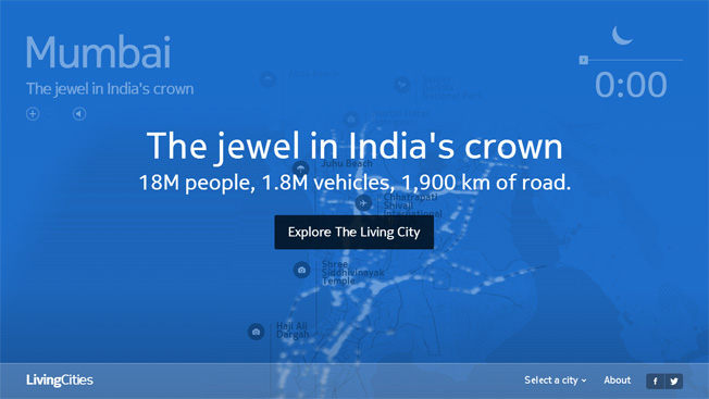
Nokia’s HERE in collaboration with CartoDB has released beautiful and dynamic visualizations of traffic for five metros across the globe – London, Chicago, Rome, Helsinki and Mumbai – The Living Cities project.
You can safely say that HERE got itself an analytical facelift! CartoDB is a high profile, cloud based mapping, analysis and visualization engine who’s clients list include the likes of NASA, Guardian and the United Nations! Pretty impressive! What’s even more impressive is their awesome API’s that let you visualize your data within minutes in a really neat and inspiring manner.
What’s so unique and different about the Living Cities project that makes it stand out from the tons of traffic visualizations that we have seen in the past?
Living Cities is basically a web project that visualises traffic in a time-lapsed format over the course of 24 hours, in five different global cities, namely, Mumbai, London, Chicago, Rome and Helsinki. The project anonymised data from the HERE platform of Nokia and allowed CartoDB to visualize traffic movements over a period of one month. CartoDB made the visualizations a lot more happening by offering users an experience to hear the sounds of the road besides pop-up windows with stats and trivia relating to the Metro along with its Points of Interest (POI). All this besides providing insights into the traffic pattern in the city. Even the colors of the map turn bright and dark in line with the weather and time of day 🙂 Wondering if all this can be shared on FaceBook and Twitter? Apparently, yes 🙂 Hail Social Media!
What does this mean for Nokia in terms of business?
Well, clearly Nokia is targeting governments and other agencies that could utilize such data – think traffic planners and logistics companies like DHL and more! They could all benefit from such data and analysis. This data might already be available but the market is still nascent and Nokia wants a piece of it.