Typical travel planning tools like Google Maps give you directions and travel times from point A to point B. The routes are selected based on algorithms using real-time or historic traffic information. It’s cool and very practical. But what if you’d like to use such a tool for urban planning or simply to learn something about your neighbourhood? In that case the information you’re looking for is how far can you get in particular time… to any point. In cartography the tool for analysing such an information is called isochrone and it’s a line on the map connecting points at which something occurs or arrives at the same time.
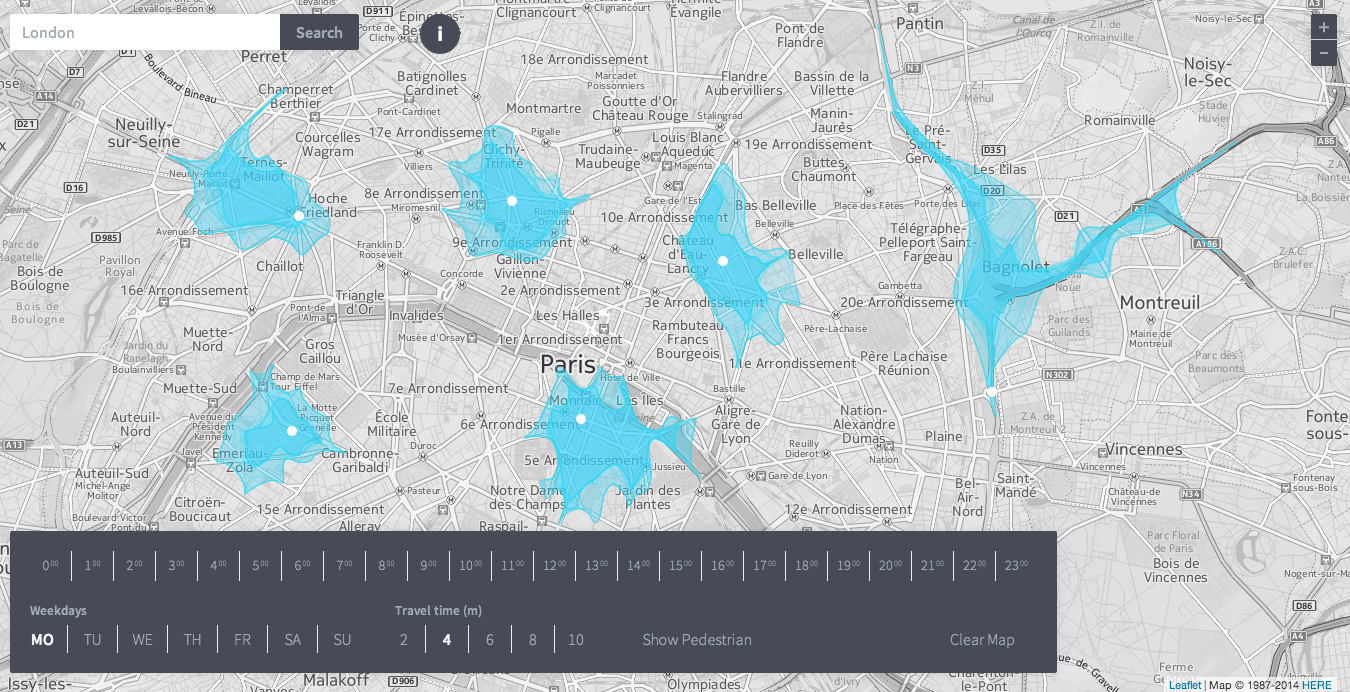
Recently I found a map which shows one of the coolest usage of isochrones out there. Isoscope is a project created at urban mobility class at the University of Applied Sciences in Potsdam. It allows you to pick any point in the world and generate 2 to 10 minutes isochrones for any day of the week. The tool is using the HERE API which allows for calculating areas reachable within a given time automatically (based on historical speed profiles of HERE) and well-known Leaflet Java Script library.
“We wanted our project to shed light on situations when urban mobility is compromised, when the pulse of the city falters, such as during traffic jams,” said Sebastian Kaim, who developed the tool along with Flavio Gortana and Martin von Lupin.
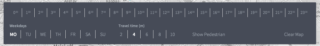
User can play with the tool using this simple menu. Essentially what you can do is to select typical day of the week and travel time distance isochrones. What you get is a set of 24 isolines displayed together for selected points. Now by sliding through hours on the top of the menu you can observe the changes in the traffic flows.
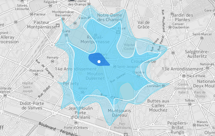
One of the coolest features of the tool is adding isochrones for pedestrians. Now it starts to bring the true value to urban planners. Imagine that using the API we could identify the areas where pedestrian travel time is close to car travel time. Having such an information about your destination would you still choose a car instead of walking?
DO YOU LIKE GEOAWESOMENESS? SUBSCRIBE TO OUR WEEKLY NEWSLETTER
[wysija_form id=”1″]
source: FastCoExist, Isoscope

#Featured


Next article
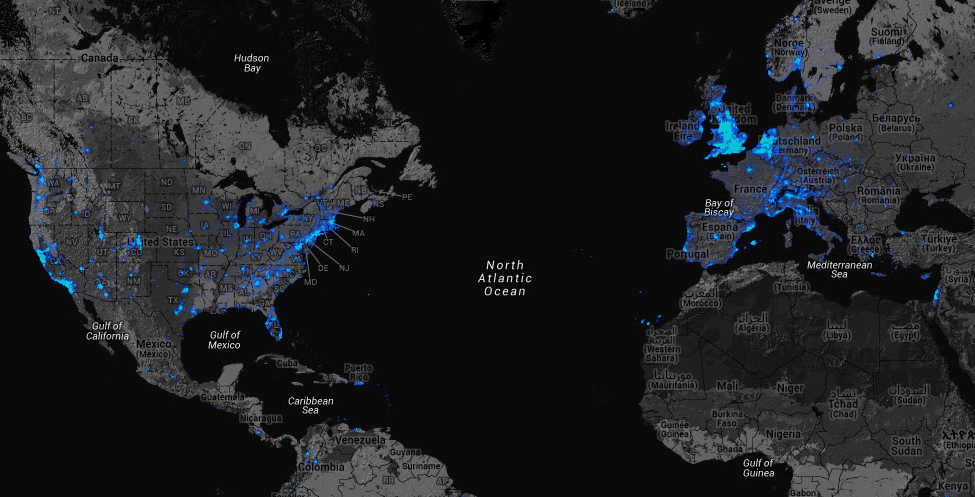
Strava is a San Francisco-based start-up founded in 2009. It offers cycling and running tracking apps for multiple platforms. Although Strava works in a similar way to Endomondo and other fitness tracking apps, it managed to gather relatively large community. While they won’t reveal how many people use the app, they claim to be tracking over 1 million activities per week around the world. Not bad.
DATA, DATA, DATA
Similarily to Foursqaure guys at Strava seem to be understanding that their value is not only the app itself but also the data generated by its users. While Foursquare with 40 mln user base shifted its business towards Big Data, Strava has just started to explore this area offering a data service for city planners and departments of transportation which usually lack data about cycling and pedestrian route preferences.
COOL MAP
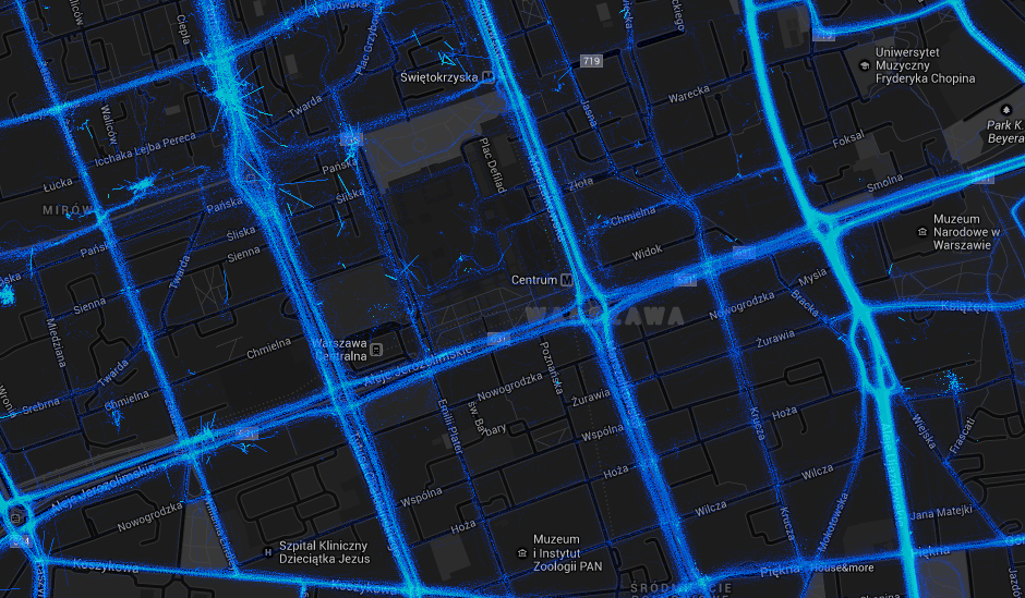
With having this in mind Strava released a really cool heatmap of global 77,688,848 rides and 19,660,163 runs. The map is based on Google Maps API. You can browse the data from all around the world, so you can also check your neighbourhood. In fact what you see is over 220,000,000,000 GPS data points displayed on a single map.