
GPS in our phones in an amazing invention. It connects the virtual space of the Internet with the physical world. Smartphones can quite precisely pinpoint our location on a map but how accurate is the mobile positioning in urban spaces where the majority of us spend most of the time?
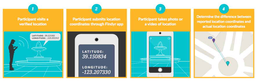
Location data company PlaceIQ released the results of an independent, third-party analysis that answers this question. The positioning accuracy study has been performed in 150 locations across five US cities by Findyr – company that enables people to task data collectors to gather specific information via the mobile app. People were sent to locations with well-known geographic coordinates and they had to send a photo to verify their exact location. In that way the study determined the difference between the recorded coordinates and the device’s actual location.
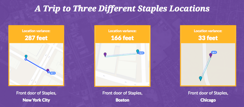
The results showed that an average variance of smartphone positioning in a city is roughly 93 feet (30 meters). The actual range of results was pretty wide with some variances as small as 3 feet (1m) , and other as high as 669 feet (204m). In the case of Staples, the biggest office supply chain in the US, the average location accuracy for stores in different cities varied greatly: New York – 285 feet (87 meters), Boston – 167 feet (51 meters), Chicago – 33 feet (10 meters).
According to the study the overall, location data accuracy comes down to an interplay of several factors, including signal source (GPS signals, Wi-Fi, and cell tower triangulation), environment (area density, skyline view, and indoor or outdoor location), and personal use (location data access enabled, type of mobile app used, and operating system usage).
For the majority of use cases 30 meters accuracy is more than enough. Nonetheless it’s a limitation that we all should be aware of.

#Business


Next article
Google spends $1 bln each year to keep Maps up-to-date and to make the user experience better. It is not surprising that the company wants to get the return on investment…
In a blog post Google announced that it will start experimenting with new ad types. It will offer brands more customisation options for example showing logos instead of pins for physical business locations on Google Maps.
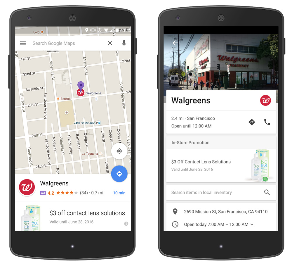
These “promoted pins” as Google calls them will appear when you browse the map but also in a driving mode, so it will show you logos of stores and coffee shop along your route. When you tap on a pin you will display special offers or coupons and the ability to browse the store’s inventory.
Google will also start interfering with search results in Maps. The highest bidders will be higher in search results. These promoted brands will be identified as an ad with a small purple box next to the logo.
It is not surprising that the company which earns 95% of its revenues on advertising and has almost half a billion people using Maps wants to leverage it. Lets just hope that it’s not going to be a change for worse.