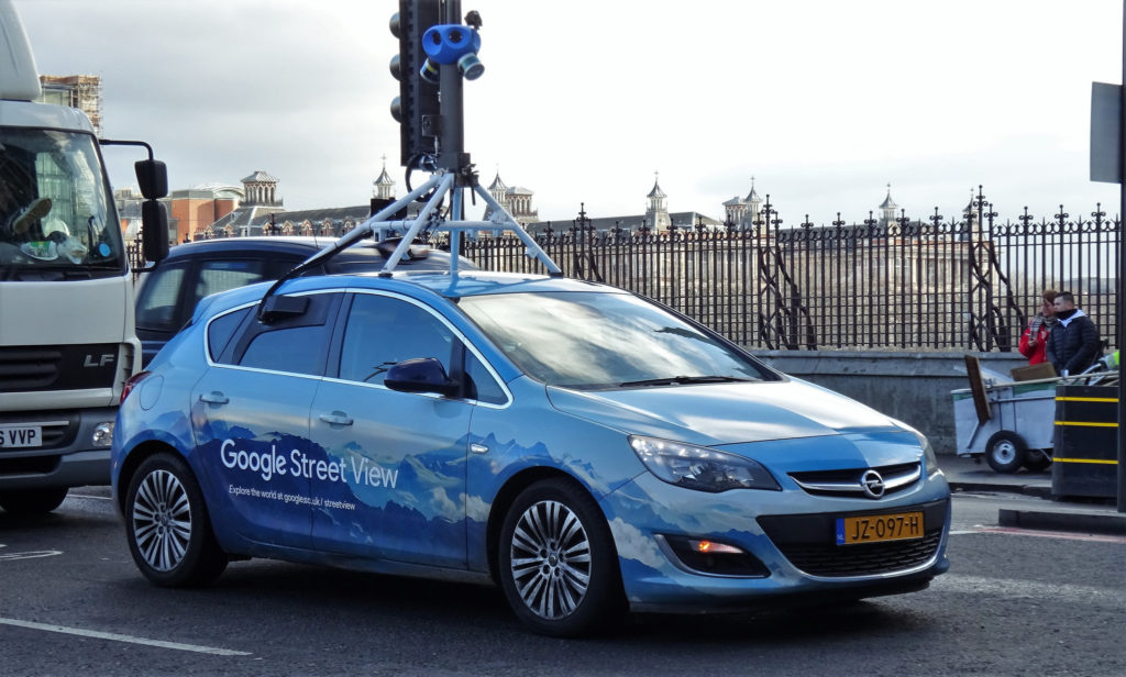

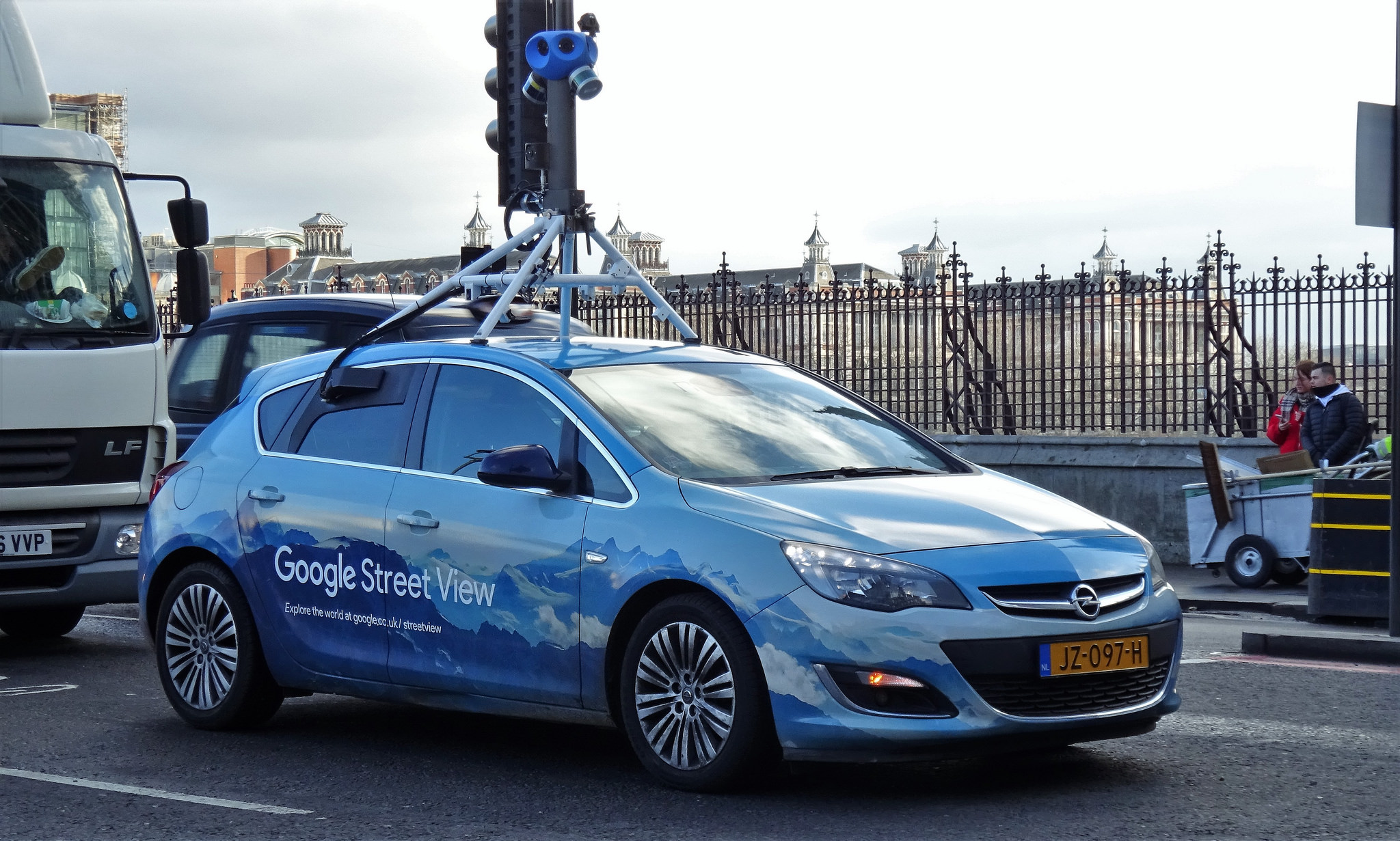
London Mayor Sadiq Khan is in no mood to make light of his city’s reputation as one of the most polluted in Europe. Come July 2018 and London will launch an air quality monitoring network that Khan is hailing as “the most sophisticated in the world”.
As a part of the project, two Google Street View cars are being fitted with sensors that would take record air quality data every 30 meters. For the next one year, these cars will make it their job to identify pollution hotspots in the capital of England and the United Kingdom, in addition to collecting up-to-date imagery for Google Maps and Google Earth.
Apart from the Street View mobile sensors, 100 fixed sensors are also being fitted to buildings and lampposts in areas notorious for their contaminated air. The combined data will be displayed on online maps in real time to give Londoners detailed information about the air they are breathing and help them plan their outdoor activities better.
The development comes amidst UNICEF’s troubling reports that 4.5 million children in the UK are living in areas with toxic levels of air pollution. As millions of children walk to school every day on polluted roads, they fill their lungs with exhaust fumes that could have long-term implications for their health.
Must read: Map shows how much sooner you’ll die because of air pollution
Mayor Khan, meanwhile, maintains he is doing everything in his power to tackle London’s lethal air. Some of his initiatives include cleaning up the bus and taxi fleets, introducing a Toxicity Charge for the oldest polluting vehicles in central London and breaking ground for an Ultra-Low Emission Zone which goes into effect in April 2019.
The year-long air quality monitoring project will be run by nonprofit organization Environmental Defense Fund Europe, in collaboration with Air Monitors, Google Earth Outreach, Cambridge Environmental Research Consultants, University of Cambridge, and National Physical Laboratory. King’s College London will conduct a linked study focusing especially on school children.

#Business


Next article
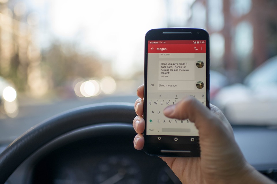
We shouldn’t use our cell phones while driving, we all know that. But how many of us actually follow the rules of keeping the eyes on the road and hands on the wheel – at all times? How many times have you thought a quick glance to check who is calling or messaging wouldn’t make a difference? Or that if you put your phone on speaker mode or connect it to your car’s Bluetooth, you should be fine?
Chances are, it has happened with most of us more times than we would care to admit. So much so, we no longer even consider it as ‘distracted driving’. But that’s exactly what it is. And it is responsible for 26% of all collisions in the United States, according to the National Safety Council.
So, how bad is the problem, really? 100 times worse than previously thought, a new study by Zendrive has revealed. Till now, the most reliable data for distracted driving came from the US National Highway Traffic Safety Administration, who estimated that 660,000 drivers use their phones during daylight hours. But Zendrive is convinced a whopping 69 million US drivers use their phones each day.
Now, the mobile driver analytics platform didn’t come to the conclusion easily. They studied 3.1 million anonymous drivers for 3 months, analyzing 570 million trips that covered 5.6-billion miles. Zendrive’s technology uses a phone’s sensors and GPS to measure driver behavior, including speeding, aggressive driving, hard braking, collisions, and phone use. This sensor data is then turned over to machine learning algorithms to draw actionable insights. This particular analysis revealed that out of 100 trips, drivers would use their phones 88 times. Let that number sink in before we break it down further for you.
The study found that average phone use was 3.5 minutes per hour of driving. Doesn’t sound like much? Here’s a fun fact: Taking your eyes off the road for only 2 seconds increases your chances of a collision by 20 times. And if you’re driving distracted for 3.5 minutes at 55mph, that’s like driving 42 football fields with your eyes closed! “In other words, that’s equivalent to 105 opportunities an hour that you could nearly kill yourself and/or others,” says Noah Budnick, Director of Public Policy & Government Affairs for Zendrive.
According to the study, phone usage among drivers peaks during daytime hours. While, on an average, 40% of drivers use their phone at least once at any given hour of the day, this number goes up 72% between 10am-5pm.
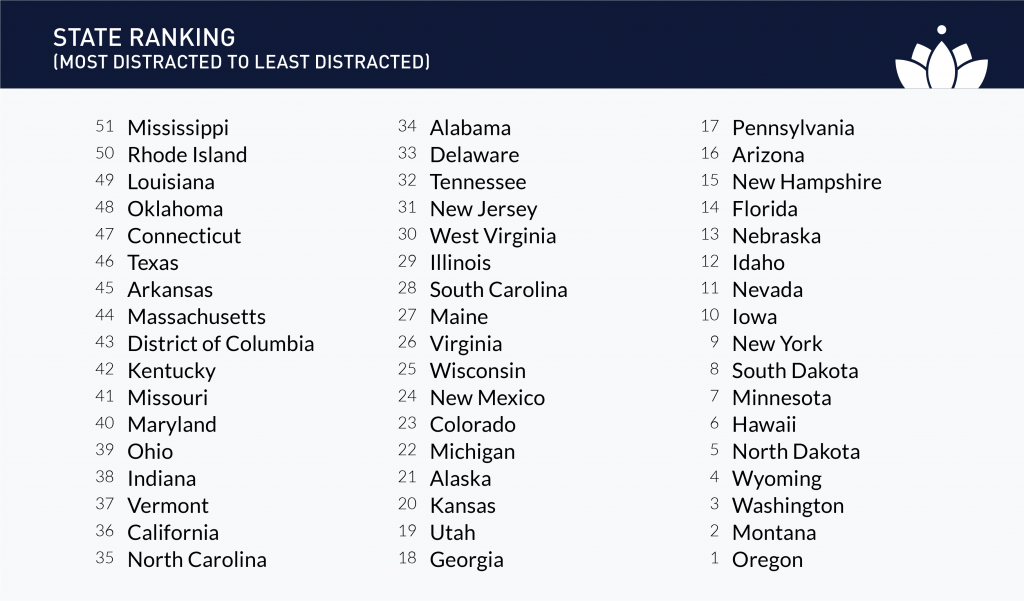
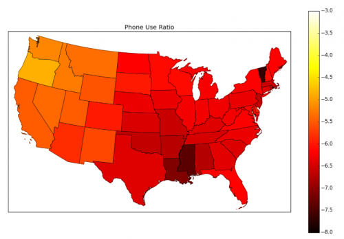
As Zendrive says, traffic deaths are preventable. If we know what behaviors contribute to traffic deaths, we can develop strategies to reduce and, eventually, eliminate them. It would be interesting to see how communities, governments, and safety experts use this new data to save lives. Here’s how different states fared in the study: