
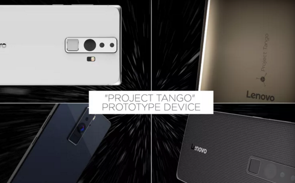
Yesterday in the evening at CES 2016 Google and Lenovo announced that they’ve teamed up to build and sell the first smartphone that could be able to support Google’s Project Tango. The device will cost under $500 and will launch globally later this year.
Tango, unveiled nearly two years ago, allows devices to map the 3D space around them in real-time using a combination of cameras and sensors. That means that smartphones, tablets or other devices can measure the dimensions of a room, measure distances between objects or display them in a camera’s view as augmented reality.
In parallel Google announced an app incubator program to motivate developers to create apps and games for the new platform. The best will receive funding and be featured on Lenovo’s phone out of the box.
We don’t know yet if whether Lenovo is an exclusive partner or if Google is going to announce more phones supporting the technology in the coming months. Nonetheless the project brings endless possibilities for indoor mapping. We’re waiting to put our hands on that device.

#Business


Next article


GPS/GNSS is everywhere, its in your smartphone, your smartwatch and if you are interested its even available in jackets (Urban Wayfinding Jackets); add a top hat to that list now!
Sound Localization Assisted GPS Navigation
A team of students from Cornell University working on their final project titled “Sound Navigation: Sound Localization Assisted GPS Navigation” utilised the inherent capability of our ears to localise sound to help us navigate to our destination.
The top hat uses directional sound to serve as an audio cue to help you navigate. It uses both amplitude and phase shifting to do this and its language independent.

Sound Navigation – Top hat: Image copyright Cornell University
The GPS enabled Top hat isn’t really the kind of wearable tech that might be of interest to everyday users (I guess) but it would make a world of difference to differently-abled people who need non-visual cues to navigate. Its a refreshing change to see a wearable tech prototype that is perhaps more helpful to the differently-abled.
If you are interested in the details of this interesting project, check it out. The webpage is really very detailed and informative.
Source: The Next Web, Engadget