
TeleGeography has published a revised version of their “Global Internet Map” and again it proves that map making is the art. The map‘s global projection traces the intercontinental links between the countries of Europe, Asia, North and Latin America, and Africa. The is the interactive version as well. Just have a look at it:
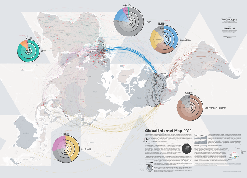
source: http://datavisualization.ch

#Ideas


Next article
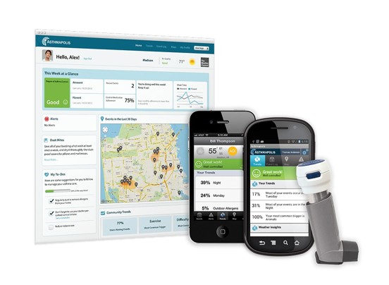
Geomedicine: Rescue Inhaler topped with a GPS Sensor: Creating a new Paradigm for Doctors and Patients

Hi folks, really I have been latent here for a while now, I crave your indulgence, been out of seat. Sure my geoawesome team has been great in keeping you constantly abreast of the latest developments in our geo-world.
Here is an awesome one, GPS-enabled Rescue Inhaler now helps doctors to quickly locate Asthmatic attacks. Each puff of a patient on the inhaler maps the location of the user.
Epidemiologist David Van Sickle came up with this awesome invention after many years of frustration in trying to determine precise trigger of an individual asthma attacks.
”Such a device, Van Sickle thought, would give doctors data about when and where attacks occurred, helping them figure out possible environmental causes and allowing them to plan treatment accordingly”.
This is one of the out-shoots of the evolving field of geomedicine which uses geospatial technologies to correlate environmental conditions with health risks. Locational data integrated into a patient’s medical history gives doctors and researchers more insight to precise diagnoses and treatments. In other words, ”Place should be a vital sign”.
Etisalat Telecom subscribers in Nigeria receive alerts of possible poliomyelitis attacks depending on the subscribers locations. Geomedicine and Geodiagnosis evolving swiftly and giving more meaning to the stories we tell about GIS and Health.
Source:washingtonpost.com