
TED talks have kept me busy off late and I have watched talks on pretty much everything from African symbology to Peace negotiations, Engineering happiness to GIS! Some have been interesting while one talk in particular was simply Geoawesome! Which one? Its by the talk Bill Davenhall,ESRI’s Global Marketing Manager for Health and Human Services Solution on Geomedicine! Unlike other TED talks, this is not going to take you longer than 10 minutes which is an added bonus and one more solid reason why you should really watch it 😉
Now if you think GeoMedicine, the industry jargon for Geospatial Information in Medicine is a recent phenomenon think again! Remember the “London Cholera Map” by Dr. Snow. Dr. Snow is for sure the “father of medical mapping” like Iyke here at Geoawesomeness likes to call him. GIS has been used in health related applications pretty much similar to the London Cholera map but more importantly GIS and GeoMedicine are finding their way into the latest technology i.e. Electronic Health Records. These are not only going to highlight the risks of a particular region to say Lung Cancer which is the usual research behind Health GIS solutions but you as an individual could actually make health choices based on your travel history. Here’s the link to a recent article on Electronic Health Records and how GIS/Geography is playing a role in it.
I believe the difference between Health GIS and GeoMedicine is this, Health GIS = evaluating the Health risks of a particular place whereas GeoMedicine = Adding your geographic history to evaluate your health risks. While one might argue that Health GIS is a subset of the latter and that is also the truth but in a sense GeoMedicine makes it more valuable than just a set of map that show you the risk of malaria in your region! In no way am I discounting the value of such a map but GeoMedicine is simply Health GIS V 10.0! ESRI has an amazing collection of articles on this topic, here’s the link to a presentation by ESRI on Geomedicine and here’s the link to ESRI’s homepage on Geomedicine.
The question is not ” Can Geographic Information keep you healthy? “, the question is how can we utilize geographic information to take care of ourselves and live a better life. (Read more: The role of Wearable Tech and Internet of Things in Geomedicine).
What are your thoughts?


#Ideas


Next article

India, the second-most populous country with over 1.2 billion people and is the seventh-largest country by area composed of more than 600,000 villages and 7,000 cities and features a varied geography with a rapidly changing and complex social and economic character. India is also ethnically, religion-wise, linguistically, culturally, climatically and agriculturally very diverse. One can imagine how complex and challenging is to develop an enterprise GIS solution to manage and maintain GIS infrastructure for the country.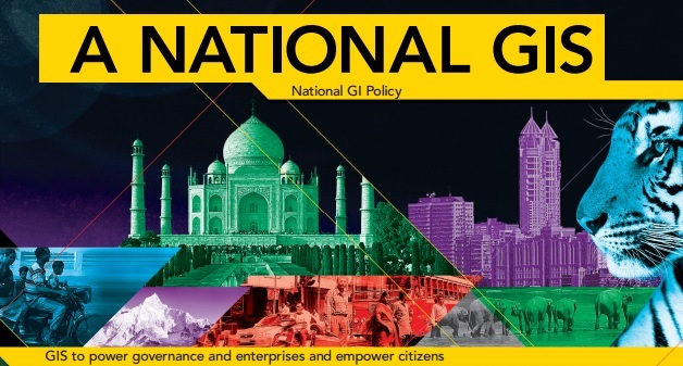
Here, I am talking about “National GIS for India” project which is India’s next-generation GIS program, envisioned as a critical support to the national governance and empowering its citizens—thereby extending GIS to all levels of society.
Though India has already witnessed to the true power of GIS with existing GIS projects in India, Nationation GIS project is different from GIS in India today.
Sam Pitroda, adviser to India’s Prime Minister for Public Information Infrastructure, has explained about the project in a detailed manner in the below video.
With a large talent pool and many veterans providing the vision, leadership, and drive, now a national movement has taken shape in India’s next-generation GIS program—National GIS. Click here for more views from key people involved in preparing the blueprint for this project.
Having discussed about National GIS, Geoawesomeness wishes a great success in the achieving the goal and looking forward to have more such GIS initiatives in future !!!