
 Maps have been our favourite form of representing information that is geographic in nature. With the boom of mobile technology and internet, the average person uses maps almost everyday.
But can maps be used to mislead and create false perceptions? Maps are a very powerful media that can create perceptions and the unfortunate part happens to be that they can indeed create false perceptions when they are used in an improper manner.
Hmm, sounds possible right? Well ever wondered to what extent maps can create our impression about the world? Here’s a video that has been doing the rounds for sometime now.
http://www.youtube.com/watch?v=n8zBC2dvERM
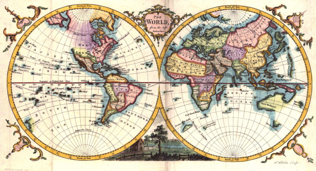
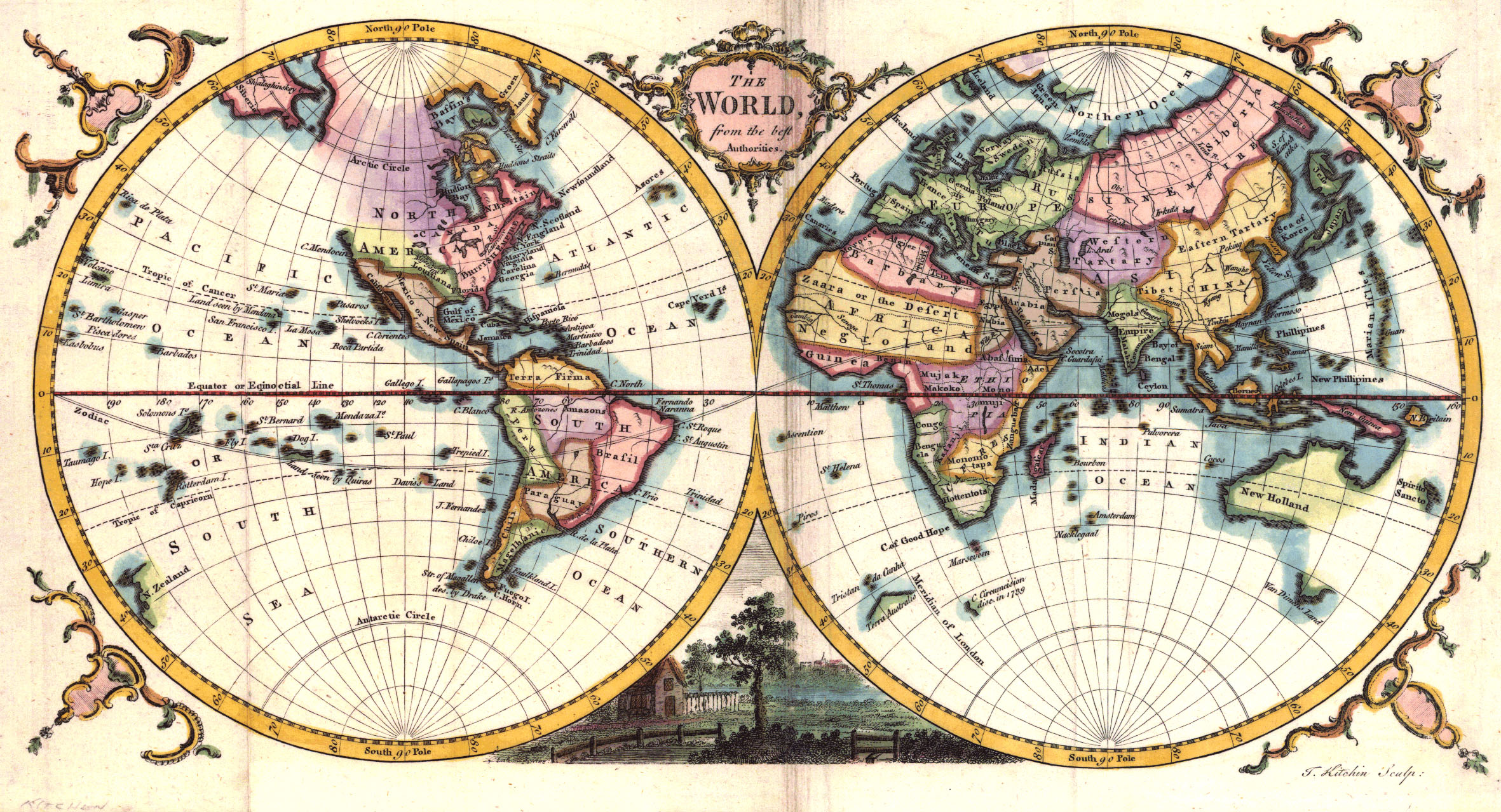
Surprise! Surprise! Yup that’s true. For the last 500 years, our impression about the world has been based on one person’s interests and we have not really made much of an attempt to correct the “false” perception.
Can we create perfect map?
Well unfortunately we cannot! Maps happen to be 2 dimensional representations of an almost spherical planet that we call home. It is mathematically impossible to transform from 3-D to 2-D without inducing some sort of errors or the other. I can go on rambling about it for another couple of hours 😉 But its more interesting to read about it from a cartographer than a GPS engineer 🙂 If you are more interested in understanding the different map projections and transformations, have a read. What sort of errors are we talking about in these projections? Well, errors in representing relative areas for one, distances and others. Dean Howell wrote an interesting article elaborating on it. Here’s the link
But Still…
Maps may not be perfect due to their inherent mathematical limitations but it is always possible to ensure that as a cartographer we are using the right projection for the right (information) visualization/representation. It is very important that we educate our audience about how maps can be used to mislead as well.
Maps are like any other form of information. They are misleading if the intention is to do so. Cartographers for Social Equality is a wonderful attempt to ensure that we understand the responsibility of being a cartographer. Remember we have the power to create perceptions! With power comes responsibility!
Source: Upworthy.com


#Ideas


Next article
 Google for “Location Privacy” and you end with 1,990,000,000 results!! Although all of us are excited and passionate about the possibilities of Geospatial technology, we cannot afford to ignore the privacy concerns and issues that been raised regarding sharing one’s location.
The common person on the street has a reason to be worried if he/she can be tracked using a “normal” application without his/her knowledge. The privacy concerns are not limited to application alone, a couple of years ago there was a controversy when Google “mistakenly” mapped all the Wi-Fi connections in Britain.
Such kind of mapping helps in providing what is commonly termed as “Geolocation Lookups”, the industry alias for providing your device a rough idea of where it is immediately so that the location algorithms can triangulate their position better. But that is no excuse for invading one’s privacy (location privacy). But until now, there has been no open source initiative to provide such a service based on publicly available geolocation references like Cell phone towers and the like.
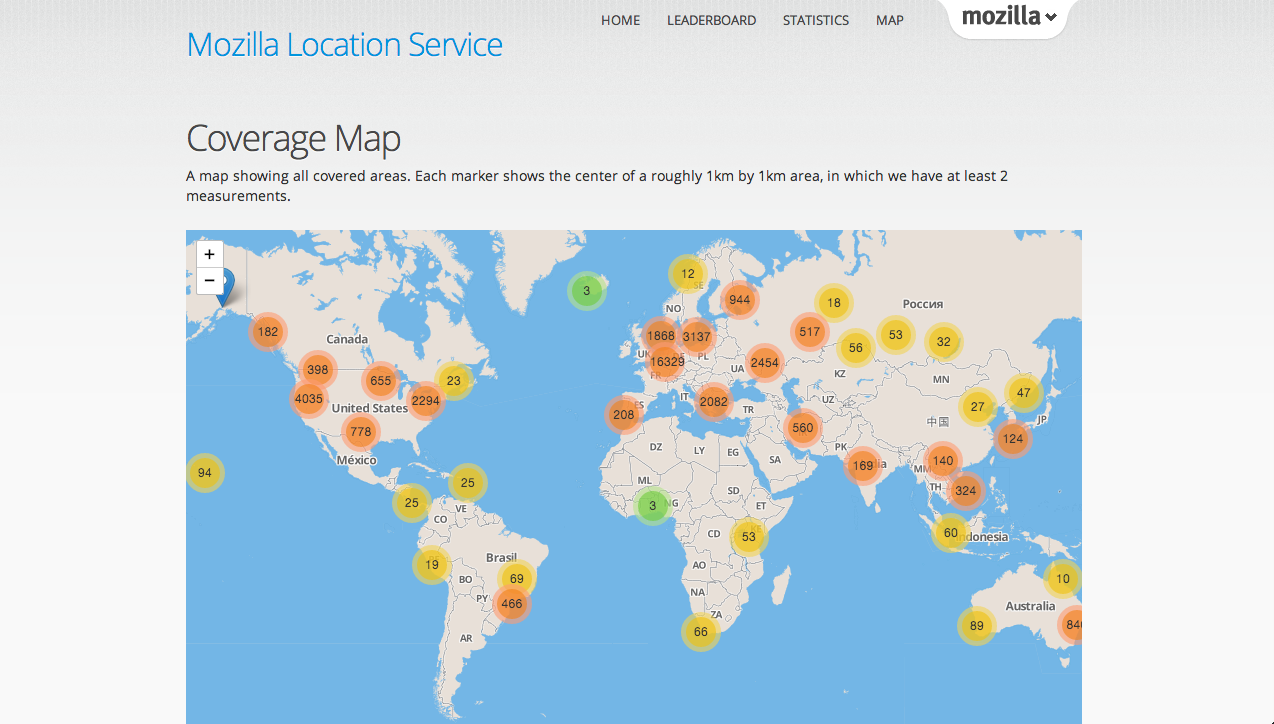 Mozilla location service is an open source, crowd-sourced initiative to provide geolocation lookups based on publicly observable information like Cell phone tower and Wi-Fi access points. Mozilla is collecting data from users who are contributing using the app, MozStumbler. There’s even a leaderboard for the game theory enthusiasts 😉 Addressing privacy concerns alone is a big motivation for a lot of people to encourage this project! But the biggest disappointment is that the app is not available on Play Store! If you someone who is interested in contributing, visit this page and download the app directly to your device.
” Geolocation lookup is a very useful service to provide to users. There’s no public data set to provide this service. None of the current companies offering this type of service have any incentive to improve on privacy. Geolocation lookup and the potential for tracking the physical movement of individuals is a serious privacy issue. ” – Mozilla
Interested in the project? Looking for more information regarding the project? Here’s the link.If you are interested in contributing to Mozilla Location Service, here’s where you go.
Geolocation Lookups are a very good idea for minimizing positioning errors and reducing the time taken to find out where you are. However we also need to understand that with data/information comes responsibility as well. We have to address the privacy concerns. I personally believe that we need more such open source initiatives like the mozilla location service to address the growing concern over privacy and data protection. What is your opinion?