In the fields of landscape architecture and planning, leading practitioners are tying together the power of GIS to integrate geographic information right into the design process. Known as Geodesign, a term coined by Jack Dangermond, the CEO of ESRI Inc, this approach utilizes new technologies and web-based tools, enabling a design team to create quickly and effectively alternative designs, visualize the design impacts, and evaluate results all with the goal of providing effective, evidence based solutions.
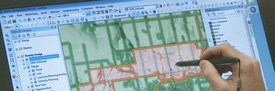
O2 Planning + Design, a landscape architecture and urban design firm based in Calgary, Canada, embraces Geodesign as an integral part of its practice. In response to a request from the City of Calgary in 2008, O2 created a plan for the Nose Creek Watershed with the goal of mitigating the effect of urban development on water flow and quality, and minimizing damage to riparian ecosystems. The project is revisited in 2011 with the express purpose of employing the analytical capabilities of ArcGIS and CityEngine, Geodesign tools offered by Esri. Using both 2D and 3D modeling the designers are able to evaluate the success of the project to date, then create scenarios of future developments showing resulting impacts on the watershed.
Nose Creek Watershed (credit: O2 Design)
O2 was recently tasked with the planning and redesigning of High River, a town in Alberta whose commercial centre was destroyed by flooding in 2013. Along with analysis of water levels and elevations, serious questions will need to be raised as to the wisdom of rebuilding a town centre in what is essentially a floodplain. The 3D visualizations produced by Geodesign technologies should assist the population in making informed decisions, particularly as the immediate reaction after a disaster is to rebuild in the same location. O2 utilized a detailed set of landscape constraint evaluation models and urban development impact models in a seamless design, evaluation, and reporting workflow based in ESRI’s ArcMap GIS and CityEngine 3D modeling software; offering a more effective and quicker project outcome.
Ming-Chun Lee, a professor at the University of North Carolina at Charlotte, School of Architecture, addressed the importance of Geodesign in urban design and architectural practice at the 2015 Esri Geodesign Summit. His design studio focused on Coastal Cities and the issue of “keeping the water out” or “moving the town”. Ming-Chun Lee, along with his colleagues in the Urban Design Studio, presented this challenge to his students and gave them the opportunity to design with GIS.
The selected site was Wilmington NC, a city bounded by river and ocean. The City’s website includes information such as “Is my property in a flood zone?” Given rising sea levels, the City is some major concerns which needs to be addressed. The UNC design students began with the premise of a 2m sea level rise over a period of 100 years. They examined and analyzed three levels of scale: Regional, Sub-Area and District.
At the Regional scale, these were the questions that the students tackled “What are the big issues in terms of land use and populations? Where will we lose land and infrastructure?”
At the Sub-Area scale, these questions were part of the project. “Where is vacant and underused land that will still be usable? Can we build infrastructure and increase population density in these places?”
The questions that arose at the District Scale, included, “What parts of downtown will be underwater? Can we use this water as an ecological and recreational resource?”
For this critical urban design project, GIS was used throughout all scales for the design process, to maintain the same level of information. Several design recommendations were made to the City from circulation and street patterns, transportation hubs and to overall future neighbourhood developments that addressed rising sea levels. See Ming-Chun Lee’s presentation at the 2015 Geodesign Summit for more information.
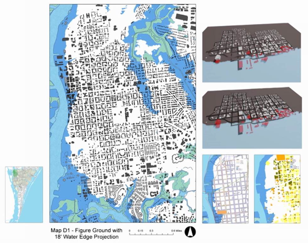
Figure Ground map with Water edge protection (Credit: Ming-Chun Lee, UNCC)
Kongjian Yu of Turenscape Architecture, Landscape Architecture and Urbanism has been advocating Geodesign for almost 20 years and has taken Geodesign to a national scale by influencing the planning and construction of new cities in China.
“Today’s Chinese cities and architectures are unsustainable: Our monumental architecture, wide roads, endless parking lots, huge city squares, flowered landscapes, and engineering-oriented municipal networks will eventually be seen as ghastly mistakes.”
Yu Kongjian continues to advocate the importance of Geodesign for smart design practice, which allows landscape architects and designers to understand and design intelligently to address many of the environmental issues of today and the future that are far too complex to be managed in traditional ways. “More than the technology of overlaying and GIS, Geodesign is a way of thinking when facing complicated spatial issues that need systematic and integrative solutions.
In 2006, Turenscape undertook the restoration of a seriously degraded site in Tianjin City, China. The 54-acre site was formerly a shooting range, but had become so degraded that residents insisted something must be done. The site was polluted, filled with garbage, prone to flooding and surrounded by slums.
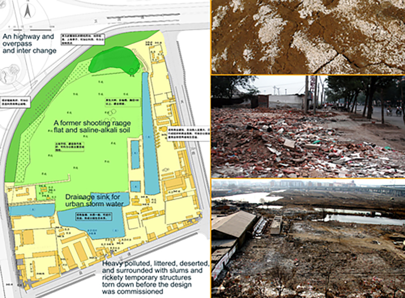
The original site was heavily polluted (Credit: Turenscape)
The original ecosystems included wetlands and marshes. After extensive analysis that included Geodesign, Turenscape created a series of cavities (depressions) to retain and detain storm water and aid in the regeneration of the site.
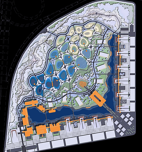
A series of cavities was designed to capture storm water (Credit: Turenscape)
As part of Yu’s design, a mixed palette of plant material was seeded to adapt to the various water levels of the site and would grow accordingly. Within two years the site was flourishing; water was filtered and purified, and garbage had given way to greenery. Given the opportunity, nature had quickly healed the site and a beautiful park was created for the community.


#Science


Next article
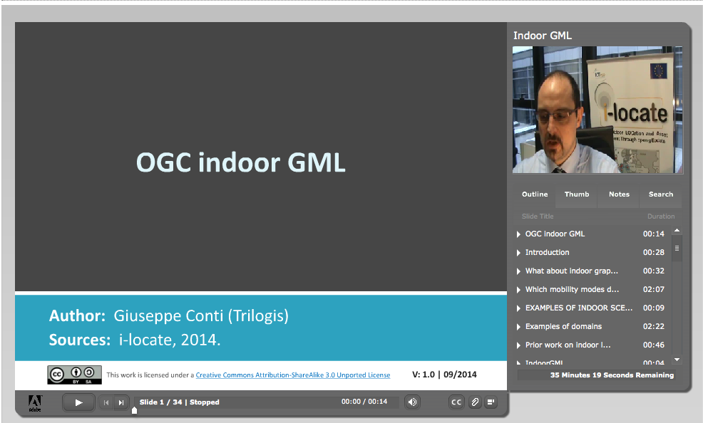
Recently we’ve reported that in mid December 2014 Open Geospatial Consortium published IndoorGML a new standard for modelling a spatial data of indoor spaces. As it’s typically with every complicated standard there are only couple of people who actually understand what it is all about. Today you will become one of them.
Accidentally I came across an European funded project called i-locate which is the first implementation of the IndoorGML standard and aims to bring the indoor location technology to European public sector. Fortunately one of project deliverables are openly available online learning materials.
On the project website, under the training section I’ve managed to find the online course of IndoorGML. During less than 1 hour the course will give you all the necessary information about the standard. The only drawback is that need to register on the e-learning platform to access the course.