This week we go extreme. We’ve got for you 10 questions about the world’s biggest, tallest, deepest, and smallest one-of-a-kind places. Remember to share your score with the world. If you liked that one, here are all our other quizzes.
[viralQuiz id=49]

#Fun


Next article
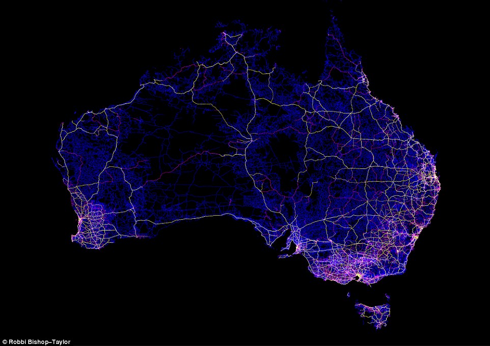
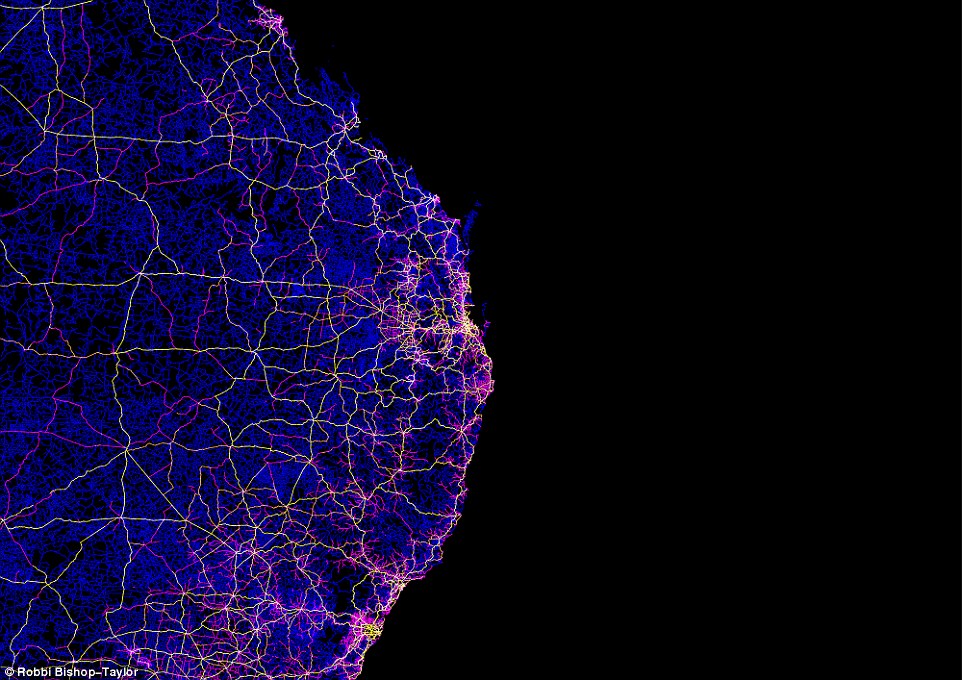
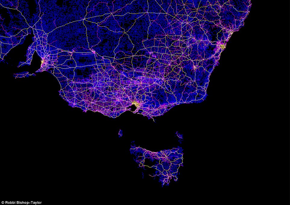
Robbi Bishop-Taylor – PhD student of Geospatial Science at the University of New South Wales, created amazing map that visualizes almost 500,000 dirt tracks, roads and highways in Australia.
He created the map using QGIS and freely available topographic mapping datasets from Geoscience Australia, which is the same data that’s used to make regular paper maps. The roads have been colour coded, with yellow and white representing major roads and highways, dark blue marking unsealed dirt tracks, and pink and orange showing minor unsealed and sealed roads.
The effect is stunning and it shows that beautiful cartographic visualization can be made by anyone without any programming skills.
Cool project! You can buy the map here.