
 We share our location thousands of times a day, sometimes we explicitly share with individuals, other times we share to specific platforms, and still other times the sharing is deeply embedded in the systems we use. In each case we share our location information, we are giving up some of our geo-privacy.
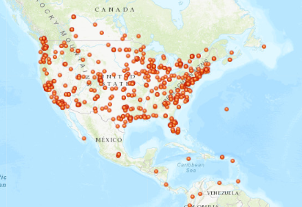
“Find my Friends” is a very common example of explicit geo-privacy sharing, so we can see where our friends are on a map in relation to ourselves. In many social apps you can “check-in” and share your location as part of social community, putting yourself as a dot on a map for others to find. But you may not be as aware that your location may also be constantly tracked from non-map apps, logs of IP address, and by your mobile provider.
Organizations: Adopt a Location Strategy
As an organization, you must be very aware of how you are using and storing location information. Most organizations have location information, such as mailing addresses (employees, customers, and suppliers), facility locations, and perhaps real-time feeds of their workers. How is that data managed? If it got out or was shared, what could that information reveal? Is there a certain pattern that could put people or assets at risk? Accessing this information over time can reveal patterns and compromise privacy. If this information gets into the wrong hands, it could have devastating effect.
![]() Do you track your employee’s daily locations? Many organizations use employee tracking to optimize operations and improve security, but you may also be ‘tracking’ employees via their IP addresses when they access your company’s network. If so, what are you doing with that information? Just as PII (Personally Identifiable Information) has become something that CIOs need to worry about, so is PLI – Personal Location Information. Your organization needs to have a policy around what data is kept and why and who can get access to it.
Do you track your employee’s daily locations? Many organizations use employee tracking to optimize operations and improve security, but you may also be ‘tracking’ employees via their IP addresses when they access your company’s network. If so, what are you doing with that information? Just as PII (Personally Identifiable Information) has become something that CIOs need to worry about, so is PLI – Personal Location Information. Your organization needs to have a policy around what data is kept and why and who can get access to it.
You may feel reassured when people tell you, “don’t worry that data has been anonymized” so they cannot track an individual. But the reality is at some point it wasn’t anonymous. Is that data on your system? Even if the anonymized data is all you have now, it can still be analyzed and individual patterns derived. Let’s say, for example, that you have data from a company that has an exercise app. They shared the anonymized data with researchers to help them better understand where people are exercising (all good intent). But if you were to look at who was jogging at 5:00am in a neighborhood, you could see individual tracks, and by tracking the start and end position over a few days you probably know where that person lives, which leads to a name, to an email, to web sites visited….
If your organization collects this sort of data, you need to consider if removing the names is enough if you share this data with others. Ultimately, as part of a location strategy for your organization, you need to understand how you use location information to help your organization and how you protect and manage personal location information.
Individuals: Take Ownership of Your Location Data
As an individual what can you do to manage your own personal location information? First and foremost, don’t share your location with everyone. It sounds simple – and it usually is – but you should only share your location with your friends when you are in an app.
If you use an app for work, check on its tracking settings. It should be using your location only when the app is open. Then, only open the app when on the clock. Ask your employer how they manage this information. Ask them if they have a geo-privacy policy and understand what information they collect and store.
And finally check your location history. Many platforms save your location history and use it to improve the convenience of the app for you. This may include things like your search history and most visited locations. You can easily delete or reset it.
Developers: Just because you can, doesn’t mean you should
 As an application developer, you should think beyond specific XYs. If your application allows people to share their location, how specific does it really need to be? Just because the GPS gives you 6+ numbers after the decimal, do you really need that precision? I would argue probably not.
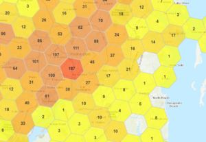
When sharing data, can you easily aggregate or generalize it at different resolutions as appropriate to obscure the source (hexagons are a great aggregation method). And it’s not just how you display the data, what you store is equally important, the less data you store, the easier it is to protect privacy.
Just because you can track individuals very precisely, doesn’t mean you need to store all that precision, nor does it mean you should analyze and share that precise data with others.
Personal Location Information – Harmless or Do No Harm?
We share all sorts of information, isn’t your Personal Location Information just like all that other information? I would argue no.
![]() Sharing your thoughts, opinions, dreams, apparitions, or the fact you like pineapple on pizza does not impact you in the physical world. (Although the pineapple thing might get you in trouble.) But location matters. If your location details are no longer private, any digital attacks can easily become physical. PII is increasingly regulated, but Location is a key aspect of your personal information that is not yet as closely guarded.
Sharing your thoughts, opinions, dreams, apparitions, or the fact you like pineapple on pizza does not impact you in the physical world. (Although the pineapple thing might get you in trouble.) But location matters. If your location details are no longer private, any digital attacks can easily become physical. PII is increasingly regulated, but Location is a key aspect of your personal information that is not yet as closely guarded.
There are plenty of reasons we share our location in today’s world, and individually these are mainly harmless. However, because location is persistent and can be matched with other information, others may be able to figure out a lot more about you than just where you get your coffee. And for you and your organization to effectively understand and deal with the issues of Personal Location Information, you must ensure you have a comprehensive geo-privacy location strategy.


#Business


Next article

We all have read and heard about the “big data” revolution, and how it has completely transformed the way industries operate today. And when we talk about big data, we cannot not talk about geospatial data. It is one of the most accessible, yet underappreciated forms of data with proven use cases across sectors, including public health, retail, governance, and business. For a long time, geospatial data required powerful infrastructure like ArcGIS. But today, R and its visualization libraries have made it possible to work with geospatial data with ease. And in the world of data science, this has started a new wave of innovation.

At SocialCops, our work involves helping companies create business advantages by converting messy data into intelligent insights. This includes data from varying sources including geospatial data. When we first started using massive geospatial data sources like Landsat 8 data and other open sources, it was overwhelming. But as our work with geospatial data expanded, we were able to unlock the mysteries of this form of data, and we wanted to help anyone else who wanted to work with geospatial data. To do this, we recently launched an online Introductory GIS course in R.
The course has been developed by our team of data scientists, economists and GIS experts to help anyone who works with R to get started with extracting, processing, analyzing, and mapping geospatial data in R.
Who should take this course?
This course is for anyone who has experience working with R, and is interested in expanding their skills to learn the latest R packages and start working with geospatial data.
Why should you take this course?
The course has been developed by leading GIS and data science experts, and it covers a complete introduction to extracting, processing, analyzing and mapping geospatial data in R. The course includes 100+ useful R code snippets, step-by-step demos using sample data, 50+ sample maps, and 80+ links to other free resources. This makes it a complete resource for anyone who is getting started with understanding geospatial data.
Hundreds of students and professionals from more than 30 countries across the world have enrolled in the course already, including people from leading organizations like Google, MIT, Gartner, Nielsen, Columbia University, HSBC, and IBM among others. It has also been recommended by professors of some of the leading universities as recommended course reading.
The text- and code-based course is free of cost! Anybody can enroll in this course for free, learn at their own pace, and get a completion certificate at the end from SocialCops Academy.
What will you learn?
The online course will help you learn everything from the basic “Hello World” geospatial code to in-depth analysis of satellite images with 6 in-depth lessons.
Lesson 1: Use Cases of Geospatial Data
This lesson covers the basics of geospatial data, and how it is used in public and and business areas across sectors for market segmentation, detection and fraud prevention, improvement of operations, and more.
Lesson 2: Manipulating Geospatial Data in R
The lessons starts with why you should use R as a GIS, followed by a comparison of two R packages for geospatial data, fundamental geospatial operations like storing geospatial & attribute data in a spatial dataframe.
Lesson 3: Creating Static Maps in R
The lesson introduces some well-known R packages like sf, tmap, and ggplot2 for creating static geospatial maps. It also covers visualizations like choropleth, inset, hexbin, faceted, cartogram, and dot density maps.
Lesson 4: Creating Animated & Interactive Maps in R
This lesson teaches how to build animated and maps of geospatial data using 7 different R packages — tmap, ggiraph, geogrid, geofacet, mapview, plotly, and leaflet. It also gives an overview of how to build geospatial interactive web applications with Shiny.
Lesson 5: Performing Spatial Subsetting in R
This lesson explains how to filter the regions in data based on their relation to other regions (such as a common border, distance from a certain point, intersection, and more).
Lesson 6: Exploring Raster Images in R
Raster data is a complex form of geospatial data captured by satellites. This lesson explains what raster images are, where to get them, how to extract and process them, and what basic operations and analysis you can do on them.
If you have any feedback, questions, or suggestions, feel free to write to us on academy@socialcops.com. Hope you enjoy taking the course and discovering more about geospatial data!