 The European Space Agency has been sharing images, videos and other contents with the scientific community, geospatial industry, media and the general public for over two decades now. But it was only earlier this year that the agency bolstered its commitment to openness by adopting an Open Access policy for its vast amount of content and information, such as, imagery, videos and select datasets.
And now, ESA has announced the inclusion of all high-resolution Copernicus Sentinel satellite stills and animations into the open repository that already includes EO data from Envisat and Earth Explorers, Rosetta images, Hubble images and video, and the Planetary Science Data Archive.
The very ambitious earth observation program, Copernicus, is spearheaded by the European Commission in partnership with ESA, who develops, builds, flies and operates the Sentinel family of satellites and missions. ESA has been releasing this data under the Creative Commons IGO licensing scheme.
It’s important to note that in the first phase of this Open Access policy, ESA is only releasing the material which it owns fully or for which third-party usage rights have already been obtained. The images, videos and content which are produced with the help of partner agencies are not being released here.
But why open data?
The interest of the people at large in earth observation and location technologies has been increasing of late. And ESA wants to provide more insight to the taxpayers who fund the agency’s activities. According to ESA Director General Jan Woerner, “This evolution in opening access to ESA’s images, information and knowledge is an important element of our goal to inform, innovate, interact and inspire in the Space 4.0 landscape.”
For Marco Trovatello, who’s taking care of the Creative Commons project for ESA, says, “Free and open access to ESA’s knowledge, information and data are a cornerstone regarding our link with the larger public and user communities and will thus contribute to societal benefit.”
ESA plans to keep adding more data to Open Access as and when it becomes available. You may access the data already made available by ESA here.

#


Next article
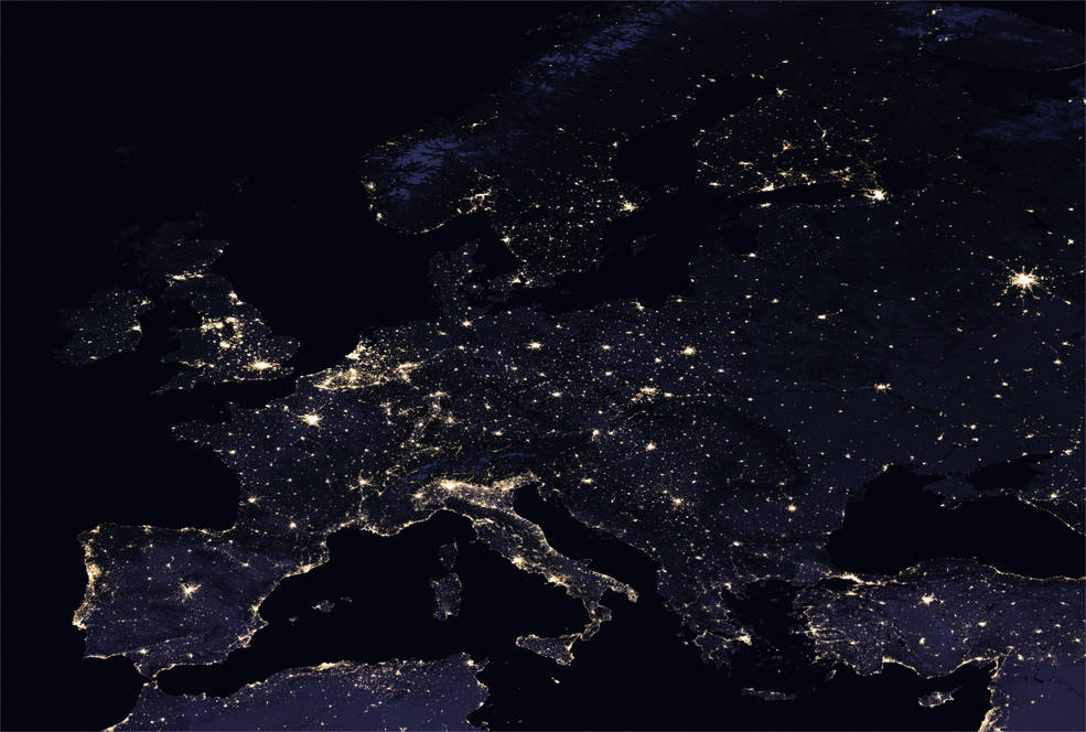
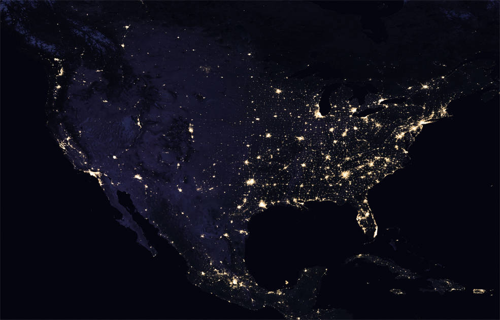
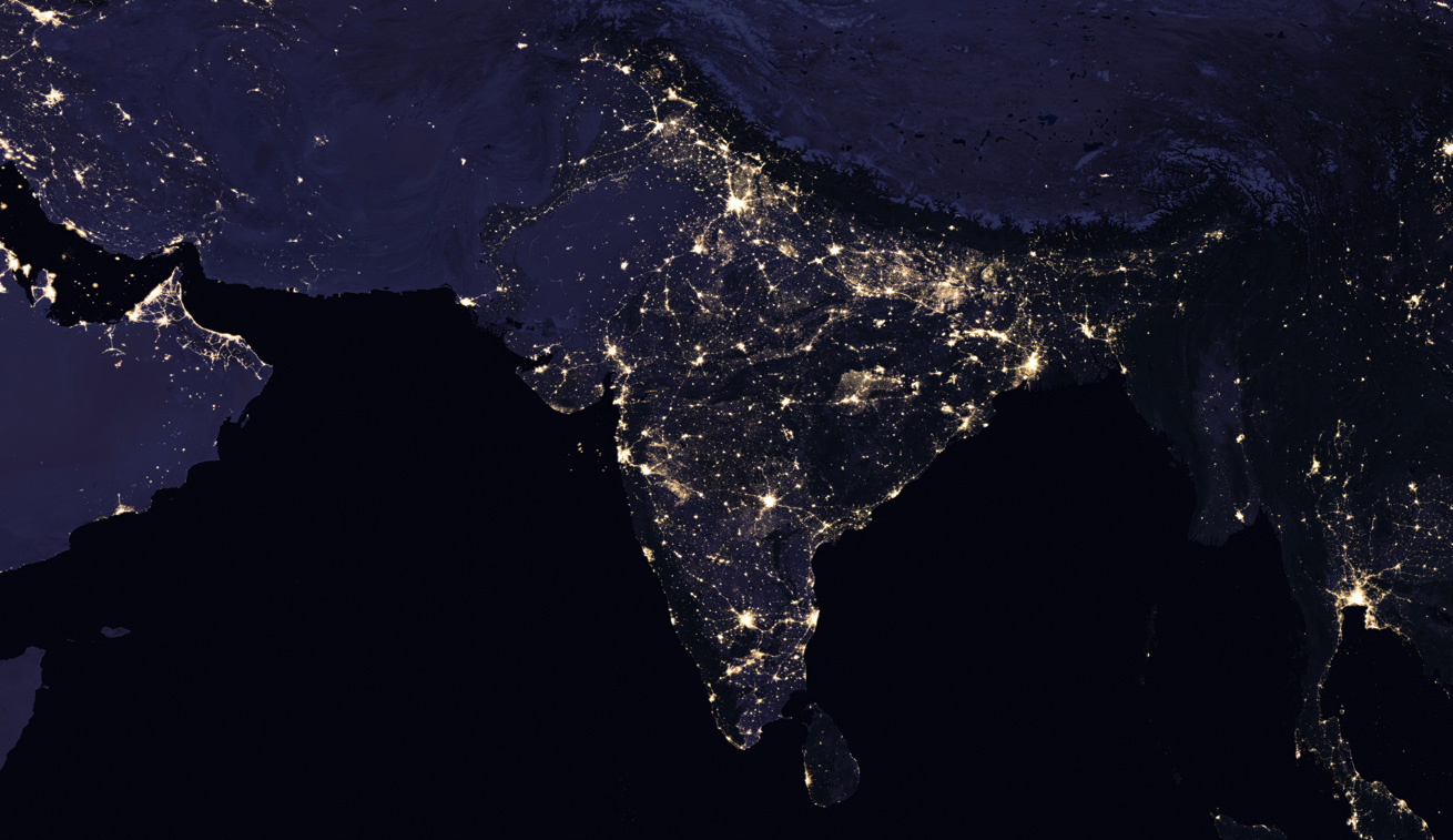
The satellite images of Earth taken at night always hypnotizes me. They are not only beautiful, but they also give the clearest view on the human settlement patterns on our planet. New Night Light satellite maps from NASA, will be a mesmerizing beauty.
From a research perspective, it creates an amazing value, but the temporal resolution of the data has always been a problem. These datasets have been produced every decade or so which made it impossible to do any large scale change detection analysis.
This year NASA plans to change it! In the years since the 2011 launch of the NASA-NOAA Suomi National Polar-orbiting Partnership (NPP) satellite, guys at NASA have been analyzing night lights data and developing new software and algorithms to make night lights imagery clearer, more accurate and readily available. Later this year they plan to release these data on a daily basis to the science community. This is an amazing quality change that will trigger a lot of cool projects.
Generating this data with such a temporal resolution is not an easy task. When generating the images, you need to account the phases of the moon, seasonal vegetation, clouds, aerosols, snow and ice cover, and even faint atmospheric emissions. All of these change the way light is observed in different parts of the world. It will be interesting to learn how NASA has managed to compute the final output.
We will keep you posted once the data will be released. Meanwhile, you can download the 2016 night map here: 8 MB jpg, (or a hi-res image here: 266 MB jpg). You can also find more images at NASA’s Global Imagery Browse Services and Worldview tools.