
Even in the age of smartphones most people would agree that build-in navigation systems are a useful feature in your car. They offer larger screens with no extra cables and annoying mounting kits. Most of the new navigation systems work offline with periodical map updates and real-time traffic services.
Nothing really fancy but still quite pricey… Automakers sell embedded systems typically for $500 to $2,000 offering a solution that is not any better than a high-end PND or a premium smartphone navigation app. There are however two exceptions… Audi and Tesla.
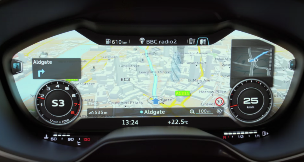
Audi MMI Navigation is a great example that you can create an impressive infotainment system without a touchscreen. In fact touchscreen wouldn’t make much sense as the screen is hidden behind a steering wheel (instead of analog speedometer). It’s a safety feature as it makes you focus on the road rather than looking at the central panel. Driver interacts with the navigation using a joystick with a touchpad equipped with handwriting recognition.
What I mostly like about it is how Audi engineers designed the User Interface to optimize the usage of space on the screen. Take a look:
https://www.youtube.com/watch?v=Y3wYFLAmLYA
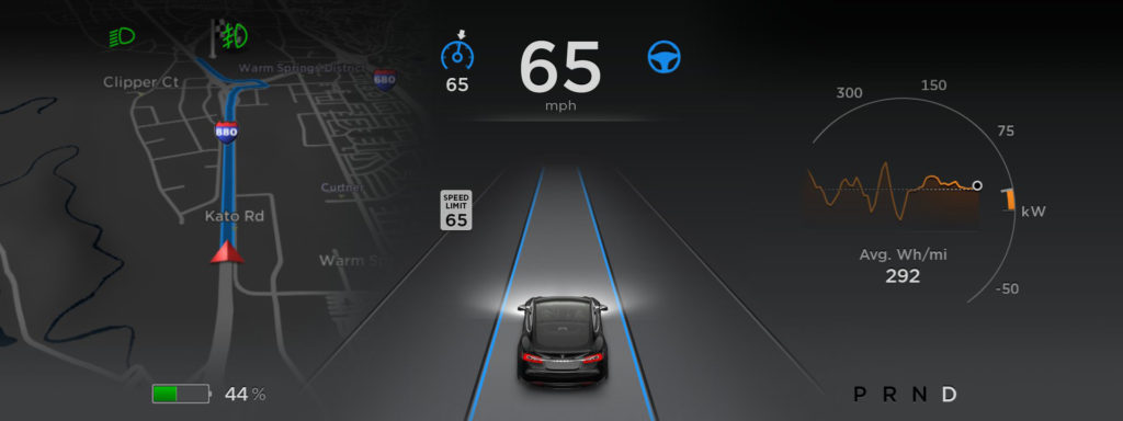
Tesla went one step further. The model S features a huge 17-inch touchscreen in a central panel… It’s like putting a large PC monitor in the dash. Tesla has also ditched almost every physical button and control. The navigation allows you to use Google Maps and it looks amazing.

But guys at Tesla didn’t rest on their laurels. In addition to the navigation directions on the 17″ touchscreen, the map is also pulled up to the main driver console, to the left of the speedometer.
It seems that Tesla has managed to create the best in-car navigation multimedia system yet. We hope that other car makers will also try to rise their standards and offer something stunning, so that when the next time you pay $2,000 for in-dash sat nav, it’s actually worth it.

#Business

Next article

I had first heard about a proposed legislative bill from the Hindustan Times a few weeks back. At that time, I thought it would be best to wait for draft to come out, before reacting to an unsourced media report. Things couldn’t be that bad, could they?
The draft came out yesterday, and it’s even worse than I had imagined. A lot of news sites, such as the Economics Times, Business Insider & Indian Express have focused on the Boundary aspect of the bill (I’ll come back to the boundaries of India in a bit), but a reading of the bill tells us that there is a larger, darker side to the bill.
Now where do I start with the problems in the bill? Let’s start with section 1. This bill is applicable is basically everyone on the earth, wherever they are:
The scope of the bill baffles me. It’s applicable to anyone and everyone. pic.twitter.com/m4Wh0wwHU3
— Sajjad Anwar (@geohacker) May 6, 2016
Now what data is it applicable to? The bill says:
geospatial imagery or data acquired through space or aerial platforms such as satellite, aircrafts, airships, balloons, unmanned aerial vehicles including value addition; or graphical or digital data depicting natural or man-made physical features, phenomenon or boundaries of the earth or any information related thereto including surveys, charts, maps, terrestrial photos referenced to a co-ordinate system and having attributes;
What this means is that if you have access to this kind of data, whether you acquired it, or someone else acquired it, this data falls under that the ambit of this law. The scope is just too vast. It doesn’t limit itself to high resolution data, or data of recent vintage.
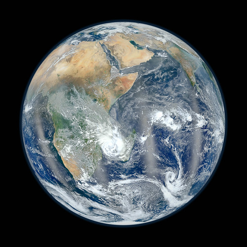
So say you download this wonderful Image from NASA; Congrats!! You can now be tried under this law if you did not seek a license.
What actions is this bill applicable to? The bill is again ambiguous and overreaches, and pulls in a lot of things under its purview, such as:
Save as otherwise …. no person shall acquire geospatial imagery or data …
· Every person who has already acquired …. prior to coming of this Act into effect, shall within one year from the commencement of this Act, make an application alongwith requisite fees to the Security Vetting Authority for retaining such geospatial information and grant of licence thereof.
· …no person shall disseminate or allow visualization of any geospatial information of India either through internet platforms or online services, or publish or distribute any geospatial information of India in any electronic or physical form
· no person shall, in any manner, make use of, disseminate, publish or distribute any geospatial information of India, outside India, without prior permission
I can’t begin to tell you how much the Indian government is overreaching here. Under this law’s reach, are millions of things that people have been doing freely, that will be banned without a license, or a permit.
Did you collect the GPS location of a scenic point while hiking, from your phone? You’ve just collected information about a physical feature, and you can’t do that without a license.
Did you retweet the following image taken from the ISS?
#Mumbai. Good afternoon from the #ISS. I hope to visit you someday. #YearInSpace pic.twitter.com/yeqwWZa3bJ
— Scott Kelly (@StationCDRKelly) April 12, 2015
Congratulations! You just disseminated Satellite based data. You need a License for that.
Did you create the following Image, based on the bus routes Information from Bangalore’s BMTC?
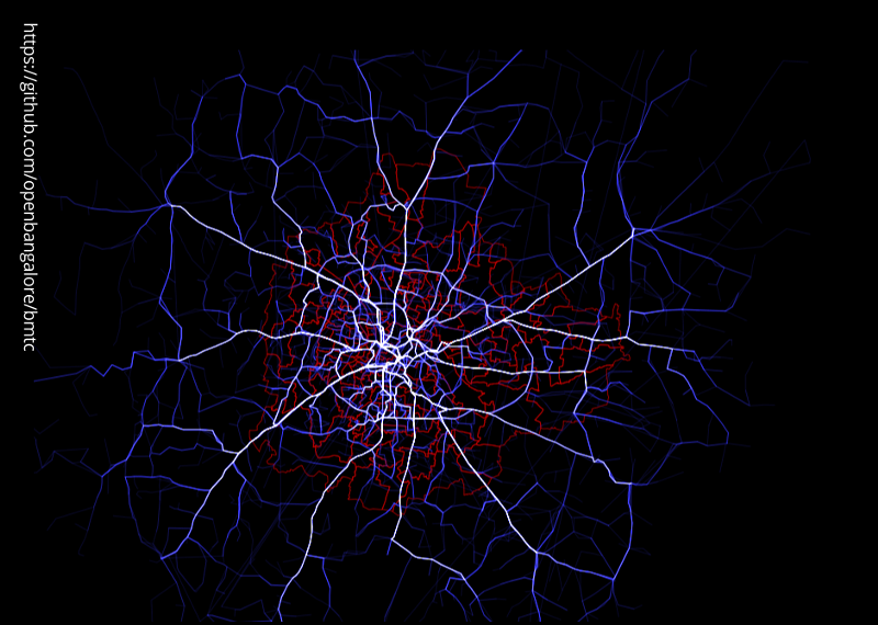
Congratulations! You just created and disseminated a visualization based on geospatial data. You can’t do that.
Are you a foreigner working with an International organization and you wrote a report with a map of the world? You might not want to get a Visa and come to India, because you might now be a criminal in the eye of the Indian law.
Besides these, there are several legal issues with the draft, such as:
https://twitter.com/rahulabhatia/status/728470687531204608
See I understand the possible intent of this bill. They want to force Internet mapping providers like Google Maps, Bing, Open Street Maps, and Mapbox etc to show the boundaries which are claimed by the Indian Government. This might be a lost cause, but it is understandable.
What is not understandable is the heavy handedness of the government, and it trying to overreach and try to regulate such a vast field. This is going back to the permit-raj style of government.
Actually now that I think of it, the Indian government itself does not disseminate high resolution, vector boundaries to private organizations and citizens. Given this, it is then unreasonable for the same private organizations to have to have perfect boundaries in the outputs that they generate.
My opposition to this bill is about more than just the Geospatial aspect. This bill is an ill-thought-out and ham fisted attempt to control and force international mapping providers to follow local laws, but it will leave several domestic and smaller players dead as collateral damage. The government might want all satellite data companies to allow the sale of only low-resolution data, but these kinds of laws will have to be followed only by the entities working within the country and not those outside. This leaves the nascent Indian GIS Industry at a disadvantage, when compared to its counterparts across the globe.
Worst of all, it is trying to implement Security by Obscurity, which is expecting the country to become secure by hiding information from its citizens. This is dangerous, because the real mischief creators, be they terrorists, Foreign government agencies, or domestic criminals, will most likely have access to kind of data from foreign sources, and will not even think about getting permits and licenses from these Indian Authorities.
https://twitter.com/harsham/status/728453568001232896
Lastly, these restrictions do not go along with the Digital India and Start up India programs, and will stymie such initiatives, because over 80% of data is spatial data; without the free access to such data by Industry, Academia, researchers, and citizens, these kinds of programs, as well as the general development of the country cannot go forward.