

A simple survey proved what the team at Coord had long suspected: A driver would give up the perfect parking spot in a heartbeat if it meant getting a guaranteed space in a nearby lot and not being forced to drive around in circles.
But curbside and parking data is something for which real-time information is not widely available. No one’s doling out practical curbside info every driver can use: Where can I pick-up passengers for my Lyft or Uber without violating curb rules? Or where can I find free parking for my car? [Google Maps does provide limited parking information about some destinations, but it doesn’t let you book a parking space in-app].
And that’s how Coord, an offshoot of Sidewalk Labs (Alphabet’s smart cities branch) was conceptualized. Coord is a Cloud-based platform that allows easy integration of real-time transit information into digital navigation tools. “Coord provides software developers with access to APIs for data on tolls, curbs, and parking in cities across the US, with more options like bike-share to come,” Stephen Smyth, CEO of Coord, explains in a blog post.
Last month, the company announced the launch of its first web tool for the public at large: A Curb Explorer for the city of San Francisco. By creating a free account here, anybody can use this tool to discover where and how the curb space of San Francisco can be used for free parking, passenger pick-up, loading and unloading vehicles, or bus stoppages. Any data that you are looking for can be found by its date, time, vehicle type, and desired action.
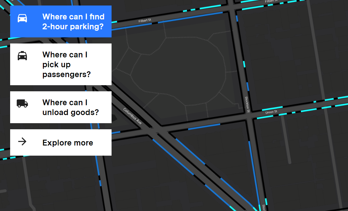
The Coord team created this highly detailed and useful map of San Francisco by using their own app called Surveyor. “Employees walked the streets of San Francisco, taking pictures of curb cuts and prominent intersections. The app, using augmented reality tech, then read the signs, measured the distance between spaces, and snapped it to a 3D map — all in about four minutes,” The Verge reports.
Apart from San Francisco, Coord already has a ready API that gives curb-related data around loading and passenger pick-up zones, street-parking rules, bus stops, and more for New York City, Seattle, and Los Angeles. In fact, Google Maps is already piloting the option of finding available parking in Seattle and San Francisco using information from Coord. Another API is packed with updated prices for 85% of all toll plazas in the United States, and more are in the pipeline.
According to Smyth, “Transportation in the 20th century was all about connecting cities with new roads. The challenge of the 21st century is coordinating the roads and streets that already exist to improve convenience, cost, and economic opportunity.” The team at Coord wants to focus their attention on the kind of choices it can provide to the commuters, and not on the type of vehicle they own. Doing that, Coord believes, is going to help us make our cities smarter.

#Business


Next article

Water is one of the Earth’s most valuable resources. Some of us living in the cities take drinking water for granted, while millions of people across the globe can’t even imagine having everyday access to clean water.
With GIS solutions in the cloud, mapping available water sources, managing the delivery of water filters and using collected data to eradicate water-borne sickness, diminish death rates, and create a sustainable solution which brings clean drinking water to nations in remote areas, is no longer an impossible effort.
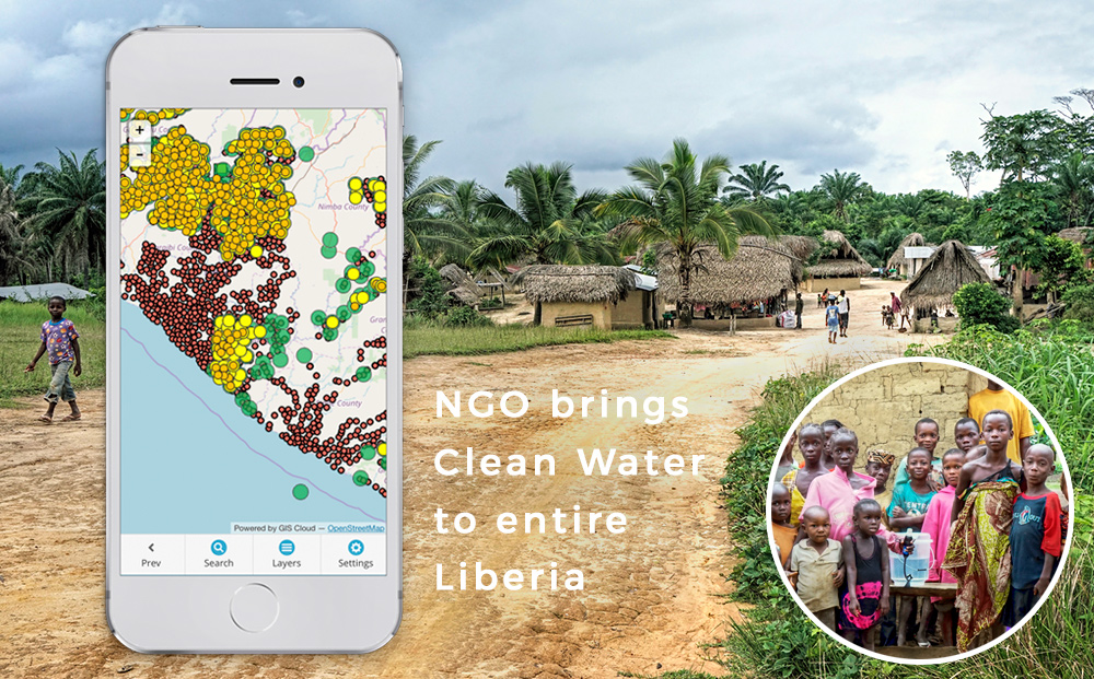
The Last Well nonprofit organization joined forces with other NGOs and Darrel Larson, International Director of Sawyer Products water filter company, to reach a unique goal envisioned in 2008: map out entire Liberia and bring clean water to every single resident by December of 2020.
To achieve this goal, organizations had to collaborate to gather data on demographics of every village in Liberia, regarding their location, population, existing water resources, and solution needed, as well as on individual health problems caused by bacteria in the water.
Divided into teams, 150 Liberians were sent out on motorcycles and trained in GIS data collection, which included filling out custom created surveys on mobile devices. Each submitted entry instantly mapped the household, a survey was linked to, allowing for a country-wide assessment.
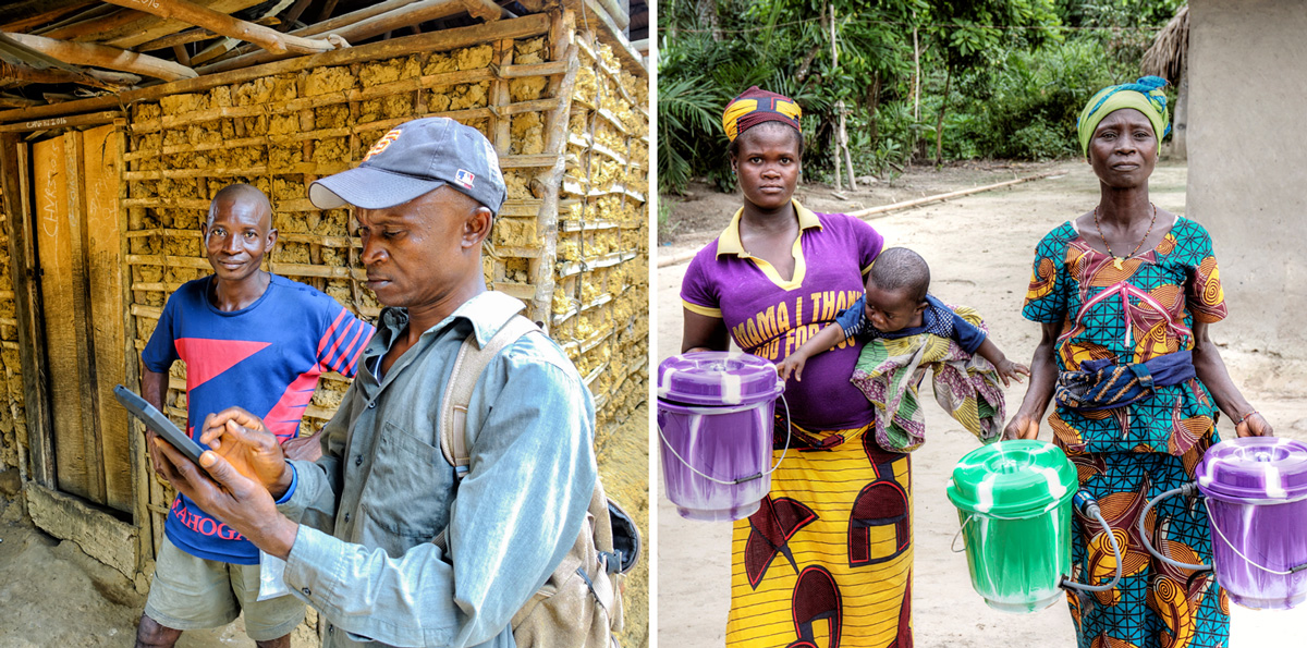
The first round of data collection was followed by installation of water filters, providing clean water for villages too small to receive a hand-pump well. GIS mapping technology enabled them to track and manage filter installations and later follow-ups, which resulted in a significant amount of health and socioeconomic data.
Surveys were combined as layers in a single map showing the overview of the process, area covered and estimation for additional resources needed to reach the goal.
Analysis of the collected data showed terrific results, such as reduction in reported cases of diarrhea from 2197 to 107 in just two weeks! This outcome allowed for further funding of the project as well as its expansion on other countries and plans for many future projects.
Join the Webinar on April 12th for a first-hand story and a live demo of this data collection and management process, and learn how to execute such an impressive project. Darrel Larson will share his story and answer questions about project creation and funding to data collection, data reviewing, data management, and upscaling to more teams working with data.