


Project Tango
Long before Pokémon Go made augmented reality (AR) a household name, Google was pushing people to experiment with 3D motion and AR using their smartphones. Project Tango, launched in 2014, used 3D motion tracking and cameras with depth sensor to not only map a building’s interiors, but also to position the device in its surrounding space to let it know exactly where it is and how it moves in relation to the world around it. Needless to say, our geoawesome community of mappers was pretty excited about this technology.
But then, this August, Google introduced ARCore – a platform for building augmented reality apps on Android. Similar to Tango, ARCore also tracks the position of the mobile device as it moves, and builds its own understanding of the real world. And though ARCore’s data is not as accurate as to enable indoor navigation, it is enough to attract the attention and investment for some killer apps. Additionally, the new platform can estimate the lighting conditions in the area around it and allows you to pause your AR sessions and perform another task on your smartphone.

Google ARCore
Needless to say, the moment ARCore was announced, it spelled the death knell for Project Tango. The thing is, while Tango requires special hardware (additional cameras), ARCore is an Android-scale SDK compatible with a wide range of mobile devices. ARCore can bring augmented reality closer to many, many more people than Tango ever could have.
So, come March 2018 and Google will stop support for Project Tango. The platform’s Twitter bio now reads: “Tango will be deprecated on March 1st, 2018 and will not be supported by Google. Google is continuing AR development with ARCore.”
This is echoed by Nikhil Chandhok, Director – Product Management, who wrote on Google’s blog, “As we focus on bringing augmented reality to the entire Android ecosystem with ARCore, we’re turning down support of Tango. Thank you to our incredible community of developers who made such progress with Tango over the last three years. We look forward to continuing the journey with you on ARCore.”
Google expects around 100 million users to take advantage of ARCore by the time the platform comes out developer preview mode.

#Business


Next article
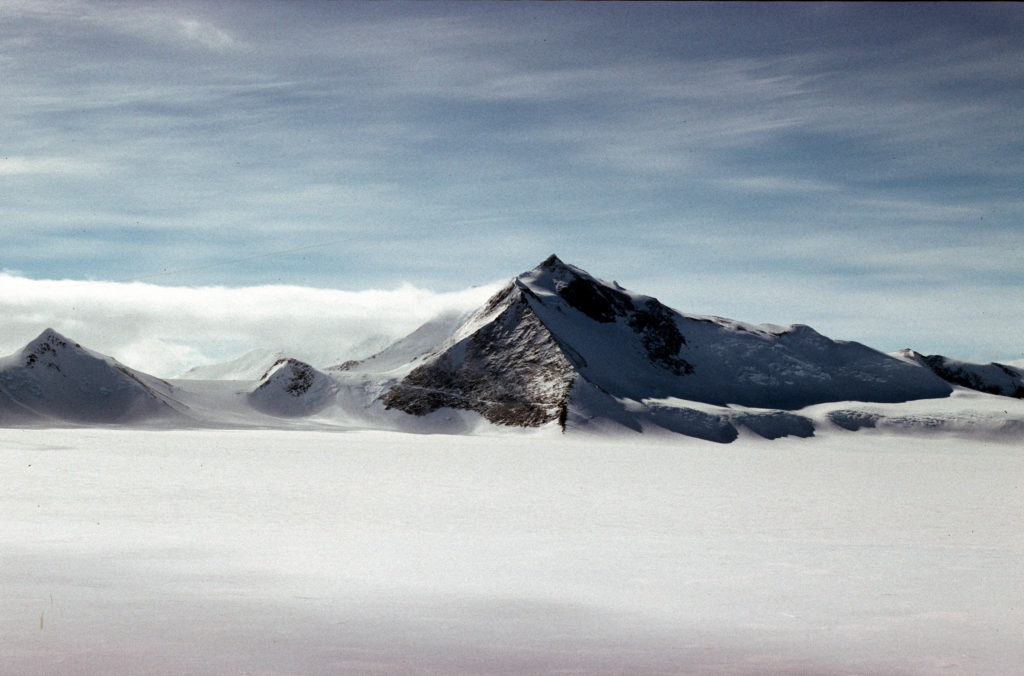

Mount Hope. Courtesy: Alan Vaughan/BAS
The United Kingdom needs to update its Geography books for there’s a new tallest peak in town the territory! For years, Brits believed that at 3,184 meters, Mount Jackson in the British Antarctic Territory was their highest mountain. But new satellite data has revealed that Mount Hope – standing proudly at 3,239 meters above sea level – is actually the highest peak in the territory. The British Antarctic Survey (BAS) made this discovery while updating the planning maps for pilots operating in Antarctica.
Mount Hope, which was previously estimated to be 377 meters shorter, had originally been mapped by overland dog-sleighing teams. Their simplistic method for measuring the height of a mountain involved basic math calculations: Measure the distance between two points at the base of a mountain and calculate the angle between the summit and each base point. Naturally, this system left a huge room for error.
Nowadays, however, the modern mapping technique of photogrammetry can find out the elevation of a surface with an error margin as low as 5 meters. Adrian Fox, Head of Mapping and Geographic Information at BAS, agrees: “Modern satellite data highlights how inaccurate previous surveys and maps were for some parts of the region.”
Related: Why we love USGS Global Mountain Explorer (and you should too!)
Interestingly, the new cartographic survey not only helped BAS to correct the height of Mount Hope, several new mountain heights and ranges were also discovered. In addition, the correct location of some peaks was also found to be 5 kilometers off previous records.
As Fox points out, maps with reliable measurements of the highest peaks are an essential safety requirement for flight planning. “Accurate elevation data from satellite imagery now allows us to produce these resources for Antarctica, where flying is difficult at the best of times,” he adds.
The title for the highest mountain in Antarctica still rests with Mount Vinson at 4,892 meters.