
 For most GeoGeeks like me smartwatches and other wearable tech are mostly about location-based features. I would like my watch to navigate me, to give location-related information and notifications, to have a compass and other geo features… And to do most of as a standalone device not as an extension of my phone.
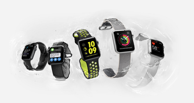
Why would I spend a few hundred bucks on a device that requires a smartphone to give me my geographic position. It’s like having a phone that requires a laptop to operate. This was the case for the 1st generation of Apple Watch devices. Released today, Apple Watch Series 2 finally gets a build-in GPS chip but it’s a pity that it’s not ‘the first time right’.
Apple Watch Series 2 looks just like the original one. The main difference is that it’s now waterproof to track your swimming workouts as well as it has the build-in GPS so that it can finally work as a standalone outdoor activity tracker.
For many GeoGeeks it might be the feature which will convince them to buy it. For me it’s still not enough to make me want to convert from my Garmin Fenix 3. The main difference between these two is that Garmin is a multi-activity outdoor GPS watch with some smart features, while Apple Watch is a smartwatch with a little bit of location-based functionality.

#Business


Next article

Open data is cumbersome for the many social, economic, environmental and humanitarian needs that government officers and citizens claim everywhere, although most developing countries governments confidentially recognize that they still can’t provide enough answers to when day to day problems arise or even disasters break up. For many philanthropic organizations like Melinda and Bill Gates Foundations geo open data literacy and geospatial platforms initiatives are desperately needed for the African continent, fighting at all levels with pronounced cartographic weaknesses and huge gaps in coverage, training and technologies. Specifically, they argue that “many Sub-Saharan Africa countries (have) significant gaps (that) still need to be addressed in the quality, completeness and sustainability of geospatial data. Lack of capacity can cause countries to be slow to adopt methodologies to produce, maintain, and more importantly, benefit from robust geospatial data and analysis systems. Lack of new tools or approaches to geospatial data can inhibit many opportunities for growth and innovation”.
Multilateral organizations are recommending that governments and high end NGO players should take stock and lessons of what civil society is doing about geo open data to engage the public outreach shored up with collaborative projects. Luckily, for civic tech initiatives, many United Nations bodies have recently recognized that regarding Sustainable Development Goals or SDG selection for the Global Agenda 2030, a geo data revolution and a stronger open data ecosystem is greatly needed. Unfortunately for Africa, geo open data initiatives are scarce, unsupported and misunderstood.
In the verge of the 4th industrial revolution in many developing countries, East African countries are just getting started and giving birth to its first open data civic tech innovations and nurturing the next open government champions. This effort shouldn´t be neglected as the continent proves resiliency and to be easily catching up in the mastering of technology and exercising its start up muscle.
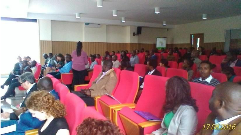
Last August 17th and 18th the East African Open Data Conference (and Fest) gathered around 180 attendants in Strathmore University campus in Nairobi, Kenya. The audience included vibrant mapping communities, together with enthusiastic university level students from all around East Africa. The event allowed all participants to share a long awaited dialogue, radiating geo data collection experiences and timidly wishing to create opportunities for investment partnerships to strengthen and expand the ebullient African open data ecosystem.
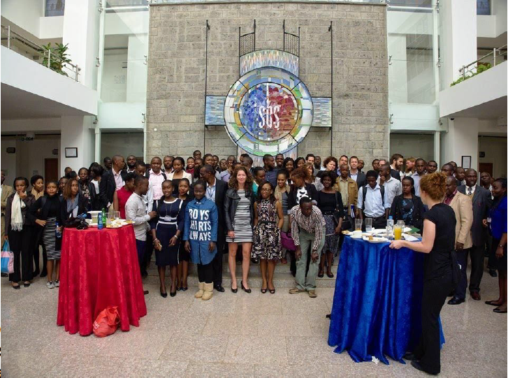
Mapping was the keynote practice of this colorful data fest, starting with a brilliant coordination for a satellite “01” group image idea on the ground , also planning many mapping party alike activities in the agenda. . Civic tech geo data groups like Map Kibera or Carolina for Kibera attended and assertively proposed solutions and shared diverse related experiences. Many valuable demand driven insights and experiences about geodata base sharing within the government brought by Sifa Mawiyoo from the ICT Kenyan authority and his team spiced the talks.
To set in motion the open movement over rapid rails, government agencies, multilevel organizations and private firms of all sizes teamed up at Strathmore University. Most of the supporting think tanks of the event worked already with the geospatial industry. No wonder why one third of the supporting organizations of the EAODC event had a mapping mission.
Key players such as Digital Globe, Mapbox, ESRI, Flowminder and Ushaidi were the mentors providing auspices to cement the foundations of the coming great geo open data endeavour in the continent. Also start ups like DigiMattsolutions, the Data Act Lab and Safaricom networked their creative ideas in the event.
A silent crowd might be expectant for the African Open Data ecosystem outcomes as many participated off site and made #africaopendata to increasingly pop out as a national twitter trending topic even 3 days after the event ended. Finally, drinks were on the Mapbox local crew at Taidys Nairobi West.
Don’t tell us later that we didn´t warn you about the African data revolution. Now: would you like to join it?