
What does it take to restore a rare 17th-century map – found in a condition so fragile that even the force of a person’s breath could damage it – to its former glory? More than a thousand hours of painstaking work by 11 skilled conservators over a period of four years.
What’s the story here?
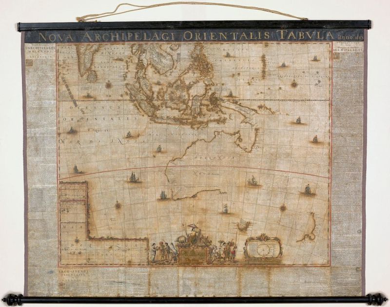
A map of Australia, Archipelagus Orientalis, hand-drawn by master cartographer Joan Blaeu in 1663, was discovered in an attic in Sweden in 2010. Being a wall map, it had spent most of its early life weathering exposure to the elements and people touching it. In 2013, the National Library of Australia acquired it for a staggering $600,000 (approx).
Why the library doled out so much money for this map is because it is believed to be the ‘birth certificate’ of Australia. When it was created more than 350 years ago, the map was the first to label Australia as Nova Hollandia, Latin for New Holland – more than 100 years before Captain James Cook set foot in the continent.
The academic significance of this map increases when you factor in the fact that it was also the first to mention Tasmania, following its discovery by Dutch explorer Abel Tasman. Archipelagus Orientalis was a part of series of maps of the world created by Blaeu.
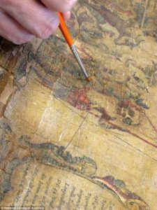
The map being restored
What did the conservators find?
Apart from being extremely flaky and fragile, the map held several other complications (and surprises) in its folds. Senior Paper Conservator from the University of Melbourne, Libby Melzer, who was a part of the project told Pursuit, “We thought we were just removing varnish, but we discovered a dirty layer underneath which meant we had four passes at each square on the gridded map – of which there were around 300. There are lots of ship details on the map, and as we removed the varnish we discovered they bore either a Dutch or a Spanish flag. They are a key to indicate the owners of that territory.”
I’m sold! Where can I see this?
Down Under, of course! The National Library of Australia just put the magnificent map up on display in its Treasures Gallery. It would remain there until the mid of next year.

#Ideas


Next article

Waymo, formerly known as Google’s self-driving car, now owned by Google parent Alphabet, is launching a fully autonomous ride-hailing service with no human driver behind the wheel.
Recently, Waymo team tested the vehicles on public roads in Arizona and ride-hailing service project was announced by the company’s CEO John Krafcik at a tech conference in Lisbon.
The public will begin riding in its fleet of modified Fiat Chrysler Pacifica minivans outfitted with self-driving technology in the next few months. Initially, passengers will be accompanied by a Waymo employee, in the back seat, but eventually, riders will be able to travel alone in the fully autonomous car.